Quantcast
Channel: The Lost Fort
Viewing all 241 articles
Browse latest View live

A Virtual Tour through Mediaeval Bruges

$
0
0

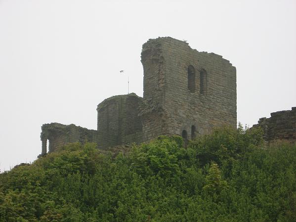
The weather turned into a mix of sunshine and clouds during the days I spent in Bruges, but despite the dramatic appearance of some of those clouds, it never rained.

A tour on the canals is very popular

Bruges has even more canals than Ghent, so one of the first things I did was to take a tour on the water, which was almost as crowded as the roads. A bicycle taxi proved the fastest way to get to my hotel. (Ghent has recently closed its old town for most cars which makes walking the narrow lanes easier.) And this is Bruges in April; in summer you'll better get a Nimbus 3000 to move around. *grin*

Old houses at the canals

There are a lot of old houses along the canals, and bits of green wherever it manages to grow. It is a lovely way to explore Bruges. I got a bunch of photos and will post more of them in a separate post some day; this one shall show you most the highlights of Bruges, also those not along the water.

There are a lot of bridges

There are a lot of bridges as well. When you stand up to take a photo over the heads of the other people in the boat, you need to watch out for those and duck in time, because most of the bridges are very low. In the Middle Ages, cogs could reach the former Water Hall at the market place, but on the smaller canals, transport was done by barges.

Bruges-la-morte

When the sun disappeared behind a layer of grey clouds, the vista reminded me a bit of the 19th century Bruges desribed in George Rodenbach's novel Bruges-la-morte (published 1892) with its grey houses, dark waters and mists. At that time, the town had lost its connection with the sea due to silting of the Zwin river, and the industry didn't take hold like fe. in Antwerp.

But today, tourists enliven the picture in most places even on a dreary day. Though there are spots where few tourists go (and miss out on some pretty and interesting places).

Sometimes the sun came out

And when the sun came out, the canals were a most lovely place. This charming spot can be found behind the choir of the Church of Our Dear Lady, Bruges' main church (more below).

Cloth Hall with belfry

Bruges has its Cloth Merchants' Hall with a high belfry, too, dating to the 13th century. It is 83 metres (272 feet) high and can be ascended by 366 stairs. The view from top is probably spectacular, but I don't like heights and I didn't fell like ascending 366 stairs, either. Plus, those vistas never come out as grand on photos. In summer, people sometimes wait for an hour and more to get inside, because the number of people allowed in the tower is limited.

Pretty old houses at the Market

The belfry dominates the market square, but on the opposite side is a row of pretty old houses, another postcard motive.

Under those green sunshades hides a whole row of restaurants with yummy, albeit somewhat expensive, Belgian food. Yes, I did try the famous mussels and loved them.

The hall of the Provincial Court at the market

The third side of the market square is framed by the Hall of the Provincial Court, an 19th century Neo-Gothic building erected on the site of the old Water Hall, a roofed-in harbour in the Middle Ages.

The well in the foreground shows the figures of Pieter de Coninck and Jan Breydel, two men who led a Flemish uprising and successfully fought against the French occupants at the batte of Kortrijk, also known as the Battle of the Golden Spurs, in 1302.

The old town hall

The oldest square in Bruges is called Steen, after the castle that once stood there. The town hall - now its outstanding feature - was completed in 1421. It is the oldest example of a minicipal building in the Brabantine Gothic style in Belgium. The town halls of Ghent and Leuven followed its example.

Town hall, interior: the great hall

The interior was restored about 1900 in the Gothic revival style. The two halls were joined into one and the ceiling renewed with some Gothic looking beam constructions. The murals show scenes from the history of Bruges.

Holy Blood Chapel, interior

The Chapel of the Holy Blood started out as a two storeyed chapel adjacent to the old castle. In 1150, Thierri of Alsace, Count of Flanders, returned from the second crusade with a relic of the Holy Blood; until today one of the most venerated relics in Catholic Flanders. It is presented in a famous procession every year.

The upper chapel was transformed in Gothic style in the 15th century, and altered again in the 19th, this time in Gothic revival style. The chapel is now a - to my taste - overdecorated mix of styles. It is also full of tourists.

St.Basil's Chapel, interior

The lower chapel, known as St.Basil's Chapel, was never changed and therefore kept its Romanesque style. Regular readers of my blog know that this is my favourite style in architecture, so I really enjoyed this beautiful example. The place was much quieter, too.

Tower of the Church of Our Dear Lady, seen from one of the canals

The tower of the Church of Our Lady is the second tallest brick tower in the world. It rises to 122.3 metres (401 ft.). The cathedral was erected in several stages from the 13th to the 15th century; its dominating style is Gothic.

Unfortunately, the tower was pretty much the only part not scaffolded in right now. Most of the interior is not accessible due to renovation work, either.

Michelangelo's Madonna with Child

What can be seen is the church's most famous treasure (and they charge the full fee for it even during renovation); the Madonna with Child sculpted by Michelangelo in 1504. Merchants from Bruges bought it during the artist's lifetime and gifted it to the town.

I almost missed it. The madonna is a small part of a huge Baroque altar setting with pillars of black marble which I walked right past because I'm not a fan of that style. I had to ask a guide where the statue was hiding.

Old St.Johns Hospital

St. John's hospital dates back to the 11th century and was expanded during the Middle Ages, eventually incorporating a monastery and a convent. Further wards were added in the 19th century. It was a place where the sick too poor to pay for private treatment by a physician, including pilgrims and travellers, were cared for. It was in use as hospital until 1977. Today, the buildings house a congress centre and museums.

Béguinage Ten Wijngaerde, the inner court

Of all the béguinages in Flanders, the one in Bruges is the most beautiful, especially in spring when the narcisses on the central lawn are in bloom. It was founded in 1245 by Margaret of Constantinople, Countess of Flanders and Hainaut. Fun fact aside: she had a few too many sons from two marriages, which led to a nasty little succession war.

Most of the pretty white houses date to the 16th - 18th century. Beguines lived there until 1927, since then it is a convent of Benedictines, and a place of quiet despite the tourists (most of them respect the signs that ask for silence).

The Ghent Gate

The Gentpoort is one of the remaining gates of the Mediaeval town fortifications. The town walls date to 1297 (little of them remains), but several of the gates are from the early 15th century, including the Ghent Gate. It includes a little museum which unfortunately was closed for lunch; and I didn't have the time to return.

Jerusalem Chapel, interior

One of the places missed out by the busloads of tourists is the Jerusalem Chapel and the town manor of the Adorne family, who some may know from the Niccolò series by Dorothy Dunnett. A member of the Adorne family - which had moved from Genua to Bruges in the 13th century - commissioned the chapel in 1470. An existing chapel was altered to resemble the Church of the Holy Sepulchre in Jerusalem.

Jerusalem Chapel, the crypt

The main room with the stone altar and stone-carved calvary is flanked by two staircases leading to a second floor with another altar. Hidden behind the stairs is the entrance to the crypt which in turn leads to a narrow corridor and a small room with an imitation of the holy sepulchre.

There were no other tourists around and I found the chapel to be a nice and peaceful place. Some rooms of the former manor house include a small museum about the Adorne family.

House Ter Beurze

The place in front of the inn run by the family van der Beurze was used as stock exchange market since the 14th century, when purely financial transactions were introduced from Italy. The family also worked as brokers and agents for visiting merchants. The house and square gave the name to the German word for stock exchange market - Börse. The house with its Gothic façade dates to 1493, though the inn existed since 1276.

Seven houses in seven different styles

Bruges is a town with lots of old houses, often with crow step gables or decorated façades in late Gothic, Renaissance or Baroque style. The ones in this photo represent seven different styles; the houses just happened to end up in a row.

Crow step gabled brick houses

A number of houses are made of brick and reminded me of Lübeck, like the ones in the photo above.

Bruges is a town that is best explored by walking around a lot, also outside the main tourist paths (and a boat tour on the canals, of course).

Van Eyck Square

The Jan van Eyck Square lies on the site of the former toll stop for ships visiting Bruges. At that time the canal, crossed by a bridge, ran all the way to the market. Part of it has been covered in the 18th century, thus creating the square. Today, the pretty vista is included in the boat tours.

Roman and Mediaeval Vestiges in Tongeren

$
0
0

On my way back, I spent a day in Tongeren, a smaller town that often gets missed by tourists focussing on the Big Three, though it is well worth a visit. It is a nice place with some impressive Roman walls, a must see Roman museum, and a fine Gothic basilica. The sun decided to come back as well, so it was fun to walk around. (No boat tour this time, there are not so many canals.)

The 2nd century Roman wall

Tongeren started out as a Roman municipium called Atuatuca Tungrorum, a town situated on the crossing of several military roads. It lies futher east than the cities of Ghent, Bruges and Antwerp, at the foothills of the Ardenne mountains. But the documented history of the area goes back to this chap who defeated several of Caesar's legions in a place called Atuatuca in 54 BC.

Statue of Ambiorix

Ambiorix, chieftain - sometimes also called king - of the Eburones got his own statue on the market square in Tongeren. Of course, Caesar came back with more legions and conquered the tribes of the Belgae. Ambiorix disappeared into the woods and into legend, and another tribe, the Tungri, gave its name to the settlement that soon grew near a Roman fort.

Another remaining piece of the Roman wall

Like every Roman town, Atuatuca Tungrorum got a town wall. Luckily, some parts of it survive until today, though only the inner ashley and mortar kernel remains; the outer stone blocks went into the Mediaeval town wall, the old Romanesque basilica and other places. It is still impressive, though.

Exhibits in the Gallo-Roman Museum

Rich Gallo-Roman citizens and owners of the villae soon surrounding the town liked impressive burials. That way, lots of finds have come to light during various excavations. They are presented in the Provinciaal Gallo-Romeins Museum, together with other finds from the area all the way back to the Neanderthals.

Celtic torques and coins

Of course, there are exhibits from the culture of the Celtic tribes as well, like these gold torques and coins.

The remains of the burials have been moved into the museum, where the colours and decorations can be preserved better than on the original sites of the finds.

Roman tombs in the museum

The museum is located directly beside the Gothic 'Basilica of Our Dear Lady'. That church may be less spectacular than the cathedral in Antwerp or St.Bavo in Ghent, but I liked it better because the interior is unmarred by chubby Baroque angels and Rococo frills. There are also less tourists around.

Basilica of Our Dear Lady

The basilica is based on the foundations of older churches. A cathedral chapter and monastery existed here since Carolingian times. The construction of the present three naved basilica with transept started in 1240 and took until the 16th century, thus the influence of the late Brabantian Gothic is stronger in some parts, like the main tower.

Interior of the basilica

The loveliest part is the cloister which is still Romanesque. It can be accessed via the Teseum, a museum that displays church treasures and which is located in the former chapter hall and a remaining Romanesque tower. The golden bling is fun to begin with, but it was the cloister where I spent most time, just sitting in the garden and enjoying a quiet moment.

The lovely Romanesque cloister

One should take the eyes off the bling for a bit and have a look at the architecture of the chapter hall and the tower. Next year, a glass floor will show more of the foundations of the older churches that have been discovered during renovations.

Chapter hall of the basilica

Tongeren has a béguinage as well, though it is smaller than the ones in Ghent and Bruges. There is a restaurant hiding in one of the gardens, a modern art exhibition in the chapel and some pretty vistas in the sun. Unfortunately, the little museum that shows the living conditions in one of the houses was closed.

The béguinage

Tongeren once had six town gates, but only the Moerenpoort from 1379 survives. The worst setback of the town, which played a larger role in the Middle Ages than today, was the sacking by the French troops of King Louis XIV in 1677 where large parts of Tongeren were destroyed.

The Moerenpoort

The Mediaeval town wall was built in 1241 after an attack by Duke Hendrik of Brabant. Some of those Roman stones came quite handy for its construction. Parts of the wall luckily survived the French attack from 1677.

The Mediaeval town wall

Today, Tongeren is a place to see for people interested in Roman history, and worth a stop if you like Mediaeval history and architecture as well.

12th Bloggiversary

$
0
0

My blog is celebrating its 12th anniversary this year. This makes it one of the rare species of Neanderthal blogs surving the rise of Homo Facebookiensis and Homo Instagramis - though I can still find some other Neanderthal blogs on my blogroll.

Standing stones of Stenness, Orkney (visited in 2013)

I tried to teach my layout some modern tricks of flint knapping, but it didn't work out with that odd mix of travel journal and history blog, and the comprehensive archive I've accumulated over the last 12 years. So I only merged some posts - I tended to write more but shorter posts during the first years - and decluttered and restructured the sidebar archives. Plus I added a Featured Posts item which I will change every 2-3 months. Most modern blogs have those.

View from the Fløyen to Bergen

I've traveled a fair bit during those last 12 years, even if a lot of it took place in my native Germany. But we got plenty of beautiful nature, lots of castles and a number of charming old towns, so I haven't tired of exploring this country yet. But of course, going abroad is a lot of fun.

Honnigsvåg, north of the Polar Circle

One of the most memorable tours was the one I did in April 2011 when I traveled from Copenhagen via Oslo to Bergen and then took the Hurtigruten Cruise. If you like snow and want to escape the big tourist groups, a spring voyage is the best time.

Stockholm

Another great voyage was the Baltic Sea Cruise with the MS Phoenix Albatross in May 2012. The weather was perfect, warm and sunny. Returning to Stockholm where I lived for 18 months in the late 80ies was a trip back the memory lane, and St.Petersburg was just splendid. It was the time of the white nights, which made it even more beautiful.

St.Petersburg in the evening sun

The UK, especially Scotland, never fail to attract me. I've been there serveral times, and the archive shows a number of posts about Scottish history and Scottish castles (or Welsh castles, for that matter).

View from Stirling Castle to the Scottish Highlands

No wonder, with views like this.

So I'll keep traveling, and blogging with those old flint tools of mine, and hope my readers will continue to enjoy my little corner of the internet.

Border Castle and Forester's Lodge - The Altenstein at the Werra

$
0
0

There are several castles named Altenstein or Altenburg in Germany. The one I'm writing about here are a few ruins hidden in a forest near Bad Sooden-Allendorf, on a promontory 350 metres above a rivulet confluencing into the Werra, with no tourists around. But it was one of those border castles between Hessia and Thuringia which has played a role in history, albeit a small one.

The ruins of Castle Altenstein near Bad Sooden-Allendorf

Today, the castle belongs to Thuringia, but during history, it was part of the landgraviate of Hessia most of the time. The Altenstein is first mentioned in 1329 (see below), but it is well possible that the castle was part of the 'eight fortified places' which Duke Albrecht of Braunschweig gave to the margrave Heinrich of Meissen as ransom. The War of the Thuringian Succession (1) had attracted several nobles who wanted to bite off a chunk of the Thurigian possessions. It didn't go well for Albrecht who was captured by margrave Heinrich. Heinrich of Meissen gave the 'fortified places', which included Eschwege, Allendorf and Witzenhausen, to the young landgrave Heinrich of Hessia (the son of Sophie of Brabant) in 1264, in exchange for other lands and privileges.

Remains of the hall and nothern curtain wall

In 1329, Landgrave Heinrich II of Hessia pawned out the 'new castle' of Altenstein and some villages to the knight Berthold Eselskopf (no idea why the guy was called Donkey's Head) and Hugo from the Mark (2). The mention of the 'nuwe hus Aldensteyn' is interesting because it implies that there has been an old house or castle prior to 1329 which was in need of repair or rebuilding, a task which Berthold Eselskopf and Hugo obviously already had begun to undertake. Landgrave Heinrich promised to refund the expenses of further repairs and new buildings should he redeem the pawn.

How old was the castle at that point and why would Berthold and Hugo put money into its upkeep? As mentioned above, the Altenstein may have been part of Albrecht of Braunschweig's ransom and then would date back to prior to 1264. Another possibility is that the Altenstein was part of the lands of the counts of Bilstein which they sold to Landgrave Heinrich I of Hessia in 1301. Berthold Eselskopf and Hugo of the Mark in that case could have been vassals of the counts of Bilstein and transfered the feudal relationship to the landgrave of Hessia in 1301 (3). We will likely never find out for sure, but one can assume that both Berthold Eselskopf and Hugo (and his wife) regarded the Altenstein as quasi-allodial possession or they would not have invested their own money.

Interior of the ruins of the hall and chapel

It was not unusual for the landgrave of Hessia to pawn out land to trusted vassals because he needed a lot of money. Relations with the archbishop of Mainz, who held lands in the nearby Eichsfeld, were still more than a bit strained, and a place like the Altenstein would be of interest to both.

It looks like the Eselskopf family was busy trying to take advantage of those problems. There are several notes in chronicles and chartes from the 1340ies, all involving members of the Eselskopf and Weberstedt families (the Weberstedt obviously also held feudal rights to the Altenstein; maybe they were the family of Hugo of the Mark's wife Gertrud). Like so often, the chronicles don't specify the crimes, only mention things like 'he shall end the acts because of which he has been seperated from his lord', or 'the aforementioned acts'. No pity with modern historians, those chroncilers. But it seems clear that the Eselskopf and Weberstedt families got involved in quarrels between the landgrave of Hessia and the archbishop of Mainz, and were not always on the side to which they belonged by feudal obligations. They promised in November 1346 that they would not commit 'unjust robbery' but instead would bring the quarrels to the court of the landgrave, to name one example.

Hall and chapel seen from the west

In the following decennies one can trace several financial transactions among the local nobility which all include clauses about the rights of the landgraves to redeem the Altenstein and how do deal with the financial mess that would cause.

Different angle from the north-west

There was a feud between the counts of Hanstein - vassals of the archbishop of Mainz - and the Dalwigk family and the counts of Boyneburg who at that time held castle Altenstein for the landgraves of Hessia, which ended with a peace contract in 1377.

The Altenstein was captured by Braunschweigian forces during the Star Wars between Duke Otto of Braunschweig, the archbishop of Mainz and the landgraves of Hessia and Thuringia. The castle came back to Hessia in 1438 and was given to the Bischoffshausen family who held it until 1643.

The northern curtain wall

Times had changed and now the nobility, often in debt, pawned out their castles to the dukes and princes of the realm. In this case, the Bischoffshausen brothers pawned out the castle with several villages and forests to Landgravine Amalie Elisabeth of Hessia. Which is interesting insofar as for one, the landgraves must have redeemed the pawn at some point, and second, the Bischoffshausen probably held allodial rights to the castle, or it would have been difficult to pawn out the place without agreement of their lord.

The interior was not in a good shape. The booklet about the Altenstein (see footnotes) gives an old list of broken furniture (beds, chests, wardrobes, banks, but also doors and windows) which 'if it was to be used must be repaired'. We don't know if the reeve who was installed in the Altenstein kept the old stuff or brought his own. But such lists show that furniture in bad repair still had a value, or it would not have been mentioned at all and simply thrown out instead.

Remains of the northern dike

The castle was badly damaged during the Thirty Years War. I suppose the forests and fields were the true value of the deal at the time; the Altenstein became the lodging of a forester. At first, the mayor (Schultheiss) also lived on the Altenstein and court of justice was held there, but the court was moved to Allendorf and the mayor got himself a pretty house in town.

The inner bailey

We can catch another glimpse of the life on the Altenstein in about 1800. At that time, the remaining buildings of the castle were in dire need of an Extreme House Makeover. The forester Wiegand spent years writing letters to the revenue of Hessia, listing the damage and asking for repair and finances to order repair work himself, but as so often, money was slow in coming.

1799: There were holes in the floor and planks rotten, several parts of the half timbered walls (Gefache) in the second floor had fallen out, windows were missing (those got replaced pretty fast which was the exception), the well was blocked, the stone water trough broken, the oven in the living room smoked so badly that it was impossible to stay there for long, and one of the gables was on the verge of falling off and taking most of the roof with it. The stable and granary were unusable. In spring 1801, his maid broke through the floor and injured herself badly.

Well, the floor was at least completely renewed with planks after that and Wiegand got a new stone water trough. The smoking oven continued to be an issue, though. It took until 1806 before most of the mess was repaired except for a leaky roof, and that was at least on the to do list. Wiegand got an annual salary of 200 thaler; the repair stuff cost more than 150 thaler, so he could not have paid it off his salary.

The chapel seen from the west

It looks like the forester's lodge got a better upkeep in the 20th century. One can see the main building, the former eastern palas of the castle, on some old photos from the 1930ies. The rest of the castle were but ruins. The Altenstein became popular as hiking destination, and the forester's wife sold beverages and rented out some rooms.

The remains of the hall seen from the inner bailey

Castle Altenstein belonged to Hessia, but after the exchange of territories in September 1945 between the Sovjet and American zones of occupation, it came to Thuringia in the former GDR. A forester still lived there until 1955; then the building was used as children's holiday home, but lack of money for the upkeep of the house soon led to the first traces of decay, and in 1961, the castle and forester's lodge were abandoned. Since the area belonged to the restricted zone, no one could hike up to the Altenstein any longer. The remaining buildings were torn down in 1973 (there are no traces left today), though the ruins of the castle proper were left alone and only crumbled a bit further, until a group of dedicated people did some renovation work in 2001. Today, the Altenstein is again a fine hiking destination.

Walls among trees and leaves

The promontory on which castle Altenstein sits has steep slopes on three sides, only to the north a dike was dug out; remains of it can still be seen. The castle had a rectangular shape with a palas building and a gate house to the east (which no longer exists) and another hall - sometimes described as keep (4) - with a chapel to the west. The other walls were framed with stables, granaries and other timber buildings which have long since disappeared.

Two main buildings may have been necessary because the castle often was divided between two families (f.e. the Eselskopf and Weberstedt in the 14th century). What can still be seen is a part of the northern curtain wall with remains of the western the hall and the chapel. Not a spectacular ruin, but a charming one.

View from the castle into the valley

Footnotes
1) After the last Ludowing landgrave Heinrich Raspe died without offspring in 1247, the cousins came out of the woodworks. His father, landgrave Hermann I, had been married twice. The daughter of the first marriage, Jutta, wed Dietrich Margrave of Meissen from the Wettin family ; their son was Heinrich of Meissen. A daughter from his second marriage (and sister to Heinrich Raspe) was Sophia, who in turn married Hendrik II Duke of Brabant and became known as Sophia of Brabant. She claimed Thuringia for her son. Her daughter was married to Duke Albrecht of Braunschweig, a reason for him to join the fun. The archbishop of Mainz had interests in the lands as well, which should not come as a surprise.
2) Wikipedia says that Hugo was Eberhard's squire, but the book about the Altenstein doesn't mention that detail. It seems unlikely to me that a lord and his squire would hold equal shares in a transaction. Moreover, Kuno was married, which was unusual for a squire.
3) The book about the Altenstein states this as fact, but cannot offer proof.
4) The walls of the building are only 1,20 metres thick which would be unusually fragile for a keep.

Literature
York-Egbert König, Karl Kollmann, Erna Ursel Lange: Der Altenstein 1329-2004 ­– 675 Jahre im hessisch-eichsfeldischen Grenzland. Eschwege/Heiligenstadt 2004
Wilfried Warsitzka: Die Thüringer Landgrafen. 2nd revised edition, Erfurt, 2009

From Castle to Convention Centre - Castle Scharfenstein in the Eichsfeld

$
0
0

We can thank Pope Benedict XVI for most of the repairs of castle Scharfenstein near Leinefelde-Worbis (1), and the surprisingly comfortable road leading to it.

The castle sits on a promontory of a musselkalk plateau near the twin town of Leinefelde-Worbis in the Eichsfeld, a Catholic enclave in the overall Protestant county of Thuringia, and a little part of southern Lower Saxony (2). And that is why the pope came here in 2011.

Castle Scharfenstein, view to the inner bailey with the great hall

Like so many castles in the former GDR, the Scharfenstein had first been used as state holiday site for families and later fell into decline; it was pretty much abandoned in the 1980ies. After the reunion, no one wanted to take the financial burden until the community of Leinefelde-Worbis bought the ruins in 2002. The visit of Pope Benedict gave a real boost to the renovation work, since it was planned for him to hold a public mass there. The event was later moved to nearby Etzelsbach Chapel, but the road, the newly renovated great hall and the rooms in the former stables and other outhouses remained.

View to the castle, with the keep in construction to the right

The castle probably dates to the second half of the 12th century; a Godehard of Scharfenstein is mentioned as witness in several chartes since 1161. The castle itself is first mentioned in 1209.

There must have been some feudal problems between the lords of Scharfenstein and the landgrave of Thuringia, because Landgrave Ludwig III conquered the castle in 1219 during a feud with the archbishop Siegfried II of Eppstein of Mainz; a feud which had been caused by the strife between the emperor Otto IV and Friedrich II of Staufen.

The outer bailey seen from the outside

The castle then went to the family of Gleichenstein (sometimes also called 'of Gleichen') who must have been vassals to the landgraves of Thuringia. In 1287, Heinrich the Illustrious pawned out the 'castrum Scharphenstein' to the archbishop of Mainz. His successor Albrecht II ('the Degenerate' - he of the ongoing money problems) sold the castle to Mainz together with some other possessions a few years later (1294). This was the beginning of the Eichsfeld, an enclave of the archbishopric of Mainz in Thuringia. The lords of Gleichenstein seem to have kept the castle as fief for some time.

Remains of the outer curtain walls in the foreground

The castle must have been much larger than today at the beginning of the 14th century. But it burned down in 1431, due to a lightning strike. At that time, the Scharfenstein was held by the Wintzingerode family who rebuilt the castle, but in smaller scale. The Wintzingerode - the family still exists today - had large possessions in the Eichsfeld (3).

The outer bailey with convention rooms and a chapel

Next time the castle comes into the focus of the local history was during the Reformation. The former Cistercian munk Heinrich Pfeiffer, a follower of Luther's reformation, found shelter on the Scharfenstein in 1521. But he joined the more radical and anti-nobility preacher Thomas Müntzer who led a peasants' army in revolt against not only the Catholic Church but against the nobility as well. Many castles in Thuringia fell prey to the peasants and went up in flames; Pfeiffer led his men to castle Scharfenstein and destroyed it (1525). So much for gratitude.

Interior of the chapel

The peasant revolt was put down and the leaders executed. Friedrich of Wintzingerode rebuilt the castle in 1532. Friedrich was a Protestant and at the time held the castle as pawn from the Catholic archbishop of Mainz. Who probably was not happy about that. The archbishop was looking around for money to redeem the pawn and kick that Protestant guy out. He succeeded in 1587, during the Counter-Reformation, and regained the Catholic foothold in the Thuringian Eichsfeld.

The gate house

The Eichsfeld came to Prussia in 1802, and the Scharfenstein was turned into a royal domain. But it was not one of the most important places; the crumbling granary and keep were demolished instead of reapaired in 1864. A few years later the castle - or what was left of it; basically the great hall - became the lodge of the district forester. It served in that function until 1956. (Not so different from the fate of another Eichsfeld castle, the Altenstein)

The great hall in the inner bailey

The Wintzingerode still had some interest in the castle. In 1905, Baron Wilhelm Chlothar of Wintzingerode tried to rebuy the Scharfenstein from Prussia, but his offer was turned down. Well, maybe he counted himself lucky a few years later when most of the outbuildings of the castle were destroyed in a fire (1909). I wonder if the forester kept sending letters about the bad repair of his lodge to the revenue of Prussia like his colleage from the Altenstein did to the revenue of Hessia.

Another view of the yard, towards the gate house and the former granary

Today, excavation and restoration work is still going on. One feature-in-constuction is a modern tower with glass walls at the site of the former keep. One can discuss the addition of modern elements in a Mediaeval castle (instead of restoring the old buildings), but since the place is intended as convention centre, the modern elements may work. After all, the community has to get some money out of the expenses it put into the castle.

There is a restaurant at the site of the former granary, with a terrace that offers a good view.

Former wall of the granary, with the gate now leading to a terrace

Footnotes
1) There are two more castles called Scharfenstein, one in the Middle Rhine Valley and one in the Ore Mountains near Chemnitz in Saxony.
2) Which leads to the fun fact that Thuringia gets the Catholic holidays which Lower Saxony does not get; and twice a year all the Thuringian Eichsfeld comes to Göttingen for shopping..
3) They lost most of it during the GDR-expropriations, but got returned some of their land and the castle Bodenstein after the reunion.

Neolithic Orkney - Skara Brae

$
0
0

Storms often destroy coastal land, but sometimes they also bring to light interesting finds that have long been covered by sand and earth. The Viking Treasure from the German island of Hiddensee is one of those. Another one from Orkney is much larger: an entire Neolithic village.

Skara Brae, a Neolithic settlement on Mainland Orkney

It was the winter of 1850 when a great storm hit Orkney. Its ferocous waves tore the grass layer off a mound known at Skerrabra in the Bay o'Skaill in the west Mainland. The opening in the mound revealed some stone buildings. The laird William Watt who lived in nearby Skaill House took an interest in the place and started digging around, together with James Farrer who had discovered Maes Howe. Their notes are unfortunately sketchy, but it can be assumed that they discovered what is today known as houses 1, 3, 4 and 5.

Another view of Skara Brae

No more research took place and the site remained obscure until the Watt family gave it into the care of the Commissioners of Works, the predecessor of Historic Scotland (1), in 1924. A year later, another storm destroyed most of House 3, and it became clear that the site needed to be protected against the sea. A wall was built which had to be repaired several times until today. The sea and coastal erosion continue to be a threat to the site.

Gordon Childe, the first Abercromby Professor of Prehistoric Archaeology at the University of Edinburgh was tasked with the further excavation of Skara Brae as the site was now called, in 1928. But he was not allowed to do any proper digging; the aim was to clean out the houses so they could be displayed to the public.

Remains of house 3

At the time, the site was thought to be a Pictish village (about AD 500), albeit Gordon Childe was not so sure about that and suspected an earlier date. But it would take until the 1970ies to confirm the date by radiocarbon dating: the village was inhabited between 3,200 - 2,500 BC, thus making Skara Brae part of the Neolithic world of henges and settlements around the Ring of Brodgar.

During the 1970ies excavation, some trenches were dug as well and more structures and artefacts discovered which are now shown in a little museum at the site.

House 1

Skara Brae consists of eight dwellings which are connected by a series of low, covered passages. Due to the site having been covered by sand and grass, the structures are very well preserved.

Most of the houses have a standard design that looks like everyone bought their stuff at Stone Age Ikea (complete with a set of Billys): a square room with rounded corners, with a central fireplace in the middle, a shelved stone dresser opposite the entrance and beds on both sides; all made of stone slabs. Niches in the walls served for storage. Each house had a low door that could be closed with a stone slab and a bar.

One must imagine the beds to be filled with dried grass or heather and furs, and a fire burning in the hearth - it was quite a comfortable dwelling back in the Neolithic Age.

House 9

There are two distinct stages of construction. In the older houses (no. 9 and 10) of more circular shape, the beds are built into the wall in alcove-style, while in the newer houses they stand along the side walls in the room.

The older houses date to about 3,200 BC which makes them 500 years older than the pyramids in Egypt. They were part of a village prior to the major part of the buildings visible today und hidden under those. Besides houses 9 and 10, remains of that older village have been found beneath house 7. The older village had freestanding houses and no covered passages.

House 10

The 'newer' village has been built mostly atop the older one, using the midden as part of the wall constructions. Midden consists of the organic remains of a settlement which over time turn into soil, together with harder materials like stone chips and shells. The new houses were built into the midden, and midden was also used to fill the space between the double stone walls, making the entire wall structure about two metres thick.

We do not know for sure how the roofs were built. Whale bones or driftwood beams (there never were many trees on Orkney) may have been used for support, then covered with skins, seaweed, reed or turf - all organic materials that have perished. Seaweed has been used for roofing on Orkney until the 19th century. Since the houses were built into the midden, the village would have appeared as a mound, probably with the high roofs of the houses standing out.

Exterior of house 4

With the current size, the place could have housed some 50 to 100 inhabitants. It is assumed that the village was never much larger than what we can see today, but on the other hand, since already one house was lost to the sea in 1928, there is a possibility that earlier storms destroyed more of the settlement.

A system of passages that connect the houses can be found in the newer village. The passages had a height of only about on metre and were covered with stone slabs. Since skeleton finds in house 7 show that the inhabitants were not much shorter than today's average, it meant that people had to stoop when entering the passages or passing through the doors of the houses. The main entrance of the passage could be closed by a barred stone door - maybe a measure of defense.

The passages

The similar layout of the houses and the position of the shelved dresser is an interesting feature. The dresser would be illuminated by the fire burning in the middle of the room and immediately visible from the entrance. It is assumed that valuable items would have been put there for display.

Another theory is that the right side of the house was the male, and the left side the female area. The beds to the right are usually larger, and on the left side, beads and other decorative items have been found. But there is no proof for this: beads could well have been male status jewelry and the larger beds used by mothers with children.

House 2

The thick walls had box-shaped holes for storage. In water bassins in the floor, made of stone slabs and clay, limpets were kept as fishing baits and perhaps also as emergency food, though they were not a regular part of the diet.

A somewhat larger hole; in some houses even a little rotund annex, is supposed to have been an indoor toilet. You can see one in the foreground of the photo of house 9 above. There was a surprisingly sophisticated drainage system underlying the village's design.

Storage holes in house 1

House 7 cannot be seen today because it is covered with a protective roof due to its importance. But there is a reconstruction outside of Skara Brae which is modeled after house 7. Since the house is a bit outside the rest of the village and can only be reached by a side-passage, and is built on sand, not midden, it may be the oldest structure on the site which has later been remodeled. House 7 also got an extra wall around its perimeter.

Two female skeletons have been found in a decorated stone cist under the right side beds (2) which must have been interred prior to the building of the house. The door of house 7 could only be bolted from the outside, another curious detail. One can only speculate about those features: The house could have been used for rituals, perhaps those involving the dead or the cycle of life (childbirth, menstruation etc.; 3)

Interior of the reconstructed house

The Office of Works wanted to display house 7 to the public while also protecting it from the elements. A concrete layer was put on top of the walls which still stand to 3 metres height, supporting a glass roof with sliding panels. But it turned out that the weight of the concrete and glass had damaged the walls. Therefore the roof was replaced with lighter material and measures taken to ensure that humidity and temperature inside the house remain constant.

For years, visitors were allowed to walk between the houses and crawl through the passages. But while the stone walls look solid, they are actually quite fragile, and people walking on them and touching them will cause damage in the long run. Today, the site can only be seen from a path running at its perimeter. You can still get a good view from there and use the camera zoom for details.

Skara Brae on a 'busy' day in June

Another special building is house 8. That one stood apart from the rest of the settlement to the west, was egg shaped instead of rectangular, with a fire place in the centre, but no beds and no dresser. The walls hold several alcoves. In front of it, the passage opens to a paved area which today is known as 'market place'.

The floor of the house was littered with fragments of flint and chert and other traces of toolmaking. Therefore, house 8 is considered to have been a workshop, at least for some time while the village was inhabited. Its separate situation could also point at a meeting hall or something along those lines.

House 8

Gordon Childe thought that Skara Brae was abandoned due to some catastrophic event, a 'northern Pompeii'. But today it is thought that a combination of coastal erosion, sand blows, and changes in Neolithic society led to the site being abandoned. Sand and salt spray from the sea may have rendered the land unfit for cereal production and maybe even for grazing. A migration to more productive lands is a possibilty. In that case, the village may have been abandoned step by step, with the younger members probably leaving first.

Another reason could have been the development of an elite society that changed the social patterns of village life. Larger communities became more common, attracting migrants from the village. There are no signs of a violent end (like fe. a battle) to Skara Brae.

Plan displayed at the site

More to come.

Footnotes
1) Since 2015 it is the HES, Historic Environment Scotland.
2) Which implies that in fact the right side may have been the female one.
3) Or maybe as prison, albeit a pretty comfortable one.

Sources
Dr. David Clarke: Skara Brae - Official Souvenir Guide, published by Historic Scotland 2012
Sally Foster: Maes Howe and the Heart of Neolithic Orkney, Historic Scotland Official Souvenir Guide. 2006
The Orkneya website

Neolithic Orkney - Life in Skara Brae

$
0
0

Skara Brae might look like a cozy little village at the end of the world, but it was in fact part of a net of settlements and stone settings in the area, from the Ring of Brodgar, the Stones of Stenness and the burial mound of Maes Howe to the settlement of Barnhouse and the really intriguing structures found at the Ness of Brodgar. Finds on the site also show contacts to places on the Mainland and in Ireland.

Skara Brae

5,000 years ago, Skara Brae didn't sit as closely to the coast as today. No one wants the ocean in his living room on a regular basis, after all. The sea level was lower and the settlement was therefore situated some hundred metres inland, on a gentle slope of bedrock covered by sand dunes and grass. Today, precautions have to be taken to prevent the sea from claiming the place.

Erosion at the coast and the protective wall of Skara Brae in the background

We don't know much about life at Skara Brae and the other Neolithic settlements. Archaelolgical remains are helpful, of course, but a lot is still guesswork. Does the uniformity of the houses point at a society without a clearly distinguishable elite, or was it an elite settlement, and other members of the tribe lived elsewhere in places not yet found? The construction of sites like the Ring of Brodgar would have required a good deal of organisation and probably some sort of leadership as well. We will likely never know for sure.

A covered passage

What we do know is that they were skilled workers of stone, walrus ivory and bone. They held cattle, sheep and pigs and thus ate meat and diary products, eked out with some barley and emmer wheat. They hunted red deer and boar, went fishing in the ocean for shellfish and cod, and gathered bird eggs. One came imagine that they would have found additional sources of food like kelp in bad times. They were probably clad in fur and leather, since no traces of working fabrics like wool have been found (like spindles or loom weights). Perhaps they knew felting techniques.

Remains of a house from the outside

The - less well preserved - village at Barnhouse had some houses of the same basic design as Skara Brae: the central hearth, the dresser, the beds to both sides, like Stone Age Ikea had a sale going on. *grins* We cannot say for sure whether that structure had a deeper meaning or just turned out to be the most practical one considering the material - local red sandstone that can easily be worked into slabs - and climatic conditions on Orkney. The slabs that framed the beds would surely allow for generous layers of dried heather, hay and furs against the cold.

The reconstructed house

The hearth had a central place in every house, even those not following the basic pattern. The hearths in Skara Brae and other settlements were framed with stone slabs and open on top - kids likely learned early not to go too close. Hearths were the main source of light and warmth, the fire was used for cooking and other endeavours that required heat (like the pre-heating of chert, see below), its smoke would cure leather and preserve fish and meat. We don't know if there was a chimney-like hole in the roof of the houses or by whatever means it was finally released into the air. The importance of the hearth is also shown by a hearth-like structure in the Stones of Stenness.

Interior of the reconstructed house, with the toilet enclosure in the left upper corner

The houses at Skara Brae were ensuite; I mentioned the toilet in the first post. This photo shows the special little corner, though there was no electric light, of course. In fact, we know little about the light sources other than the hearth fire. There may have been portable lamps filled with oil or fat, or maybe torches, but no archaeological digs have so far rendered clearly identifiable objects.

Interior of the reconstructed house at Skara Brae

I took this one with a flash to illuminate the limpet box to the right, between bed an dresser (about the limpet boxes see the first essay about Skara Brae). The dresser is a curious feature. It could have been used simply for storage, but since there is a lot of storage space in the walls and the position of the dresser opposite the entrance so prominent, it most likely held precious objects for display.

Carved stone objects

Something like this, maybe. We don't know what those objects were used for; the general assumption is that they had some religious significance which remains unknown. Religion and society remain mostly a mystery without written documents. The role of burial mounds and cairns implies that the dead, the ancestors, played a role in the religious thinking of the people, and the effort it took to built stone henges like Brodgar means those must have been important as well.

Bone pearl necklace

Or perhaps those small stone objects were just proof of the skill of the stone workers. To invest time in creating something of no practical use could indicate that the people were well enough off to be able to afford time to make decorative items, or had the means to purchase them. Jewelry like the above necklace most likely belonged in that category, except for bone pins necessary to hold clothes which also have been found at the site. Some slabs, like the bed frames, are sometimes decorated with carved butterfly designs.

Pots and pot sherds

Stone was not only used for the houses and furniture, but for cutlery and storage vessels as well. Some jars were so large and heavy that they probably were not moved around a lot but remained in the storage niches in the walls. There may have been wooden items as well, but those decay more easily and have not yet been found.

Worked stone tools and a hammerstone

The last photo from the displays in the small museum at the site shows some of the tools: sharpened sandstone flakes known as Skaill knives, chert (a flint like stone that is best worked by prior heating in a fire) tools, and a hammerstone. The Skaill knives were the Swiss knives of the time, used for everything from cutting wood to scraping leather.

A detail shot of House 8

I've mentioned that House 8 is different from the other houses at Skara Brae and might have been a place used for work, mostly of bone and walrus ivory. The knapping of the chert probably took place on the paved area outside of the house. An open space would be better suited for that sort of work since splinters tend to fly around, and you don't want them in your food or bed furs. It doesn't become clear from the description of the guidebook if the so called 'market square' was covered like the passages, though.

The 'market square'

Barnhouse shows a similar building outside the village proper, surrounded by a separate wall. In that case, it is assumed that it was some sort of gathering hall. Maybe the house at Skara Brae served a double function as work space and place for gatherings (since there is no other house suitable for the purpose, if not lost to the sea), though it would have been a bit small to hold all inhabitants of the village. Maybe it was only a special group who met there.

Skara Brae, seen from a different angle

Neoltihic Orkney continues to be an intriguing place. Maybe the digs at the Ness of Brodgar will help to solve some of the remaining riddles. And probably bring up new ones. *wink*

Sources
Dr. David Clarke: Skara Brae - Official Souvenir Guide, published by Historic Scotland 2012
Sally Foster: Maes Howe and the Heart of Neolithic Orkney, Historic Scotland Official Souvenir Guide. 2006
The Orkneya website

A Little Autumn Tour

$
0
0

I will be away for a few days traveling to Erfurt, Weimar and Jena in Thuringia. I've mentioned Erfurt a few times in my history posts; the town played an important role in the Middle Ages.

Weimar, and to some extent Jena as well, are mostly connected with the Weimar Classicism, an important period in German literature during the late 18th century. Its most famous representants are Johann Wolfgang von Goethe und Friedrich von Schiller. Visiting Weimar is pretty much like visiting Stratford-upon-Avon for the English people.

So there should be some Mediaeval buildings, maybe even a castle or two, and several late 18th century sites, for a change.


I'll leave you with a pretty sunset over the Baltic Sea.

Some More Castles in Thuringia - An Overview

$
0
0

I spent a week visiting the towns of Erfurt, Jena, and Weimar. Two days I went hiking to some castles in the surroundings. Here are some first impressions (posts about the towns of Erfurt, Jena, and Weimar, and more detailed portraits of the castles will follow).

Castle Gleichen near Erfurt

Some ten miles west of Erfurt, three hills of almost identical conic shape rise in the Thuringinan Basin, and each of them has a castle on top: Burg Gleichen, Mühlburg and Wachsenburg. The castles itself are pretty different, though.

(BTW, Google Maps got the location of Castle Gleichen totally wrong. It is several miles away from the second castle, the Mühlburg.)

Castle Gleichen, the keep

Castle Gleichen is the largest of the three. It is first mentioned in 1088 and was used as residence by the counts of Gleichen until the 16th century. The remains range from Romanesque to Renaissance buildings.

Inner bailey with old hall (left) and the chancelry

The castle is connected with the legend of one Count of Gleichen who was happily married to a noble lady. But then he went to a crusade, was captured by the Turks and rescued by a beautiful sultana whom he promised to marry. They went to the pope in Rome to get a dispens and then returned home. The first wife must have been a model of all female virtues, because she didn't throw a fit but instead welcomed the beautiful rival, and all three lived happily ever after.

Detail shot of the 16th century arcades

The top of the hill has been flattened during the various changes in the layout of the castle, therefore the inner bailey is unusually large and flat. There were more buildings than today, of course, mostly made of timber.

The old hall, interior

It was a fine day for hiking, warm and dry, and often sunny, though some clouds made for pretty dramatic photos, like the one of the Mühlburg below.

Castle Mühlburg near Erfurt

The Mühlburg is smaller, but its history is equally interesting (albeit lacking legends about beautiful sultanas). Most of the remains date to the mid-14th century. More traces of the fortifications remain; the trenches are still visible in parts, and the Mühlburg had a zwinger

Remains of some buildings

Since the castle is close to the village of Mühlberg, it is a fine destination for a little family afternoon out, especially on a Sunday. There is a booth selling beverages and ice cream, and yes, Köstritzer dark beer and chocolate ice do go together. I earned myself both, lol.

The zwinger

The Wachsenburg, which today houses a hotel, has been altered most, so I wasn't that interested in going there as well. It took me a day to cover the other two, after all. Luckily I got a ride back to Erfurt.

Castle Lobedburg near Jena

Castle Lobdeburg near Jena ist not a large castle, but it must have been impressive once due to its compact structures along the steep slope; the remains still are. The interior of the middle bailey is closed off because of the danger of falling stones, and the lower bailey is under repair. I managed to sneak through a gap in the fence to take some photos, though.

Lobdeburg, the lower bailey

The Lobdeburg dates to the 12th century. The counts of Lobdeburg are probably the founders of Jena. The castle was inhabited until the end of the 16th century, afterwards it was used as quarry until the Lobdeburg Society started to take care of the ruins about hundred years ago.

Remains of the middle bailey

The walk around the ruins is a bit of an adventure path right now. I was glad for my trusty walking staff. But I got some good looks on the fine Romanesque windows and other features.

The Fuchsturm (Fox Tower) near Jena

The Fox Tower is the only remaining part of another castle. There was a chain of three castles on the Hausberg ridge in the 12th century; Castle Kirchberg was the most important of them. They were destroyed in 1304 and never restored except for the Fox Tower.

A Virtual Tour through Mediaeval Erfurt

$
0
0

I had been to Erfurt, the capital of the county of Thuringia, back at the time of analog cameras, and only for a few hours. But it takes more than a few hours to explore all the interesting historical sites, so I always wanted to go back, especially since Erfurt plays such an important role in German Mediaeval history.

Cathedral (left) and St.Severus Church (right)

We'll start with the most iconic view of Erfurt, the two churches and the stairs on the cathedral hill: St.Mary's Cathedral and St. Severus Church. The cathedral is the kernel of the town. The first church on the site was built by St.Boniface in 742. Erfurt belonged to the diocese of Mainz and later the diocese of Paderborn during most of its history, but today the cathedral is the centre of the diocese of Erfurt, which administers mostly the Thuringian Eichsfeld - the rest of the county is predominantly Protestant.

Cathedral, interior

The present building is early Gothic; a three naved hall church (which means all three naves have the same height) without a transept. The choir was added in the 14th century by enlarging the hill by those huge stone arcs called cavates which you can see in the first photo. Until the 19th century, litte houses snuggled inside those large caverns.

Cathedral, the crypt

The crypt, which should rather be called a lower church, was added together with the choir. It is usually not open to the public, but sometimes they'll leave the door open for a bit after an event. I was lucky to catch such a moment, since I have a soft spot for crypts. Crypt and cloister are today used by the University of Erfurt.

The main portal of the cathedral

The portal with the parable of the ten virgins was also added about 1330. The parable tells about ten virgins waiting to escort a bridegroom to the celebration. Five of them brought extra oil for their lamps and so when the bridegroom came, they could follow him. The stupid virgins had to run to the market to buy oil, missed the bridegroom and were excluded from the party. The parable means that one should always be prepared for the Day of Judgement. The motive is quite popular for church portals.

View to the cathedral square

The stairs are a popular place to sit and look down at the cathedral square. Halfway down the hill is a kiosk with a garden, which sells original Thuringian bratwurst and dark beer. Very yummy and just the thing for a little break. The weather produced some spectacular clouds, but there was very little rain.

The Inn to the High Lily at the cathedral square

A particularly pretty house at the cathedral square is the 'Inn to the High Lily' (Gasthaus zur Hohen Lilie). It is first mentioned in a document from 1341, thus making it one of the eldest inns mentioned by name in Europe. The present building dates to the 15th century. Martin Luther stayed there in disguise, as well as King Gustav Adolf II of Sweden and other famous people. I had a lunch snack in the garden restaurant.

Renaissance houses at the Fishmarket

Erfurt lies at the crossing between the Via regia which ran all the way from Santiago de Compostela via Mainz and Frankfurt /Rhine to Kraków, and the trade route from Nuremberg to the Hanseatic towns in the north, so it is not surprising that the town has several markets. The Renaissance houses at the Fishmarket are particularly nice.

Merchant's hose To the Great Paradise and Donkey

This building is somewhat older, a fine example of a half-timbered first floor atop a ground floor and cellar made of stone. It was once the house of a wealthy merchant. Unfortunately, I could not find out where the odd name 'To the Great Paradise and Donkey' comes from.

Woad Storage Hall

From the 13th to 16th century, the production of blue dyes made from woad was one of the foundations of Erfurt's wealth. The woad hall was built in mid-16th century for storage and working of woad. Towards the end of that century, the imported indigo developed into a competition with which the Erfurt woad could not compete in the long run.

The Old Synagogue

The Old Synagogue dates to the 11th century, was rebuilt in 1270 and is thus one of the oldest synagogues in Europe. The synagogue had been abandoned after the progrome from 1349 and put to various other uses. It was converted into a ballroom and bowling alley in the 19th century and therefore survived Hitler's demolition program. The original use of the building was recovered in 1992.

Old synagogue, the Gothic wall

I admit I was pissed that photographing inside the synagogue is not allowed - it is a museum, after all, and not everyone interested in Jewish history can afford to travel to Erfurt. I would have liked to share some more photos with you than just the above and one of the entrance side of the synagogue with its Gothic windows.

The mikveh

But I managed to snatch a shot of the mikveh, which was verboten als well *grin*. The 13th century Jewish ritual bath, which makes use of the fresh water of the Gera river, was discovered in 2007 under a former cemetary. It is one of the eldest in Germany, though the mikveh in Speyer is even older.

Merchants' Bridge

The Merchant's Bridge is the second iconic site in Erfurt. It started with a timber bridge across the Gera river in the 1250ies which was rebuilt in stone in 1325. The bridge is 125 metres long and 20 metres wide, supported by six stone arcs. It had been additionally expanded by timber constructions to allow for three-storeyed houses.

On the Merchants' Bridge

Originally, there were 60 small houses on the bridge, today there are still 32 (some houses have been 'merged'). There are little stores and boutiques on the ground floors, selling handcrafted pottery and carvings, spices, very good ice cream (Goldhelm) and other items. People still live in the upper floors, making the Merchants' Bridge a unique remnant of Mediaeval town architecture and a big tourist attraction.

St.Egidius Church with entrance gate to the Merchants' Bridge,
and the Red Tower

Originally, the Merchant's Bridge was closed by gates. Above the remaining gate sits a little church which dates to the 12th century, though the oriel at the outside is late Gothic. Its separate belfry - an unusual feature in Germany - is known as the Red Tower.

St.Augustine Monastery, the cloister

The Augustine Monastery was founded in 1276. The whole complex of buildings, including a library and a woad storage hall, were finished in 1516. After the Reformation and secularisation (1559), the buildings served various purposes; some of them suffered from neglect. A few of the buildings have recently been replaced with modern ones which fit surprisingly well, but most have been repaired and reconstructed. Since 2004, the former monastery serves as religious community centre. The church and some other parts can be visited during guided tours.

St. Augustine Monastery, refectory

The Augustine Monastery is famous because Martin Luther stayed there as monk 1505 - 1511; he then moved to Wittenberg (where he had his 95 theses nailed to the church portal in 1517). Little did he suspect he would change the religious landscape of Germany and Europe when he first studied the Bible and other writings in his cell.

Collegium Maius

The Collegium Maius was the old university of Erfurt, the third eldest in Germany after Heidelberg and Cologne. It was officially acknowledged by the pope in 1392 and offered studies in four faculties: Theology, Philosophy, Law, and Medicine. The university was closed in 1816, and the building destroyed during WW2, but it was re-erected in the 1980ies. Since 1999, there is a university in Erfurt again (though it uses other buildings).

St.Michael's Church

St. Michael's Church dates to the 12th century, but - as so often with old churches - it was rebuilt in Gothic style in the 15th century. It was used as church of the university since 1392. Martin Luther held sermons there 1522 and the church became the first stronghold of the preachers of the Reformation in Erfurt.

Dominican Church (Predigerkirche), interior

The Dominican Church, also known als Predigerkirche (Preachers' Church) was once part of a 13th century Dominican monastery. It is another fine example of the early Gothic style and another hall church without a transept. Today it serves as the main Protestant church in Erfurt. It is less tourist infected than the cathedral, but I recommend a look inside; it's pretty in a somewhat austere way.

Ruins of the Franciscan Church (Barfüsserkirche)

Erfurt was littered with churches and monasteries in the Middle Ages. Not all of them survived the passage of time, but the more important ones were repaired after the damage of WW2. The 14th century Franciscan Church belonged to a monastery which already had been damaged during the Thirty Years War. The church was deliberately left a ruin after WW2, as memorial of the war.

Mill at the Gera river

The present mill dates to 1736, but there has been a mill at the site since the 13th century. It was in use as corn mill until 1982; the last remnant of a whole set of mills at the Gera river.

I hope you liked the little tour. There will be more detailed posts about some of the sites.

American Trees and an Enchanted Rock - Some Hiking in the Harz

$
0
0

It's quite some time I last posted photos from the Harz mountain range, one of our favourite hiking areas. This time we took one of the walks in the Arboretum near Bad Grund. A rather North-American walk. *grin* It will also give you some pretty autumn pics.

Totem poles

The arboretum, recently renamed Welt Wald (World Forest) was founded in 1975, so the trees are still comparably young. A storm had brought down some 20 hectares of spruce monoculture in November 1972, and the Lower Saxon Forestry Commission decided to use the space for a botanical garden to research how non-native trees would cope with the climate and to offer a recreational area for visitors to this part of the Harz.

Trees in the afternoon sun

The park now encompasses 65 hectares, with more than 600 species of trees and shrubs from nothern America, Europe and Asia, including sequoia, hemlock, grand firs, incense cedars, tulip trees, and lots of other interesting species. They were planted according to the woodland communities they would form in their native countries and climatic regions.

Hemlock and British Columbia fir

The trees are included in a long term monitoring and measurement scheme. One of the reasons it to test their suitability for further commercial use. Douglas firs, grand firs and Sitka spruce seem to thrive particularly well.

In the dark forest

We did the North-American walk, one among the several tours you can do in the park. It starts with the Pacific coast via southern Alaska to the Rocky Mountains. To add a bit fun for the kids, the walk featurs some extras like a watch tower, a pendant bridge and some hidden models of native animals. 'Spot the wolf' turned out to be quite popular.

Watch tower

The tour starts with some giant sequoias - called mammoth trees in German - form the Sierra Nevada and the coastal mountains north of San Francisco, moves to southern Alaska with its lovely hemlock, Sitka spruces, coastal firs and cedars. Next step are the Rocky Mountains (featuring - among others - bull pines and lodgepole pines) and then the path winds back to the Sierra Nevada, planted with incense cedars, Colorado white fir, and redwood species.

Pendant bridge

Geologically, the arboretum belongs to the upper Harz. Two geological zones meet here: The southern and western parts of the park consist of greywacke and slate from the Carboniferous period. The north-eastern area is part of the so called Iberg-complex, a limestone block which developed from coral reefs. The soils on top of the rock layers are base-poor and loamy.

View from the watch tower

The park is situated between 305 to 448 metres above sea level, in the transition from submontane to montane zones. Its natural communities would be beech dominated mixed forest (which had partly been replaced by spruce monocultures in the 19th century, a step which is now often reversed). The average temperature is 7.5°C and the average annual precipitation 1,070 mm; the nutrient supply is moderate to failry good. Not a bad place for tress, overall. :-)

The surrounding Harz mountains

Not far from the arboretum lies a limestone rock formation called Hübichenstein. It was the seat of the dwarf king Hübich, a small man with long, unkempt hair and a beard down to his belly, lord over the dwarves and fairies. He was a kind man as long as you didn't intrude in his subterranean realm or damaged his favourite rock. He often helped the poor by dropping pine cones in their way; if they were good of heart, the cones would turn into silver when they picked them up. But those who tried to spy on his secrets he turned to stone.

Hübichenstein

Some soldiers destroyed the peak of the limestone rock during one of the fights in the Thirty Years War, and Hübich was never seen again. A a momument dedicated to Emperor Wilhelm I was erected on the peak in the 19th century which was dismantled after WW1; only the bronze eagle remains. During the creation of the momument, rough steps were cut into the rock, so you can hike to the top.

Upper part of the main peak

The rock has two pinnacles. I have mentioned the Iberg limestone complex above; the Hübichenstein is part of that one, the remains of a coral reef. Not far from the rock is the Iberg dripstone cave, one of several to be found in the limestone formations in the Harz.

The way between the two peaks

I only went as far as the connection bridge between the two peaks - the higher one is 50 metres above ground. I'm not so good with heights and the steep slopes of that last part didn't look so enticing, not worth braving just to see a big fake eagle. That swaying pending bridge had been bad enough.

Detail shot of the limestone

November is approaching fast. I consider doing Nano again, but somehow I'm not in the mood. After having won three years in a row, there is the pressure to achieve that again, and that sort of pressure is not fun, self-made as it may be.

Another photo of the Hübichenstein

I Won the Nano Again

$
0
0

The fourth win in a row: National Novel Writing Month 2017. It was a bit harder this time, but I kept going for the minimum of 1,667 words every day (on good days it was more) and it paid off.


Of course, I will continue writing until the end of November. There should be some more words by then.
EDITED: 61016 words is the final result. I kept it at that because it looks sort of funny.

Merry Christmas

$
0
0

I wish my readers and friends a merry and peaceful Christmas holiday.


Winter in northern Norway


A Fake Death and a Secret Mistress - The Stauffenburg near Seesen / Harz

$
0
0

Today I'll show you another rather obscure castle in my surroundings: the Stauffenburg near Seesen in the Harz mountain range (1). The castle may have been built by a 'Gerberdus of Stouphenburch', a member or vassal - the sources are not clear about that - of the family of the Counts of Katlenburg who served as imperial reeves. Unfortunately, I must rely on online sources and thus got two contradictory dates for the first mention of the Stauffenberg family: 1050 or 1154. The 1154 date seems more likely since it is connected with a feudal transaction involving Duke Heinrich of Saxony, a rather well documented time. But it is likely that a castle was built much earlier, maybe around 1050. The castle protected the ore mines in the surroundings and the road to Nordhausen.

Stauffenburg, remains of the keep seen from the bailey

The nearby village is called Gittelde. It was in possession of the Billung family in 950, but may go back to an Iron Age Germanic settlement. The Billung family were important vassals of the Ottonian emperors; Margrave Hermann von Billung was administrator (procurator regis) in Germany for Otto I the Great when the latter was staying in Italy in 961-966 (2). The Counts of Katlenburg were likely vassals of the Billung family, or even related by marriage. They died out in the male line in 1130.

Remains of the main gate with one of the gate towers and curtain wall

The castle fell to Duke Heinrich the Lion of Saxony, but the Stauffenburg family, now ministeriales of the duke (3) still held the castle for him. Duke Heinrich pawned out the castle, and there are some stories about it becoming a stronghold of robbers which I could not confirm. That sort of legend gets attached to a lot of castles.

After Heinrich fell from power in 1180, the castle came into possession of the emperor Friedrich Barbarossa. When Heinrich returned from exile in 1189 and regained the former allodial possessions of his family, the Stauffenburg obviously was one of the contested places; there was a long legal shuffle between the emperor, the Welfen, and the archbishop of Magdeburg, though I could not figure out what rights the latter had to the castle. The emperor could at least claim the castle to have been built on former imperial land. It gets even more interesting since the emperor 1209-1218 was Otto IV, of the Welfen family. His successor was Friedrich II of Staufen. The quarrels shows that the castle must have been an important place in the late 12th to 13th century.

Remains of the curtain walls in the inner bailey

The Imperial Steward Gunzelin of Wolfenbüttel who held the castle for some time, managed to get along with both Otto IV and Friedrich II. His father had been a vassal of Duke Heinrich the Lion in the rank of ministeriales, but Gunzelin rose to the rank of higher nobility and expanded his possession to include allodial lands around Wolfenbüttel. The Stauffenburg was one of his responsibilites, and one of his younger sons would later take the name from it: 'Guncelinus de Stoyphonborg' (in 1254).

The gate tower seen from above

The Stauffenburg finally came into uncontested possession of the Welfen family in 1429. It served as widow's seat of Duchess Elisabeth of Braunschweig-Wolfenbüttel 1503-1522. The castle must have been at the height of comfort for that time, since a dowager duchess would likely not live in a draughty ruin with leaky roofs.

Elisabeth, born 1434, was the daughter of Count Botho of Stolberg; she was betrothed to Duke Wilhelm II of Braunschweig-Wolfenbüttel - one of the several branches of the Welfen family (4) - already as child and moved with him to Göttingen in 1454. During her time in the Stauffenburg she promoted the advancement of mining techniques for silver and iron in the mountains of the area. She was a busy old lady, and one can imagine the castle must have been a lively place in those years.

The keep

The next tidbit of history connected with the Stauffenburg involves Duke Heinrich II 'the Younger' of Braunschweig-Wolfenbüttel (1489-1568; 5). He ruled at a time when the Reformation had split Germany into Catholic and Reformed / Lutheran principalities and duchies. Duke Heinrich was a stout Catholic - the last of the Welfen to remain so; his surviving son Julius would join the Reformation as other branches of the family had already done. Heinrich got involved in various conflicts with the Schmalkaldic League, a military alliance of Lutheran princes, led by the landgrave of Hessia and the prince elector of Saxony. But Heinrich had the support of the emperor Karl (Charles) V.

The Schmalkaldic League conquered Heinrich's lands in 1342. Heinrich fled to Bavaria, returned with an army, but was taken prisoner by Hessian troops in 1545. When Emperor Karl V and his Catholic allies, including forces from Spain, won the Battle of Mühlberg in 1547, Heinrich finally was released from captivity and restored to his duchy.

But what gained him the nickname Wild Hal (der wilde Heinz) were not his wars against Protestant Princes; it was his affair with Eva von Trott.

Zwinger between keep (left) and gate tower (right)

Eva von Trott was a member of the Hessian noble family Trott zu Solz. She came to Wolfenbüttel as the duchess' maid of honour in 1522, aged sixteen. Duchess Maria of Württemberg was Heinrich's first wife with whom he had eleven children.

But Wild Hal was more busy than that. Two years after her arrival Eva was pregnant by the duke. She said she wanted to visit her family, but traveled to the Stauffenburg instead where she delivered a boy. The kid was raised by trusted servants of Duke Heinrich. That was repeated two more times until pretty much everyone got suspicious. Both the duchess and Eva's family pressured Heinrich into ending the affair, and Maria sent the girl away. Eva came as far as Gandersheim chapter where she died of the plague and was duly buried.

Gate tower

But it was a ruse. A sculptor had carved a likeness of Eva's head which was attached to a straw puppet dressed in Eva's fine clothes. I suppose a few people were bribed into not looking too closely at the body in the sarcophagus. The girl herself dressed up as peasant and fled to the Stauffenburg where she lived from 1532 to 1541. Duke Heinrich liked the hunt near the castle and Eva got seven more children. To keep people from prying around, some scary ghost stories were told, including visions of a woman in a white shroud, and so Eva lived in the castle with her children and some trusted servants. Many of the buildings have been lost today, but they had a lot more living space than the remaining keep and gate house.

Remains of the curtain walls in the inner bailey, different angle

Duchess Maria died in 1541, but a marriage of Heinrich with Eva was not possible due to class distinction. When their affair and her survival became publicily know at the diet of Regensburg, and the Schmalkaldic League drove Heinrich from his lands, Eva fled the Stauffenburg in turn. Here whereabouts are difficult to trace. She spent some time in Halberstadt and in various castles. Duke Heinrich finally found her a place in the chapter of Hildesheim in 1558; she died there in 1567.

Heinrich obtained the title 'of Kirchberg' for his surviving children with Eva. He married again in 1556: Zofia Jagiellonka, the daughter of King Zygmunt (Sigismund) I of Poland.

More remains of curtain walls

The Stauffenburg was a widow's seat again 1569-1580 when the eldest daugher of Duke Heinrich, Margaretha of Münsterberg, lived there. Margaretha had been married to the Silesian Duke Johann of Münsterberg, who died after four years of a marriage which remained childless. She turned the castle into a hospital and spent her time caring for the poor. The castle must have been a much different place then than thirty years earlier when children played in the yard during Eva's time.

Another scandal took place in 1587. The Protestant abbess of Gandersheim chapter, Margarethe of Warberg, spent the rest of her - rather short - life as prisoner in the castle. It is said that she had murdered her baby, the result of an illicit affair (6).

Curtain walls on the cliff side

The Stauffenburg was used seat of the administration office and prison of the Welfen dukes since 1600. 1713 the office was moved to the domain in the valley and the castle lost its importance. It was used as quarry, like so many defunct castles in Germany.

The keep and one of the towers have been restored to the first floor level during renovation work, and the remaining parts of the castle are secured against further decay, but the place is one of the more obscure castles today, with only a few visitors even on a nice, warm autumn day.

Different angle of gate tower and curtain wall

An old hollow way leads to the steep-sided promontory on which the Stauffenburg is situated. The upper part of the way is framed by earthen walls which may have been part of the outer defenses. A trench which cut the promontory off the ridge once separated the way from the gate, but it has long been filled in. Remains can be seen in some places, though. The entire castle measured about 200x90 metres, the inner bailey 85x30 metres.

The gate house with its flanking tower has been partly reconstructed. The remains are still impressive. Foundations of another tower remain, as do considerable bits of curtain walls, though not up to their original heigth. Several more buidings, probably some in half timbered style, must have framed the large inner bailey.

Foundations of a round tower

The partly reconstruced keep was not particularly large, it measured 7x7 metres. Main living quarters of the castle was likely a great hall which has been lost when the stones from the castle were used to build the domain in Gittelde. I could not find any information about the original heigth of the keep; maybe it can no longer be estimated. The keep has a cellar which was used as prison (though not in case of the abbess Mathilde who was allowed to move around within the confines of the walls).

Cellar

Footnotes
1) The castle is not connected with the House of Staufen / Hohenstaufen which provided Germany with a dynasty of kings.
2) The story that the Stauffenburg was a favourite castle of Otto's father, King Heinrich I 'the Fowler' († 936), is a legend. The biography by Wolfgang Giese (Darmstadt 2008) doesn't mention either Gittelde or the Stauffenburg. We can't even be sure that Hermann Billung ever stayed in Gittelde; such settlements were mostly a source of income.
3) If they were ministeriales, the Stauffenberg were likely vassals of the counts of Katlenburg and not a branch of the family, who were freeborn nobility.
4) More about the various branches of the Welfen family can be found here
5) In English research literature he is also known as Henry V of Brunswick-Wolfenbüttel.
6) Her case is less well documented and subject to legend; the only proven fact is her captivity in the Stauffenburg.


View from the Stauffenburg

And finally a pretty view from the castle. One can imagine that dowager duchess Elisabeth stood here wondering how much ore was to be found in yonder mountains, that the unhappy abbess Margarethe tried to glimpse the tower of the church in Gittelde where she was eventually allowed to visit and pray, and Eva looked out for her lover Heinrich.

Scarborough Castle, Part 1 - From Roman Signal Station to Tudor Stronghold

$
0
0

After all those obscure German castles and geneaologies of German noble families I've been blogging about those last months - if I blogged at all - I'll be back to some British history and British castles. I still got a bunch of those in my photo archives from my travels to the UK. So here is Scarborough Castle for you - photographed on one of the few days of 'British weather' I've experienced during my travels: fog, drizzle, and an icy wind.

Scarborough Castle; the keep seen from the outer gate

The history of human settlement on the rock promontory overlooking the North Sea goes further back than the Roman signal station, but the late Bronze Age and Iron Age people left few architectural traces behind. An excavation done in the 1920 produced evidence for a hill fort which dates to 900-500 BC. Some pottery finds are even older (2100-1600 BC). There is an anchorage place beneath the promontory which may have attracted interest in the site at such an early time; and the promontory is protected by steep cliffs on three sides which makes it a suitable place for a hill fort.

Scarborough Castle seen from the north bay

I've already presented the Roman signal station via an interview with our Roman guide Aelius Rufus. The Anglo-Saxon chapel which was built partly into the remains of the signal station about 1000 AD, has been covered in that post as well.

The landside curtain wall seen from the town

There was a settlement on the south bay in the 10th century. It had been assumed to be a Viking foundation, but there is no proof for that. Snorri Sturluson's Heimskringla tells about a skirmish at the site: shortly before the battle of Stamford Bridge, King Harald Harđráđa came from Norway via Orkney where he had gathered more men, to push his claim to the English throne after the death of Edward the Confessor. He wanted to secure the surrender of a place called Skarđaborg, but the inhabitants refused. So he had a big fire built on the promontory and threw brands down into the settlement until they gave up and 'ganga til handa Haraldi' (became his vassals). Harald then continued with his fleet up the Humber and landed in Riccall (1). He fell at the Battle of Stamford Bridge, together with his ally Tostig Godwinson. The victor, King Harold Godwinson, marched back south to meet his fate at Hastings.

While the details of the fight at Scarborough may be invented, and there is no archaeological evidence (which would be difficult to find anyway), I think the very existence of a settlement, including the geographically correct description, would not have been made up by Snorri Sturluson. It could have been an Anglo-Saxon foundation as well as a Viking one, though.

The curtain wall on the town side

The first castle on the promontory was built by William Count of Aumale. He was created Earl of York by King Stephan in 1138 after the victory at the Battle of the Standard where he commanded a Norman force. The chronicler William of Newburgh says that Aumale built a tower, curtain wall, moat and chapel. The structure of the castle would likely have followed the Norman motte and bailey style.

But the Count of Aumale could not enjoy his castle for long. When King Henry II ascended the throne in 1154, he firmly reestablished the royal power and reclamied the royal lands which had been given to his supporters by King Stephen, who then often treated the fiefs as their own possession. At first, Aumale refused, but when King Henry II appeared before York with an army, he thought better of it and surrendered.

The - partly destroyed - keep of King Henry II

William Aumale was not the only great noble who initially caused problems; some other earls and Welsh marcher lords closed their - illegally built - castles against Henry as well, but the latter prevailed. It is amazing how fast the king moved his army which consisted mostly of mercenariey between the north and the Welsh border to put out those brushfires. Henry pursued a conciliartory course in those first years of his reign - those who surrendered would keep their titles; thus William of Aumale remained Earl of York (2).

The keep, lower storey

Henry II turned Scarborough Castle into an important stronghold in the north. He knew about the frequent incursions of King David of Scots into England during King Stephan's reign, and while his grandson and successor Malcolm the Maiden was nothing like David, Scotland remained an uneasy neighbour.

Henry demolished some of Aumale's buildings and rebuilt them in much grander and stronger scale. The most impressive feature is the stone keep which looks formidable even today in its half ruined condition. It is placed on the highest point of the promontory, overlooking the town and the barbican, as well as the way up to the castle.

The settlement beneath the castle was given the title of Royal Borough in the mid-12th century.

The keep, upper storey

The architecture of the castle will get its own post, so here is just some basic information about the keep which was over 27 metres (90ft.) high, with walls 3.5 m (12ft.) thick. It had a basement and two storeys, as well as a countersunk roof which made it appear even taller. Attached was a forebuilding which housed a chapel.

Most of the construction work was going on between 1157 and 1169. Henry spent the considerable sum of about £ 680 on the castle - his annual income was about £ 10,000 which had to pay for a migrant royal household, mercenary armies, castle building and other venues.

There was an inner curtain wall and trench around the keep; traces of those still remain, but the buildings inside had been dismantled already during the time of King John.

Remains of the inner curtain wall and trench

King John spent even more money on the castle which served as stronghold against the northern barons: £ 2290 between 1202 - 1212. During his time, the invention of the trebuchet had changed the way of siege warfare; to defend the larger missiles thrown at higher angles, stronger and higher curtain walls were neccesary. John had the entire promontory surrounded with those, though only the ones on the land side still remain. During the baron's war at the end of John's reign, the castle was held for him by Geoffrey de Neville, but never besieged.

King John also built what is called King John's Chambers or Mosdale Hall, a building outside the former inner bailey which sat along the curtain wall. It was a two storey building with a large and a small room on each storey, each warmed by a fireplace. The rooms were still in use at the time of King Edward III.

Remains of King John's chamber block

John's son King Henry III also put some efforts in maintaining the castle, though he never spent time there himself. Henry also built the barbican with the two D-shaped towers. The barbican has been altered considerably during later times. A separate King's Hall was built at some point (it is mentioned in a survey from 1361), but only the foundations remain today.

The storms and saltwater spray from the sea made constant repairs neccesary. Severe storms carried away roofs (1237) and caused parts of the curtain wall to collapse (1241). Erosion of the seaward walls was also an issue. Nevertheless, Scarborough was considered one of the greatest royal fortresses in England at the time.

I suspect that even with fireplaces and at the peak of 13th century living standards, Scarborough Castle was not a comfortable place in bad weather. I for my part was glad I brought some hot tea along to warm myself up, and I love exploring castles.

King John's chambers adjacent to the curtain wall

Edward I continued to use the castle; he held court there in 1275 and 1280, and used Scarborough Castle as prison for captives / hostages from his Welsh and Scottish campaigns - I could not find any details, but I don't think it involved hanging them in cages from the barbican towers. *wink*

There is an interesting tidbit: In 1304, Edward I made Isabella de Vesci, a member of the influential Beaumont family, constable of Bamburgh Castle (3). According to some sources, she was constable of Scarborough as well, though maybe later (under Edward II). It was a very unusual position for a woman at the time. If she got Scarborough after Gaveston's death, it would surely have pissed off the Lords Ordainer.

To make a complicated bit of history simple: The Lords Ordainer, led by the Earl of Lancaster, were a group of barons who wanted to curb the power of King Edward II. They forced him to follow a set of Ordinances or rules in 1311, which included the exile of Edward's favourite Piers Gaveston who the barons thought was too close to the king and endangered their own position. Not to mention that he gave them insulting nicknames.

Foundations of the king's hall

Gaveston was used to going into exile by then, it was the third time he left England (early November 1311). But he did not remain absent long, instead he returned in January 1312, probably to visit his wife who had just given birth to their daughter. King Edward II declared the judgement against Gaveston unlawful, restored his lands and made him governor of Scarborough Castle.

Gaveston began to fortify the castle, but during a stay in Newcastle he and the king were set upon by the barons and barely escaped; their baggage was taken, including a number of valuable jewels. Edward fled to York and Gaveston to Scarborough where he was soon besieged by the earls of Pembroke and Warenne. Gaveston had had no time to provision the garrison and thus accepted surrender under safe escort to York where they would negotiate with the king.

After a preliminary meeting in York, Gaveston was left in custody of the Earl of Pembroke who took Gaveston with him to Oxfordshire. One day, as Pembroke was absent, the Earl of Warwick used the chance, captured Gaveston and dragged him off to Warwick Castle where he was subjected to a mock trial led by Warwick and Lancaster. Piers Gaveston was then taken outside and beheaded on June 19th (4).

Whatever Edward II's failures as king and Gaveston's character, this was the deed of a niđing, not a nobleman. The Lords Ordainer lost some of their support over it; especially the Earl of Pembroke who rightfully considered his honour slighted by Warwick's action, turned into a stout ally of King Edward.

View from the keep to the curtain wall

Maintenance of the castle continued to be an issue; often only the absolute neccesary repairs would be done - royal treasuries were not unlimited. There may also have been an element of sabotage like the story about part of the curtain wall that collapsed into a cloud of sand in 1361. *cough* I'd have checked the houses in Scarborough for recent additions of stones.

Lord Henri de Percy who lived in the castle in the mid-14th century had a bakehouse, brewhouse and kitchen built in the inner bailey.

Inner bailey (part of the keep wall to the left)

During the Hundred Years War, Scarborough Castle played a role again in protecting the town which had become an important harbour for the wool trade. King Henry VI ordered major repairs in 1424, though I could not find out what exactly was done.

King Richard III stayed in the castle in 1484 while he assembled a fleet to fight the Tudors. In the end, it was not a fleet he lacked, but a horse; Richard fell at Bosworth August 22, 1485. The Tudor dynasty would rule England for the next generations.

View from the keep to the barbican

Scarborough came into focus again during the Pilgrimage of Grace. This was an uprising in Yorkshire against King Henry VIII's break with the Catholic Church, Thomas Cromwell's politics and the dissolution of the monasteries. It was led by Robert Aske, a lawyer from a well-connected Yorkshire family. Aske tried to take Scarborough which was defended by Sir Ralph Eure who held the castle with nothing but his household servants in October 1536. There was some damage by gunfire, but obviously minor. The rising failed and the leaders - including several lords and knights - were executed. Aske was hanged in chains from Clifford Tower in York.

Scarborough proved attractive for another rebel: Thomas Stafford, grandson of the 3rd Duke of Buckingham who had been executed in 1521 during the reign of Henry VIII. Thomas Stafford did not like the idea of Queen Mary 'the Bloody' marrying Philipp II of Spain. He returned from exile in France (5), landed at Scarborough and took the castle obviously without any problems. But within six days, the Earl of Westmorland (whose mother was a daughter of the 3rd Duke of Buckingham, how's that for another dysfunctional family) retook the castle; Thomas Stafford was beheaded for treason.

Way from the the castle down to the barbican

Queen Elisabeth established a garrison at Scarborough during the Northern Rising 1569. Several powerful nobles in northern England were Catholics and would have prefered Mary Queen of Scots (who already was prisoner in southern England) to Elisabeth. The rebellion failed, but the garrison remained until the political unification of England and Scotland under James I (IV) in 1603.

Keep and curtain wall to the north, with the well in the foreground

Footnotes
1) The events are told in the Heimskringla, chapter 83, Orrosta viđ Skarđaborg. The Old Norse text can be found here (text page 502).
2) Fun fact aside: The title Earl of York was only created twice, once for William of Aumale (1138-1179) and again for Otto, son of Heinrich the Lion, who was made Earl of York by King Richard in 1190. The title became defunct with his death in 1218.
3) Isabella had married John de Vesci of Alnwick who already died in 1289. She was lady-of-honour of Edward's wife Eleanor of Castle and would remain faithful to King Edward II and Queen Isabella against the Lords Ordainer. She later sided with Queen Isabella against Edward II, but abandoned that alliance when Isabella and Roger Mortimer snatched some Beaumont lands. Kathryn Warner only mentions her being governor of Bamburgh Castle, but it is not impossible that Isabella de Vesci was governor of Scarborough Castle as well. Edward II confirmed her for Bamburgh in 1311, and he may have given her Scarborough after Gaveston's death.
4) More details can be found on Anerje's blog.
5) It was actually the second rebellion in which Thomas Stafford was involved; he had joined the - failed - one of Thomas Wyatt in 1554 and escaped to France.

Literature
Frank Barlow: The Feudal Kingdom of England 1042-1216. 5th edition, Edinburgh 1999
Robert Bartlett: England Under the Norman and Angevin Kings 1075-1225. 5th edition, Oxford University Press, 2003
John A.A. Goodall: Scarborough Castle; English Heritage Guidebook, 2010


Scarborough Castle, Part 2 - From Civil War Fortress to Tourist Attraction

$
0
0

Ths is the second part about the history of Scarborough Castle. After James I (James IV in Scotland) ascended the throne in 1603, there was no longer any danger of an invasion from the north, therefore King James parcelled out a number of northern English castles to private owners. Scarborough was bought by a prominent local family, the Thompsons. Since it was no longer used as fortress, the defenses were no longer kept up.

Scarborough Castle, view from the barbican to the keep in the mist

But the castle must still have been in a decent shape, because it played a role again in the Civil War (1642-1651). At the time, a local gentleman named Sir Hugh Cholmley commanded the castle (1). He had been commissioned by the Parlamentarians to raise a regiment, but eventually switched sides and defended Scarborough Castle for King Charles I after he had visited the king in York.

Hugh Cholmley repaired the fortifications and had a garrison of 700 Royalist soldiers (2) who held the castle, as well as the town and the harbour. It was the only port not under dominion of the Royalists, which made them pretty angry, especially since King Charles had his base in nearby York – not to mention the interception of the Parlamentarian supply ships. Even stout Puritans didn't like to go hungry.

The curtain wall leading to the sally port

King Charles lost the battle of Marston Moor in 1644, a defeat that strengthened the position of the Parlamentarians. They began to roll up the Royalist strongholds in the north, and in February 1648, Sir John Meldrum laid siege to the town of Scarborough which surrendered after three weeks, thus cutting off the supply lines for the Royalists. Sir Hugh Cholmley retreated to the castle. It followed five months of one of the bloodiest sieges of the Civil War. Sir Meldrum put a whopper of a cannon nicknamed Cannon Royal (and that for a Parlamentarian weapon) onto the rock west of the castle. It was able to fire 65 pound (about 30 kg) balls. One of those partly destroyed the Norman keep.

Tthe curtain walls were damaged badly and several bloody engagements between soldiers of both sides took place. Meldrum was killed in one of these. Cholmley's garrison suffered from lack of provisions, especially food and - at the end - gunpowder as well. His men died in the fights or of scruvy, so that he finally surrendered in July 1654.

The keep which was partly destroyed during the Civil War

But this was not the end of Scarborough's role in the Civil War. The walls were repaired by the Parlamentarians who used the castle as fortress under the governor Matthew Boynton. He followed the example of Cholmley and declared for King Charles - already imprisoned at that point - in July 1648, after his soldiers went unpaid. Though how the king should have payed them is beyond me.

This time the siege lasted until December when Boynton surrendered. The castle was ordered to be slighted, but the opposition from the town prevented such a drastic measure. King Charles was beheaded on January 30th, 1649, but the war would last another two years. Upon restoration of the monarchy in 1660, Scarborough Castle was returned to the Crown

The bridge between barbican and castle

The castle served as prison in the following years. One of the most famous prisoners was George Fox (1624-1691), founder of the 'Religious Society of Friends', today known as Quakers. He and his followers said that God was everywhere and anyone could preach, so an established church was not neccesary. They also would not take up arms or swear oaths. Small wonder that Fox made enemies among the authorities and was imprisoned several times (the time in Scarborough lasted from April 1665 to September 1666; his quarter was - according to his letters - cold and wet). Cromwell met with Fox in person and they got along rather well, but the Parliament under Charles II forbade the Quaker meetings and had many of them arrested. Fox spent several years traveling in the colonies, especially America. At his death, his religious movement had been firmly established despite all adversary (3).

The 18th century Master Gunner's House

The castle declined in the years to follows. During the last Jacobite Rising of 1754/46 - one of the attempts to regain the British throne for the Catholic Stuarts - some repair was made to the walls by the Hanoverian government, including the addition of three gun batteries. Barracks were constructed inside the remains of King John's Chambers. These would be in use into the mid-19th century. The Master Gunner's House was built at that time as well; the remains of the keep were used as powder magazine. But the castle saw no action during the Rising.

The castle was garrisoned again during the Napoleonic Wars to prevent a French landing in England.

Another angle of the curtain walls

In December 1916, Scarborough was attacked by two German warships, Derfflinger and Von der Tann, that fired some 500 shells into town and castle. 17 civilians were killed and more than 80 wounded. The castle keep and the barracks were damaged; the latter so badly that they were dismantled. The bombardment shocked the British public.

The castle seen from the harbour (on a sunny afternoon the next day)

Scarborough had become a 'spa' town already in the second half of the 17th century. The castle came into focus as tourist attraction during the second half of the 19th century when it was no longer used for military purposes. At that time, the foundations of the King's Hall were excavated.

In 1920 the castle came into the guardianship of the Ministry of Works. As the damanged barracks were dismantled, the remains of King John's Chambers were discovered, as well as the remains of the Roman signal station further seaward on the plateau. English Heritage took over the care for the castle in 1984.

Scarborough Castle is said to be haunted by three ghosts, no less, among them a Roman soldier. But despite the fog and the suitably spooky atmosphere, I didn't meet any of those.

Scarborough Castle veiled by the incoming evening fog

Footnotes
1) I could not find out what happened to the Thompson family who had bought the castle in 1603.
2) They had been raised to support the Parlamentarians, but only few left after Cholmley changed sides, though they were allowed to do so.
3) This is a very simplified summary of Fox's life, of course, and I admit that I know little about the details of the Quaker religion.

Literature
John A.A. Goodall: Scarborough Castle; English Heritage Guidebook, 2010

The Architecture of Scarborough Castle

$
0
0

After the tour through the earlier and later history of Scarborough Castle, let's have a closer look at some of the architectural features.

The barbican seen from the viewing platform;
the double D-shaped outer gate is to the left, the first bridge to the right

Since the castle is situated on a headland with steep cliffs (about 90 metres / 300 feet high) on three sides, there was only the landward side which needed additional protection. A double ditch was cut and curtain walls put up; the remains of the present ones date mostly from the 12th and early 13th centuries. The entrance was defended by a gatehouse with a double D-shaped tower on the land side, as well as two drawbridges (which today have been rebuilt in stone) and a walled-in walkway. There likely had been a portcullis, too.

Tower protecting the barbican bridge

The barbican, which is first mentioned in a source from 1175, has been altered considerably during the history of the castle. The tower protecting the walkway between outer gate and castle gate was built by King Henry III in 1243, for example. You can see the different stones: ashlar for the filling, and cut stones for the shell.

One of the wall towers seen from the outside

The curtain walls were futher protected by towers; 12 in all, which were added at different times. The towers along the inner bailey were hollow, allowing the insertion of two floors - with arrow slits - while the towers further toward the sea were solid with battlements on the top.

Interior of one of King John's towers

Several towers were added by King John; those are D-shaped, a 'modern' design for England at the time where most towers were still suqare. One of the towers in the inner bailey - albeit no longer standing to its full height - holds a viewing platform for the visitors of the castle which gives a fine view over the landward defenses.

King John's chambers with the keep in the background

King John also build what is refered to as King John's Chambers or Mosdale Hall; a two storeyed hall built against the townside curtain wall in the outer bailey. Only the basement survives today. The upper storey would have housed the royal appartments and maybe a chapel as well; the rooms were heated by fireplaces. The basement storey consisted of a hall and smaller chambers which probably were used by the household officials. The staircase was located in a tower adjacent the main building.

King John's Chambers aka Mosdale House, interior

The building was still in use at the time of King Henry III in the 1260ies. A document from the time of King Edward III says the Queen's chambers were located in the building (1361).

But the hall fell into ruins in the 16th century. It was briefly reused as barracks during WW1 when brick buildings were put up inside the remains, but those were destroyed and dismantled after the war.

Outer curtain wall seen from above, with the remains of Mosdale Hall

The inner bailey was once protected by its own curtain wall and ditch that separated it from the outer bailey, with two gates for access. Remains of wall and ditch can still be seen. Today, only the keep survives, but at the time of King Henry II the inner bailey included several more domestic buildings. Some of the stones in King John's Chambers were reused from the remains of those buildings which must have fallen into decay at an early stage.

The inner curtain walls

The rectangular keep, even in its ruinous state, still dominates the castle and appears on several of the photos I added in my prior posts. King Henry II put it on the highest spot of the headland where one could overlook the town and approach to the castle. The keep was built some time between 1159 and 1169; it was about 27 metres (90ft.) high, with walls that were up to 3.5 m (12ft.) thick.

King Henry's Norman keep, inside

The keep was erected on a sloping stone base and consisted of a basement and two additional storeys; the access was by a door in the first floor. The original staircase was housed in a tower, a forebuilding, which had two floors that did not correspond to the storeys of the main keep.

Originally, each corner of the keep proper had a turret overlooking the battlements which made it look even taller. Those battlements were higher than the countersunk roof of the quarters inside the walls (1). Countersunk roofs were rather common in Norman keeps; the fake walls hid the level of the actual roof in case of bombardements during a siege.

Interior of the keep, different angle

The present level of access is above the basement from where one can see the remains of the walls and window openings, as well as a fireplace. Some of the windows have scuncheon seats as you can see in the photo above (the uppermost window with the double arch).

Both first and second floor were divided into two rooms along the east-west range. Those walls contained one great arch on the first and three smaller ones on the second floor. Traces of those partition walls remain as well (see the first of the photos of the keep's interior here). The staircase, and latrines on both floors were hiding in the thick walls.

Another shot of the keep from the inside

The basement was used for storage. The first floor contained the great hall which was semi-separated by the arch. The chapel was a few stairs above hall level in the forebuilding. The second storey with the two rooms may have provided living quarters for the king, with the first room directly accessed from the staircase serving as a more official reception room and the second as his private quarters

The keep likely served as place for grand events during the entire Middle Ages even after King John built the living quarters at Mosdale Hall.

Barbican wall with merlons, Henry's Tower (middle),
and curtain walls seen from outside

Footnotes
1) It has formerly been assumed that there was an additonal storey, since there are traces of windows in the north wall, but any support for another floor is missing, as are fireplaces and hints to partition walls.

Literature
John A.A. Goodall: Scarborough Castle; English Heritage Guidebook, 2010


A Trace of Spring in Dovrefjell - From Trondheim to Oslo by Train

$
0
0

Researching the convoluted history of the Honour of Richmond takes a bit more time than I thought, so here is a landscape post to go in between the Yorkshire castles I visited in 2013. I took the train from Trondheim to Oslo mid-April 2011 after the Hurtigruten voyage and managed to take some photos out of the moving train. The usual caveat for pictures taken out of a train or bus applies: there might be some reflections from the windows and slight blurs.


Kongsvoll Mountains

I traveled the Dovre Railway in the 'wrong' direction. When it was built, the first stage covered the way from Oslo to Eidsvoll and was the first railway in Norway (1854). The line was then built in bits and parts. The stretch between Søren and Trondheim dates to 1864, followed the connections between Eidsvoll - Hamar - Lillehammer etc., while the last part from Dombås to Søren - the original Dovre Railway which today gives the name to the entire route - was finished in 1921.

Melting ice on the river Driva

The railway follows the Mediaeval pilgrim's route from Oslo and surroundings to the cathedral and the shrine of St.Olav in Nidaros, as Trondheim was then called. The journey would take several days; the lake Mjøsa was crossed by boat in summer, and in winter the Dovrefjell was sometimes impassable at all. Today the journey takes about 6 hours.

Mountains in the Dovrefjell

The first mountain range some 150 kilometres south of Trondheim is the Kongsvoll (886 metres above sea level). The area is knows for a rich and varied mountain flora. The railway runs beside the river Driva (see photos above).

More mountains in the Dovrefjell

The Kongsvoll gives way to one of the larger mountain ranges in Norway, the Dovrefjell. The hightest point of the railway is at Hjerkinn, 1025 metres above sea level. The highest mountain, the Snøhetta, is even higher at 2286 metres. The Dovrefjell and the bogs at Fokstumyrene are rich in wildlife: elk, reindeer and musk ox can be found here. The site was declared a national park as early as 1923.

Bogs in Dovrefjell

The train then follows the river Gudbrandsdalslågen down to Lillehammer and Lake Mjøsa. The Gudbrandsdal (dal = valley) is a popular area for tourists who love nature and hiking. The river and its tributaries are fed from the glacier at Jotunheimen.

River Gudbrandsdalslågen

Lake Mjøsa is Norway's largest lake. It is 120 kilometres long (360 square km expanse) and the train follows its shore almost the entire way. Other than the fast running rivers which were busy thawing, most of the lake was still frozen, though I'm not sure if the ice still carried. It did on the lakes near Kirkenes, but that is a far way futher north.

Lake Mjøsa was still frozen

From Eidsvoll at the end of Lake Mjøsa it is about 70 km to the final destination: Oslo.

I hope you liked the little tour into spring in Norway. Looks like the snow in the UK is mostly gone now as well. There was no snow where I live, but some really cold days. At least a bit of winter.

The railway cuts through basalt cliffs near Oslo

BTW, if everything goes according to plan, my spring tour in late April will lead me to Trier (a revisit; I'd last been there in 2006) and the Moselle valley as well as Luxembourg and Strasbourg. There should be some Roman villae, a few castles, a big cathedral, and two interesting towns.

A thawing river

The information in this article comes from a little guidebook the NSB customer Service offered the guests of the railway: Dovrebanen Oslo - Trondheim - I pilegrimens fotspor, 2002.

Winter Night on Hardangervidda - From Oslo to Bergen by Train

$
0
0

I took the afternoon train from Oslo to Bergen, well aware that the last part of the journey would take place in darkness. But as it turned out, there was sleat later changing into rain once we passed the Hardangervidda, so I didn't miss much since the scenery would have been veiled by rain and fog anway.

The first part of the ride offered a mostly overcast sky and the long period of twilight typical for late March in the north. I managed to get some photos out of the moving train - a journey into winter indeed. Snow was piling up high on the Hardanger Plateau.

Lake Krøderen

Like the Dovre Railway, the Bergenbanan (Bergen Railway) was built in bits and pieces. The part from Bergen to Voss dates to 1883. There also was a railway from Oslo to Drammen since 1866. The whole single track line connecting those parts was finished in 1909. It covers a distance of almost 500 kilometes (310 miles), with some 180 tunnels and 300 bridges; the ride takes about seven hours.

Village at the Drammensfjord

The Drammenfjord is a firth of 30 kilometres length which confluences into the outer Oslofjord. It's main estuary is the Drammenselva (Drammen river). Until 2005, a double bridge of 340 respective 450 metres length crossed the river via an island at the town Drammen, but now a modern bridge of 1890 metres spans the entire river.

Shortly after passing the town, the sun decided to have a little peek out of the clouds and made for some lovely mix of water, snow and reflections.

Evening sun sparkling on the Drammenselva

Along Lake Krøderen, the Drammen river (about 50 kilomtres from Oslo) and on to Gol (200 km from Oslo) the rise is not significant, but past Gol the train climbs up to the Hardangervidda. At Geilo (250 km from Oslo) it already reaches 794 metres, and winter was truly setting in. Geilo is one of Norway's most popular skiing regions - no wonder when you look at that.

Holiday huts near Geilo

A few miles later the Hardangervidda begins and takes us up to 1,237 metres (4,050 ft.) above sea level near Finse. The original track led up to 1,300 metres, until the Finse tunnel was built in 1993, cutting through one of the worst part of the vidda. The railway moves above the treeline for about hundred kilometres, and there is a lot of snow. Really a lot - five to eight metres of the white fluff is considered normal, as are storms and snow drifts.

Part of the landscape here is actually a lake; the huts are situated at its shore. Those huts mostly have electricity and other amenities so they can be used in winter.

Holiday houses on the Hardangervidda

The Hardangervidda is the largest high plateau in Europe with an expanse of about 8,000 square kilometres, and a height between 1,200 to 1,400 metres above sea level (the mountain range Sandfloegga rises to 1,721 metres). One can imagine how difficult it proved to build a railway across the plateau, and how difficult it continues to be to keep the track clear of snow. Parts are covered by avalance protections or run underground, but it still takes special rotating snow blasters running along the tracks from either Geilo or Myrdal to keep the traffic going. Back in the early 19th century, those were steam powered; today diesel is used.

Hardangervidda

A winter journey can be lovely, but I would like to take the tour in summer as well when one can admire the lakes and the Hardangerjøkulen (Hardanger Glacier), and the sparse, sub-arctic vegetation. There is a famous cycling and hiking way across the vidda, the Rallarvägen from Haugastøl to Flåm.

Haugastøl station

The railway station at Haugastøl (275 km from Oslo, 988 metres above sea level) is a fine example of station buildings with a stone walled first floor and a second half-storey made of timber - the only one along the railway that survives unaltered since 1908.

Below is the station and hotel of Finse with snow up to the second floor. That may be normal for my readers from some parts of the US, but I have never before seen so much snow in one place.

Finse station and hotel

After Finse, it was getting too dark to take decent photos, and the lights in the train were switched on. I decided to get me a prawn and egg sandwich from the bistro waggon and have a bit of dinner.

The train

The information in this article comes from a little guidebook the NSB Customer Service offered the guests of the railway: Oslo - Bergen. Die Bergenbahn.

Normans, Angevins and Britons - The History of the Honour of Richmond, Part 1

$
0
0

Richmond Castle, situated on a cliff above the river Swale in northern Yorkshire, is one of the finest examples of Norman architecture since it has not been altered in later centuries and displays the largest remains of 11th century architecture in England. It was part of the Honour of Richmond, a vast accumulation of lands which encompassed possessions in several counties in England. No wonder its history turned out to be rather convoluted. The castle itself played but a small role in comparison, but the photos serve as a nice illustration to the history posts.

Richmond Castle, the keep

William's conquest of nothern England did not go smoothly. Rebellions flared up in 1069/70, supported by Edgar Ætheling, last surviving member of House Wessex, who had found shelter with King Malcolm III Canmore of Scotland, Edwin and Morcar of Mercia, Gospatric of Northumbria - whom William had installed as earl - and his cousin Waltheof of Northumbria. They made a pact with King Sveyn Estridson of Denmark, so there was a significant threat to William's rule.

But he acted fast and hard, and brought the rebellion down. Warfare at the time, and specifially as a strategy used by William, was often the large scale destruction of lands and settlements. In this case it came to be known as Harrying of the North. William bought the Danes off and distributed the lands of the rebels among his followers, though Waltheof was pardoned and even married William's niece Judith.

Richmond Castle, view towards Scollard's Hall and Gold Hole Tower, with Robin Hood Tower to the left

One of those to benefit from the redistribution of lands in northern England was Alan Rufus of Brittany. He was a son of Eudes Count of Penthièvre, second cousin of the Duke of Brittany, and related to William through his grandmother. He had led a contingent of knights and warriors from Brittany at Hastings and during the Conquest. He got a nice chunk of the lands in Yorkshire that had belonged to Edwin of Mercia. Alan also held lands in Lincolnshire, Hertforshire, Dorset, Essex and several other shires and counties. Those would later be known as Honour of Richmond (1).

It is not sure when exactly the grant was made, but Alan was in possession of the borough and 'castelry' of Hindrelag - the ancient name of Riche Mount - in 1086, witnessed by the Domesday Book. It is likely that he constructed the first castle. This would have included the stone curtain wall, the archway in what is now the ground floor of the keep, and Scolland's Hall.

Scollard's Hall

After Alan's death in 1089, succession changed quickly between his younger brothers Alan of Penthièvre and Stephen of Tréguier. The next one to make an impact in history was Alan III of Richmond, Stephen's son. Stephen's other son Geoffrey inherited the Breton lands. Alan was a supporter of King Stephen (don't confuse the two Stephens) during the civil war, while Geoffrey supported the Empress Mathilda. Alan married Bertha of Brittany (Bertha of Cornouaille), the daughter of Duke Conan III of Brittany and Maude, an illegitimate daughter of King Henry I. King Stephen wanted to draw Brittany to his side by arranging the marriage.

Alan fought at Lincoln in 1141, escaped, but was later captured by Ranulf Earl of Chester during an ambush. It is said that he was tortured into submitting to Ranulf (2). When the latter wanted to ally himself with King Stephen in 1145 Alan of Richmond was among the leading nobles who counseled the king against it; Ranulf was arrested and upon release promptly returned his allegiance to Empress Mathilda.

Remains of the 12th century house

Alan died about 1146. His wife Bertha returned to Brittany where she married Eudo Viscount of Porhoët who became duke of Brittany by right of his wife (her father Conan III died that same year and renounced his son Hoël as heir; 1148).

(left: Conan's keep, with Alan's old gate integrated into the ground floor; one can distinguish the different stone work)

When Conan IV, who was born around 1135 (3), came of age some time in 1154, his stepfather Eudo denied him his heritage. Conan allied himself with his uncle Hoël who had received Nantes, but was defeated by Eudo (4) and had to flee to England where Henry II, who had just become king, installed him as Earl of Richmond.

It was likely during that time Conan started to build the large keep, though it may have been finished by King Henry II. It is 30 metres (100 ft.) high and erected over an already existing gate archway which is included in the ground floor of the keep. The barbican may also date to Henry's activities rather than Conan's who soon returned to Brittany. Richborough itself had been granted the status of borough in 1145, and in the late 1150ies was a prosperous town.

Conan returned to Brittany in 1156, assisted by troops and money from King Henry. He managed to capture Eudo at Rennes and claim the duchy, but the local nobles suspected his position as vassal of the King of England.

When Mathilda's husband Geoffrey of Anjou, who also was comte of Nantes, died in 1158; Conan snatched the county of Nantes which invoked the anger of King Henry who confiscated the earldom of Richmond and set sail for the continent. Conan submitted at Avranches, ceded Nantes and was confirmed as duke (5) and probably regained Richmond as well. He married Margaret of Huntingdon, sister of King Malcolm IV of Scotland and his more famous brother William the Lion, the future king, in 1160 (6).

Rebellions kept flaring up in Brittany, mostly aimed at King Henry II, but it seems that Duke Conan could not keep his vassals under control, either, and there were border quarrels with Normandy and Maine. Finally, Henry had enough. When Raoul II de Fougères, supported by Eudo of Porhoët and other nobles, led yet another revolt in 1166, he captured the castle and brought Raoul to heel. It seems that Henry held Conan responsible for the mess, because he forced the duke to abdicate and retire to his lands at Guigamp - though he kept Richmond as well - and betrothe his daughter Constance to Henry's fourth son, Geoffrey (he was eight, the girl five years old).

View from the cockpit garden to the domestic range

Conan died in 1171; his daughter Constance became the titular duchess of Brittany under the guardianship of King Henry, who took control of the Honour of Richmond as well. Constance and Geoffrey married in 1181, but Henry was loth to relinquish Richmond which he made a royal castle instead (though he eventually did part with the Honour in 1183).

Geoffrey of Anjou, Duke of Britanny and Earl of Richmond, died in 1186 during a tournament at Paris. His son Arthur was born after his death. Constance married Ranulph Earl of Chester, likely under pressure by King Henry. The marriage was not a happy one and she got a divorce in 1197. Constance then married Guy the Thouars. She died in 1201.

Another view of the domestic range with the Robin Hood Tower in the foreground

Little Arthur, Duke of Brittany and Earl of Richmond under the guardianship of his mother, was named as heir presumptive to his uncle Richard Lionheart, then King of England, in the Treaty of Messina 1190. I bet Richard's brother John was not happy about that.

Upon his return from crusade and captivity in 1194, King Richard started to sort out the messes in Normandy, Anjou and Brittany that had developed during his absence. One step was the attempt to take young Arthur into his custody as pawn agains the Breton nobility who was on the verge of a revolt yet again and swore an oath of fealty to Arthur. Richard invited Constance to meet him at court in 1196, but she was abducted by her own - estranged - husband (7). Arthur was spirited away to the court of Philippe Auguste King of France, the place where Richard would have wanted him least of all.

Constance was released from captivity a year later and got her divorce. Arthur was raised at the French court and betrothed to Philippe Auguste's infant daughter Marie. He still was officially Richard's heir since the latter never revoked the Treaty of Messina. Richard probably hoped for children of his own at that point.

The so-called Robin Hood Tower

Richard's unexpected death in April 1199 opened up the succession debate. Most of the Anglo-Norman barons and those from Aquitane would prefer the grown man - Richard's brother John - to the boy Arthur, while the Bretons and barons from Anjou insisted that the son of an older brother was the rightful heir. The formidable Eleanor of Aquitane, aged eighty, but still political astute and influential, supported her son John.

King Philippe Auguste of France supported Arthur, who did hommage to him for Brittany. An attempt was made to settle matters at the Treaty of Goulet: Philippe Auguste accepted John as heir of the Plantagenet lands, while Arthur would get Brittany, and his half-sister Alix de Thouars (from Constance's third marriage) the Honour of Richmond. That peace was short lived. Philippe Auguste soon confiscated some lands in Normandy, and when Arthur upon the death of his mother in 1201 became Duke of Brittany in his own right, he allied himself with the influential Lusignan family who was insulted by John's marriage to the fiancée of Hugh of Lusignan (Isabella of Angoulême), and made another attempt at the crown.

Arthur besieged his grandmother Eleanore in Mirabeau. When John rushed to her relief, his army managed to capture Arthur, several Lusignans, and a number of Breton nobles. Several Breton nobles were sent to Corfe Castle in England and starved to death, though John eventually made peace with the Lusignans.

View to domestic range with Gold Hole tower and foundations in the foreground

Arthur was first taken to Falaise Castle and later to Rouen. He obviously was treated badly, put in heavy chains and paraded around in a cart. Even the old William Marshal, one of John's stoutest supporters, commented on the injustice and ignominity of such a treatment (8). John lost some supporters over the issue, among them William de Briouze, who had captured Arthur, nor did the imprisonment of their duke stop the Bretons and Angevins from rebelling, and they were soon joined by some of John's Norman nobles.

Arthur was dead by mid-April 1203. What exactly happened will likely remains as obscure as the fate of the boys in the Tower. Morris considers the most likely scenario to have been a secret consultation of John and some of his trusted advisors who concluded that Arthur should be executed as traitor (he violated the terms of the Treaty of Goulet, after all). John's exact role cannot be determined, but rumours soon came up that he was present or even killed the youth in person. It did not help his reputation, nor his power as duke of Normandy. By the end of 1204 John had lost basically all lands in France except for Aquitaine.

Interior shot of the keep

Arthur's heir was his older sister Eleanor, but she too, was a prisoner of John (though obviously treated honourably). She would remain prisoner under Henry III and died as nun in 1241. The Bretons instead recognised Alix, daugher of Constance and Guy de Thouars as duchess. Since the girl was but three years old, her father became regent until 1206, when Philippe Auguste of France took over the guardianship. He married Alix to his own cousin Peter of Dreux. In 1218, they were installed as Earl and Countess of Richmond by William Marshal.

Their son John would become Duke of Brittany and 2nd Earl of Richmond in 1221.

Outer curtain wall with buttresses

After Arthur's death, John had divided the Honour of Richmond, granting part of it to the Earl of Chester (Constance's ex), but kept the castle for himself. He installed one Roald as constable, but that was not a good choice - Roald joined the rebel barons in 1215. He was ousted from office, but back a few months later.

John obviously offered to restore the Honour of Richmond to Alix and her husband Peter if they supported him in the war against the barons and Prince Louis of France (9) - John desperately needed soldiers and knights. But when Peter landed in England in 1217, John was dead and William Marshal regent for the underage Henry III.

The Honour of Richmond would continue to play a role in the conflict between France and England. But that is for another post.

View from the battlements to the river Swale

Footnotes
1) The name 'Honour of Richmond' - alternately 'Honour of Brittany' - is first used in 1203; the Domesday Book refers to the 'lands of Count Alan'.
2) The story about the torture is in the guidebook (and Wikipedia), but not in King's biography about King Stephen. But then, it is a biography of the king, not about Earl Alan, so the story may have been omitted due to limits of what to cover and could be true. Whatever Alan might have sworn to Ranulf, he didn't keep the oaths.
3) Other sources have 1138 as his date of birth. I hate that. ;-)
4) Hoël at the time was busy fighting Geoffrey of Anjou, younger son of Empress Mathilda and Geoffrey V of Anjou, for the possession of Nantes, and could not aid his grandson.
5) Henry II at that time got along with King Louis VII of France who else might have used the discord between Henry and Conan to get his own foot into Brittany, a problem of which Henry was well aware.
6) The French Wikipedia says that King Henry II approved or even arranged the marriage while Warren thinks it likely that he was not happy about an alliance between Conan and the unruly Scottish House of Dunkeld. Considering the strained relationship between Henry and Malcolm, I assume Warren has the right interpretation here.
7) It proved impossible to figure out what exactly Ranulph of Chester was after; did he act on behalf of Richard, or did he on the contrary try to protect Constance (and his own role thereby) from the influence of her brother-in-law?
8) There is a story told by Ralph of Coggeshall that John ordered Arthur to be blinded and castrated and thus rendered unfit to rule, but that his jailer Hubert de Burgh had pity with the boy and refused to carry out the order. The veracity of that story can neither be proven or contradicted.
9) Louis, eldest son of King Philippe Auguste, was married to Blanche of Castile, a granddaughter of King Henry II, which he used as excuse to hold a claim to the English throne.

Literature
Frank Barlow: The Feudal Kingdom of England 1042-1216. 5th edition, Edinburgh 1999
Robert Bartlett: England Under the Norman and Angevin Kings 1075-1225. 5th edition, Oxford University Press, 2003
David Bates: William the Conqueror. London, 1989
Dieter Berg: Richard Löwenherz. Wissenschaftliche Buchgesellschaft Darmstadt, 2007
John A.A. Goodall: Richmond Castle and St. Agatha's Abbey, Easby. English Heritage Guidebook, 2001
Edmund King: King Stephen. Yale English Monarchs, Yale University Press, 2010
Marc Morris: King John - Treachery, Tyranny and the Road to Magna Carta. London, 2015
W. L. Warren: Henry II. Yale English Monarchs, New Edition, Yale University Press, 2000

Viewing all 241 articles
Browse latest View live