Quantcast
Channel: The Lost Fort
Viewing all 241 articles
Browse latest View live

Nano Update

$
0
0

The National Novel Writing Month it is going better than I expected. I reached the halfway point (25,000 words) last night and thus I'm ahead and got a buffer of two days worth of writing.

Autumn at the Externsteine rock formation in the Teutoburg Forest

What I learned this year is the value of discipline. If I want to make it, I need to sit down every evening and write, even when I don't feel like it. Most days, the writing starts to flow after some time. I hope I can keep up some sort of routine after Nano, though not with such a high daily wordcount.


Ain't it Pretty?

$
0
0

I managed to write the required 50,000 words to 'win' Nano. And a few days ahead to boot. When I registered my active participation this year, I had low expectations about the chance to win, but since several online friends do it, I decided to join. Well, it paid off. :-)


It was sheer stubbornness that kept me going some days when I didn't feel like writing after a stressful day at the job. But once I got into the flow, I usually could write a fair bit. Continuing to write the amount of words I did these last 25 days would take too much time off other things - like writing blog posts, for example - but I hope I can take some of the discipline with me into the next months.

On the Threshold between Mediaeval Castle and Fortress - The Architecture of the Weidelsburg

$
0
0

I got some more photos of Castle Weidelsburg to go with a post that will focuss on the architecture of the castle. The information is taken from the panels displayed throughout the castle (1)

Remains of the southern curtain wall

Most of the remains of buildings in the Weidelsburg date from about 1380, though there are some more recent additions (mostly 15th century) as well. The castle is a good example for late Medieaval castle architecture with some traces of more modern fortress fortifications.

The eastern keep seen from between the trees
The zwinger walls were in front of it, now mostly tumbled and overgrown

The latest architectural changes were the addition of a set of walls outside the outer curtain walls which left an empty space between both walls, the zwinger (sometimes called outer courtyard) where the enemy would sit in a trap if he managed to breach the outer gates or a part of the wall. A good example of a zwinger can be seen on photos 2 and 3 in this post about Coburg Fortress.

Remains of a half tower of the northern zwinger, seen from the inner bailey

In case of the Weidelsburg, not much remains of the southern zwinger. To the north, the outer bailey took that role and was fortified with a series of half towers. The gates were protected by half towers as well. The semi-circular towers protruded out of the wall and had arrows slits at the outside, but were open to the inside, with platforms from which all sorts of interesting things could be thrown or poured onto the enemy who made it into the zwinger. The parapets on the battlements allowed a defense to both sides as well. The interior of one of the open towers and a piece of the parapet have recently been reconstructed (2).

The wall connecting the keeps, with a sally port and support stones for the parapet

The arrow slits in the towers and battlements where shaped in a key form to allow the use of the arquebus, an archaic form of muzzle loaded firearm with a matchlock trigger that came in use in the 15th century. The arquebuses were hooked to the slits to soften the recoil and allow for better aiming. The heavy bullets they shot could pierce plate mail at close distance.

The way from the bailey leading to Ippinghaus Gate

Both the keep and palas, dating to the late 14th century, could be secured by portcullis and heavy beams. The buildings also had corner oriels to cover the yard with missiles. They are connected by walls and, together with the third northern wall, form a trapezoid shaped inner bailey. The first floors had originally been windowless; the windows were added at a later stage, probably when the outer zwinger walls were built as additional defense.

Northern bailey, the inside

Two gates lead into the outer bailey, the Naumburg Gate and the Ippinghaus Gate. Besides the curtain walls with arrow slits and parapets that point at the use of the bailey as zwinger fortification, it also housed the stables, granaries, the bailiff's quaters (the curtain wall is lower in some part, pointing at a half timbered house once sitting there), and probably a smithy and other workshops. One of the half towers protected a well.

Remains of a half tower in the bailey
(This one is partly filled with mud and debris so that the arrow slit is at ground level

The keep has four storeys. The ground floor held the kitchen; one can still see remains of the fireplace and a well tower. A staircase in the south wall led to the upper floors. The sleeping chambers and a toilet were on the second floor, the great hall on the third floor. One can still see traces of the crossbar windows with their embrasures on that level. The uppermost storey was used for observation and defense (including the oriels for shooting in all directions), I suppose the room may also have been used as armoury. (3)

Eastern keep, interior

The keep was built on a cliff of pillar basalt which continues on the outside. There was no zwinger at the eastern part of the curtain walls for that reason. Since no cellar is mentioned, I assume that none was built due to the hard quality of the bedrock.

Pillar basalt cliff serving as eastern curtain wall

The palas had a double cellar and three storeys. The ground floor was separated into a great hall and an anteroom which may have been used for household works or - as I assume - as the lord's office. The hall has several large crossbar windows to the north (facing the inner bailey), with embrasures and benches. Which is a bit odd since both main buildings also have strong defense structures. The first floor held the living quarters of the lord's family and a little chapel; the uppermost floor was again used for observation and defense. There likely were small rooms for the watch.

The way down from the eastern keep into the bailey

The cellar had two storeys as well. The lower one still shows traces of the barrel vaulting and a chimney, therefore it may have been used as kitchen (which is the reason why I see the anteroom above in a different function). The other cellar was used for storage. (4)

Remains of a tower in the outskirts of the castle

The area outside the castle had been deforested in the Middle Ages to prevent enemies from sneaking up to the castle. There were three additional towers with a palisade connection to the curtain walls. The foundations of one remain. The southern side of the castle was additionally protected by a trench.

Weidelsburg, curtain wall with half tower

Footnotes
1) The information panels are avaliable online here.
2) That happened after my visit, so I don't have photos of these. A good reason to go back. :-)
3) There is a platform on the roof that allows for a view over the surrounding landscape.
4) The cellar is not open for the public but the remains of the palas are accessible now (they were scaffolded in for repair back in 2008).

Llama, llama ...

$
0
0

Just a bit of fun today. When I returned from a long stroll in the Open Air Museum Gross-Raden, I found a few interesting guys ouside the entrance hall.

Llamas outside the museum

They were surely not resembling any domesticated amimals the Slavic tribes whose life is shown is the museum would have bred. Indeed, they looked distinctly un-European. So, how did they end up in the German woods?

Making contact with a llama

There is a farm nearby, the Kamelhof Sternberger Burg, where llamas and Bactrian camels are bred. They also have reindeer, yaks and ostrichs. The family offers guided tours with the llamas and camels, among other events. That's how the long-necked fuzzy furs ended up outside the museum.

Another shot of the guys

Only the male llamas are used for the tours because the dams stay with their crias (babies). Domesticated and well treated llamas are gentle animals and rarely spit at humans. They may spit at other llamas occasionally, though.

Selfie with llama

Not exactly a selfie, I admit; the nice guide with the llamas took the shots. Too bad I had no time to visit the farm. I'm sure it would have been fun, especially since I'm fond of Bactrian camels.

Merry Christmas

$
0
0

I wish my friends and visitors of this blog a merry and peaceful Christmas holiday. I hope you can enjoy a bit of quiet after the stress of the last weeks, nice gifts, a good dinner, family, purring cats, and whatever else you may wish for.


These two angels are a Swedish Christmas decoration I set up in the bedroom every year.


Here is a version done with the flash to better show the details. But the other one is more atmospheric.

Happy New Year

$
0
0

I wish everyone a Happy New Year!


The dragon is a symbol of luck in the Chinese mythology, so I think it's an appropriate decoration for this post. I found the snow carving in the ice hotel in Kirkenes during my Norway tour in 2011.

Dower of a Polish Queen, Wettin Stronghold, Martin Luther's Hideout - The History of Coburg Fortress

$
0
0

I have mentioned Coburg Fortress, the Veste Coburg in German, in this post where I also gave some tidbits of the geneaology of Queen Victoria of England. The Royal family was known as Saxe-Coburg-Gotha before they changed their name to Windsor, because both Victoria and her Consort Albert came from branches of that House. Today we'll have a look at the history of the fortress. The architecture will be covered in another post.

Coburg Fortress, curtain walls of the old castle with the Blue Tower in the foreground

The fortress is situated on a hill 167 metres above the town of the same name. It measures 135 x 260 metres including its triple fortifications, their oldest part (the Romanesque stonework of the lower storeys of the Blue Tower) dating to 1230, the newest (one of its round towers can be seen on the photo below) to the early 17th century. Coburg is thus one of the largest fortresses in Germany.

Towers of the outermost zwinger walls

The castle of Coburg is first mentioned in 1226 (1), but the name itself first appears in a charte in 1056 wherein Queen Richeza of Poland donates her possessions in Saalfeld and Coburg (mons Coburg) to the archbishop Anno II of Cologne.

Here's an historical excursus for Kasia: Richeza of Lotharingia was the daughter of Ezzo Count Palatine of Lotharingia and Mathilde, a daughter of Emperor Otto II and the Byzantine Princess Theophanu. She was betrothed to Mieszko II Lambert, the son of Duke Bolesław Chrobry of Poland, at the congress of Gniesno in AD 1000.

During the congress, Otto III, Richeza's uncle, elevated Gniesno (German: Gnesen) to the rank of archbishopric and swore formal amicitia with Duke Bolesław (2), an act that was more a political symbol than a personal friendship, unlike the way we regard these relationships today. The betrothal served as additional tie of their relationship. The girl was about five at the time.

View through the outer gate, with the Gothic House in the background

Unfortunately, Otto III died in January 1002, without male heirs. The crown was contested between Margrave Ekkehard of Meissen and Duke Heinrich of Bavaria from a sideline of the Liudolfing/Ottonian House (3).

Bolesław supported Ekkehard, and after the margrave was assassinated, used his chance to snatch some lands in Lusatia and Meissen. That brought him in conflict with King Heinrich II which lasted for years, including several battles and peace negotiations which never really held. All the time, Richeza was still betrothed to Mieszko. Finally, they were married during the peace negotiations in Merseburg in 1013.. Heinrich II also gave the lands of Saalfeld/Coburg to Richeza's father Ezzo of Lotharingia. I suppose they may have been intended as her dower in case of a divorce.

If Heinrich thought Bolesław would stop being a pain in the behind, he was wrong though. I leave it to Kasia to sort out the troubles the duke of Poland had with Heinrich and other eastern rulers like Duke Jaroslav of Kiev (allied with Heinrich) or the duke of Bohemia. When Heinrich died in 1024, Bolesław was crowned King of Poland (4). He died but a year later, and his son Mieszko II became king (ousting an older half-brother in the process).

Fortifications, with a view of the Blue Tower

Mieszko did not get along with Jaroslav of Kiev any better than his father. The relationship with Heinrich's successor Konrad II (5) was not exactly amicable, either. Mieszko also managed to alienate the nobles of his realm. He lost Lusatia to King Konrad, was replaced by his ousted half-brother Bezprym - supported by Jaroslav - for a while, but regained the kingship after Bezprym's death. When Mieszko died in 1034, the situation in Poland and the relationship with the nobility was so poisoned that Richeza and her children fled back to Germany.

Richeza was granted the lands of Saalfeld and Coburg for a living (6); Konrad II also allowed her to keep the title of Queen of Poland. Konrad's son, Heinrich III, supported Richeza's son Casimir to reclaim the throne of Poland (1041). Casimir managed to reconquer the land and reunite the nobility; he made peace with Jaroslav of Kiev and renewed the position of the Church; those feasts gained him the name of Casimir the Restorer.

Coburg Fortress, inner bailey with the palace and chapel (right)

Richeza, like so many widows at the time, became a nun when her her last surviving brother Hermann, archbishop of Cologne, died in 1056 (her other brother, count palatine Otto, had died in 1047), living solely for the memoria of the family, which included donations of land to the Church, so churches and monasteries could be build where prayers would be said for the dead. She gave both her Saalburg possessions and her share of the Ezzonian lands at the Rhine to the archbishop of Cologne. Richeza died in 1063.

Archbishop Anno, Hermann's successor, founded a chapel dedicated to St.Peter and Paul on the Coburg Hill in 1074, which was a filiation (Nebenkloster) of the monastery in Saalfeld. The chapel and a house for the provost are the first traceable buildings on the hill.

View into the inner bailey

The next time we can trace Saalfeld/Coburg, it is again part of the imperial lands in possession of the emperor Friedrich Barbarossa (1180). I would like to know how the lands got wrestled out of the paws of the archbishopric of Cologne, but I could not find any information.

The castle (translated as sloss, 'palace', implying there must have been a great hall) is mentioned as possession of the Dukes of Andechs-Merania in 1226 (7). The oldest buildings of which remains can still be found date from that time.

The dukes of Andechs-Merania were among the winners of the redistribution of lands after the fall of Duke Heinrich the Lion. His former duchies of Saxony and Bavaria were split - the emperor Friedrich Barbarossa did not want one such powerful and rich magnate in his realm again. Parts of Bavaria were thrown together with other lands, creating the new duchies of Bavaria (held by the Wittelsbach line), Styria, and Merania (8). The line of the dukes of Andechs-Merania died out in 1248 and the duchy became defunct.

The 14th century Gothic House, or High House

The Coburg and adjacent lands then came into possession of the counts of Henneberg, one of the ancient Franconian noble families who settled in Thuringia (documented since 1078). They soon split into several branches. Count Poppo IV of Henneberg (†1190) had married Sophia of Andechs-Istria, and the counts of Henneberg took their claim to Coburg from that connection.

Poppo's grandson Hermann I of Henneberg-Coburg not only gained those possessions but more lands in Thuringia when the Ludowing line died out, establishing the so-called New Lordship (Neue Herrschaft). His mother was Jutta of Thuringia who before had been married to the margrave of Meissen. The son from that marriage, Heinrich 'the Illustrious' founded the House Wettin. Hermann himself married the sister of William of Holland, who became King of the Germans in 1247.

The Coburg lands fell to Margrave Otto V of Brandenburg-Salzwedel of House Ascania, by marriage to Hermann's daughter, another Jutta (1291). But they came back to the Henneberg family in 1312 when their granddaughter Jutta (yes, I know *sigh*) married Heinrich VIII of Henneberg-Schleusingen.

The Mediaeval Steinerne Kemenate (bower or ladies' chambers)

Heinrich died without male heirs and the heritage was split between his widow - who got the New Lordship - and his younger brother. Part of the New Lordship, including Coburg, then went as dowry to House Wettin when Heinrich's daughter Katharina (born ~1334) married Friedrich the Severe, Landgrave of Thuringia and Margrave of Meissen, the grandson of of Friedrich the Brave. But the complicated heritage succession meant that Friedrich could only claim the lands after Jutta's death, something he did not seem particularly happy about. At least he wasted no time getting the fief confirmed by Emperor Karl IV in Prague but eight days after Jutta died (February 9, 1353).

Legend has it that Katharina was sent back to her mother for a time, because the dowry was not delivered, but that tale is more likely a result of her producing children only 20 years after the wedding night. Well, she spent most of her time in Coburg after her mother's death, while her husband traveled around in his lands, so it may have been a problem of logistics, lol. When Friedrich died in 1381, his sons were minors. Katharina acted as regent until her death in 1397, which meant that during the last years she ruled the lands together with her sons who were of age then (9). An unusual arrangement for what seems to have been an unusual woman.

Gatehouse with tower

Katharina's and Friedrich's eldest son, another Friedrich, nicknamed 'the Warlike' (der Streitbare), participated in the Hussite Wars (1419-1436) at the side of the emperor Sigismund, son of Karl IV. As acknowledgement of his assistance, Sigismund created Friedrich Duke of Saxe-Wittenberg - which made him one of the prince electors - and Count Palatine of Saxony (1425). From that time the name Saxony / Saxe (Sachsen) was used for all the lands in possession of the Wettin family.

His grandsons Ernest and Albert split the House in two lines (1485). Coburg fell to the older, the Ernestinian line. That line would later divide into several branches, among them Saxe-Coburg-Saalfeld and Saxe-Altenburg-Gotha. And here we tie in with the geneaology presented in the post linked above.

I'll spare you the various Ernests, Eduards and Friedrichs and the changes of borders between inherited lands. The Coburg remained in possession of the Wettin family until 1918 when the fortress was taken over by the County of Bavaria.

Luther's chamber

One incident is worth mentioning, though. Ernest's sons were stout supporters of Martin Luther and the Protestant movement. Friedrich the Sage, Elector of Saxony († 1525) had saved Luther by giving him shelter in the Wartburg in 1522, after the diet at Worms resulted in the Edict of Worms and the imperial ban for Luther. His brother and successor, Johann the Steadfast, gave Luther shelter in the Coburg during the diet of Augsburg in 1530, since Luther was still officially under ban, and it would have been too dangerous for him to appear in Augsburg.

Luther used the time to continue his translation of the Bible, and wrote letters to Philipp Melanchthon who was sort of his spokesman at the diet. Luther was involved in the composition of the Confession of Augsburg (Confessio Augustana) which stated the position of the Protestant Church and was signed by several German princes (among them the Elector of Saxony, the Landgrave of Hessia and the Duke of Braunschweig-Lüneburg) and imperial towns like Nuremberg (10). The emperor Karl V refused to acknowledge the Confession, though, thus the Protestant duchies, counties, and free towns established the Schmalkaldic League in opposition to the emperor.

A view of the three layers of curtain walls

The Thirty Years War was the final result of these events. The guidebook says that Coburg Fortress was never taken by military force, but that it was conquered due to a forged letter which ordered the capitulation in the name of Duke Johann Ernest, after general Lamboy had laid siege to the fortress for five months in 1635. Well, Lamboy turned from supporter of Wallenstein to supporter of the emperor Ferdinand II while Wallenstein's body (assassinated by order of Ferdinand II) was still warm, so I would not put it beyond him to resort to tricks, but I could not find any proof aside from the guidebook. The duke got the Coburg back in the following year and strengthened the fortifications further. It was the last time the fortress played a military role.

More impressive curtain walls

Footnotes
1) There is a mention of a castrum Choburg from 1207 I found in an online timetable, but it is not backed up by the guidebook.
2) The - not exactly unbiased - Polish Chronicle of Gallus Anonymous says Bolesław was fratrem et cooperatorem imperii constituit and Otto put a diadem on his head. The act of swearing amicitia included the exchange of presents, but there is no implication that Otto indeed elevated Bolesław to king as some researchers assume. Bolesław was officially crowned as king in 1025.
3) Heinrich II was the son of Heinrich 'the Troublemaker' (der Zänker) Duke of Bavaria and Gisela of Burgundy. Heinrich the Troublemaker in turn was a son of Judith of Bavaria and Heinrich, a younger son of Heinrich the Fowler, the first Ottonian king. Heinrich had been installed as Duke in Bavaria by his brother, the emperor Otto I, after they finally reconciled. His grandson Heinrich II became king in 1002 and emperor in 1014.
4) The coronation was done by a papal legate. Bolesław had to wait so long for papal approval since Heinrich II always opposed his elevation to king.
5) Konrad II (990-1039), the first king and emperor of the Salian dynasty.
6) Richeza's father died about the same time she returned to Germany and received the lands of Saalfeld/Coburg; that coincidence blurs the question whether Saalfeld may have been her dower or her inheritance. Richeza's brother, Count Palatine Otto of Lotharingia, inherited the ancient family possessions at the Rhine; several sisters were abbesses of nunneries at the Rhine.
7) There is some genaological connection between House Andechs and the former margraves of Schweinfurt who had possessions around Saalfeld/Coburg before Richeza and Anno. It seems those old claims were brought up again.
8) Austria had been split off already in 1154 when Heinrich the Lion was granted Bavaria.
9) Friedrich was born 1370, Wilhelm 1371.
10) An English translation was presented to King Henry VIII of England.

Literature
Gerd Althoff: Die Ottonen. 3rd revised edition, Stuttgart, 2013
Egon Boshof: Die Salier. 5th revised edition, Stuttgart, 2008
Odilo Engels: Die Staufer. 9th revised edition, Stuttgart, 2010
Bernd Schneidmüller: Die Welfen - Herrschaft und Erinnerung. Stuttgart, 2000
Wilfried Warsitzka: Die Thüringer Landgrafen. 2nd revised edition, Erfurt, 2009
Guidebook: Kunstsammlungen der Veste Coburg. Regensburg, 2008

The Crown of Franconia - The Architecture of Coburg Fortress

$
0
0

I concentrated on photos of the fortifications and those buildings that date back - at least in some remaining parts - to the Middle Ages in the first post about Coburg Fortress, which is also known as the Crown of Franconia due to its size and good state of preservation. This post will give you some more fortifications and some younger buildings which were added to the vast complex over time.

The inner curtain wall and the first zwinger wall

No traces remain of the first chapel and provost's house on the hill. The buildings may have been protected by a timber palisade, but we can't say for sure. Excavations have only found remains of a churchyard on the plateau, but since the site is covered by buildings now, older ruins may be lost forever.

Parapets on the curtain walls

The inner bailey with the palas, kitchen house and chapel, the bower, a keep and a wall tower to protect the eastern side, is the oldest part of the castle. The Romanesque remains of the wall tower have been integrated into the High Bastion built 1533. Engravings by Lucas Cranach from 1506 still show that tower in its original shape.

The palace with the annex and the chapel (to the right)

Some of the buildings had been severely damaged in a fire in 1500 and were altered upon repair. The bower got a staircase tower, and the palace was extended four metres into the yard by addition of a half timbered annex; its former outer stone wall is now an interior one (see also below).

Walls with the High House

The Gothic or High House in the outer bailey, dating to the late 14th century, is the oldest part of the castle that remains mostly unaltered except for repair of fire damage here as well (1489). It was originally used as arsenal. We can trace a chatellain from that time: Count Ernst of Hohenstein-Lohra, most likely a member of the family I blogged about here. They had become important vassals of House Wettin. Count Ernst commissioned the repair. The building now houses the museum administration.

The High Bastion built on the remains of a Romanesque tower

The fortifications already surrounded the entire plateau on the hill; the Blue Tower mentioned several times in the previous post, still shows Romanesque stonework in its lower storeys. There are also remains of Romanesque cellars. Remains of another Romanesque tower have been found in the outer bailey. It is assumed that the first main gate may have been between that tower (today the Bear Bastion) and the Blue Tower, which would make sense since gates usually led to the outer bailey.

Gate tunnel under the walls leading to the Bear Bastion, 1553

From 1553 to 1660, the main entrance was a tunnel under the Red Tower, leading to the Bear Bastion, thus restoring the gate to the outer bailey. The mighty cellar vaults under the Carl-Eduard House and the Duchess' House date to the same time (see below).

Another view of the fortifications

The outer defenses were fortified during the Hussite Wars by Duke Friedrich the Warlike (~1425; see first post). A double, in part triple, row of walls was set up, with zwingers in between, towers, and powder magazines. Gunpowder started to play a role in warfare, and its storage was tricky since it must be kept away from fire. Several of the towers were dismantled when the fortifications were increased further in the 17th century.

View across the zwinger to the bridge

The main entrance today leads into the inner bailey again (like in the 14th and 15th century). The tunnel under the curtain wall dates to the 15th century, but the decorated Baroque gate in front of it was added in 1670. The zwinger was crossed by a a wooden drawbridge which was replaced by a stone bridge in 1859.

The old gate tunnel with portcullis

Duke Johann Ernst (1521-1553), the first Duke of Saxe-Coburg (the Wettin family split into several branches that had to be provided for with lands) moved to live in Ehrenburg Palace at the foot of the castle hill, since the living quarters in the castle had become uncomfortable by the standard of his time. Coburg castle was turned into a Bavarian state fortress, partly financed by the state diet. Bastions were added to the fortifications during 1533 to 1615, the time of Duke Johann Casimir.

The Bear Bastion on the west side from 1614

After the fortress was returned to Duke Johann Ernst (another one; they don't even get numbers because the various family branches are such a shrubbery) during the Thirty Yeas War in May 1635, the fortifications were strengthened further.

But modern warfare made fortified castles increasingly obsolete, and in 1802, the garrison was disbanded; Coburg lost its status as state fortress. The buildings were used as hospital and prison (the High House); since 1838 they housed the art and armour collections of the dukes. The trench was filled in and turned into a park, including a walk around the fortress.

An angle of the Bear Bastion with remains of the old gate foundations

Duke Ernest I put some effort into restoring the fortress in the neo-Romanesque style popular in the 19th century (starting in 1838). Most of the changes were made inside the buildings, but he also altered the chapel, the parapets and the gate tower, and put extra oriels on the towers.

Closeup of the palace / Duke's House

Coburg Fortress had come into possession of the County of Bavaria in 1918, but since Duke Carl Eduard and his family had the right to live in the fortress, extensive repairs were done to the palace, chapel, guest house, the fomer sheep stables and several bastions. The architect, Bodo Ebhardt, removed the pseudo-historical additions of the 19th century and replaced them with more 'modern' and less fancy elements.

The palace seen from the curtain wall side

Duke Carl Eduard was heavily involved in the repairs. He often visited the site and had an input in the plans. He also set up a lottery to fund the renovations (though the County of Bavaria invested money as well).

The palace, now called Duke's House, was completed in 1920. Today the palace is used to present parts of the art collection. The extended structure with the half timbered annex from the late 15th century was kept; the style ties in well with the curtain wall side of the building.

The Guest House

The ducal family also lived in the Guest House in the inner bailey - they were large enough to need more than one house, I suppose. The building replaced a 19th century inn. Prior to that, half timbered buildings from various times had occupied the site, Mediaeval outbuildings as well as 18th century barracks.

A hall in the Stone Bower

The Stone Bower which I already mentioned in the first post was restored in the early 1980ies. Massive foundations were discovered under the ground floor, maybe the remains of the first building (before the fire of 1500). When Luther stayed in Coburg Fortress, he got a room in this house.

Carl Eduard House

Several buildings frame the yard of the outer bailey:

The Carl-Eduard House was erected on the ruins of an older building known as the Red Bower. Its 16th century cellar vaults still exist. The new house was finished in 1924. One of the rooms in the house is a great hall which is called the congress hall, though I could not figure out where the name comes from.

Duchess' House

The Duchess' House originally was a sheep- and grain house from the 16th century. It too, was modernised in the 1920ies.

Both the Carl-Edward House and the Duchess' House suffered damage during the last days of WW2; they were repaired in the 1950ies and 60ies, and again between 2003-2008, after the last member of the ducal family who had the living rights of the fortress died in 1998. Today, the State of Bavaria has the care of the fortress.

View from the High Bastion to the Thuringian forests and Sonneberg

Literature
Guidebook: Kunstsammlungen der Veste Coburg. Regensburg, 2008

Harbour Impressions from Stralsund

$
0
0

Since I stayed in a hotel on the harbour island adjacent to Stralsund's old town, I had plenty of chances to catch impressions of the harbour district from various angles and in different light. Here are a few of them.

View to the town harbour entrance, with Rügen island in the background

Stralsund started out as a Slavonic fishing village in the 10th century. In 1168, King Valdemar I of Denmark conquered the tribe of the Rujani and made their princes his vassals. The Danes then used the stragegically well positioned settlement with its sea front facing the Rügen pensinsula and the lagoon as their harbour for campaings further inland. Stralsund received the rights of town according to the Lübeck Charta in 1234 and rose to one of the preeminent members of the Hanseatic League in the 14th century.

View from my hotel room to St.Nikolai Church

Stralsund fell to Sweden in the Peace of Westphalia which ended the Thirty Years Was (1648) and would remain in Swedish possession until the late 19th century when the town came to Prussia. Like so many other places, the old town of Stralsund which had already been hit by several bombs at the end of WW2, suffered neglect during the GDR (the government was more interested in erecting large panel-system buildings - Plattenbauten - in the suburbs which could house more people than restoring old buildings) but was renovated after the reunion. The old town is now part of the Unesco World Heritage.

Stralsund seen from the sea: St.John's Church to the left, St.Nikolai to the right

The town looked a bit different during the Middle Ages, of course, though the churches were already dominating the skyline. The harbour island did not exist; instead long wooden quays were built into the shallow waters of the lagoon. The cogs anchored further out and the wares were shifted to smaller vessels which could be unloaded at the quays. The wares were then transported into the town on well kept cobblestone ways.

Stralsund seen from the sea: Gorch Fock (right), Oceanographic Museum, some hotels
(I took these pictures from the ferry to Hiddensee)

Another feature that has changed is the town wall which once surrounded the entire town since the 13th century, with additional fortifications from later times. Now, only some ruins at the land side remain; the harbour walls had been dismantled 1873 because they stood in the way of expanding the town.

Part of the harbour isle (the red and white house is the hotel I've been staying)

One of the expanding industries were shipyards. To give the shipwrights more space, an artificial insula was constructed outside the old town in 1860. Where once the quays for the Hansa cogs stretched into the shallow waters of the lagoon between Rügen and Hiddensee, piles were rammed into the ground and earth deposited. Twenty new sailing ships were built on the harbour isle in 1862.

View from my hotel room to the canals separating the harbour isle from the old town

But the ship building industry declined with the rise of steam engines, and other uses for the isle had to be found, mostly by building warehouses. A number of those today house hotels and restaurants. The newest addition to the harbour isle is the Oceanographic Museum which opened in 2008. Due to its shape it is nicknamed the toilet paper roll.

St.Nikolai and one of the warehouses (left) on the harbour isle, seen from the sea

Stralsund has a town harbour, a sea harbour for cargo vessels, and several marinas. The sea harbour manages the handling of bulk goods and piece goods, especially salt. The transhipping in 2013 was 1.5 million tons. The town harbour is the starting point for the ferries to Hiddensee and harbour cruises; it also offers anchorage for river cruise ships. A pretty addition to the town harbour is the sail training ship Gorch Fock I.

One of the marinas in the morning light

I took the chance to visit the ship, but that will be a post of its own. Here are some basic informations about her history. The Gorch Fock I is a three mast barque built for the Reichsmarine in 1933. She was used as training ship until the beginning of the war and then as stationary office ship in Kiel and Stralsund. She was briefly activated towards the end of the war and finally sunk by its crew. The Sovjets had her salvaged and restored. She was renamed Tovarishch and used as training ship for the Russian Marine until 1991. During that time she participated in several tall ships' races around the world.

Gorch Fock I

From 1991 the ship sailed under Ukrainian flag, but the money for necessary repairs was lacking, so she ended up in a dock in Wilhelmshaven until 2003, when she was bought by the Tall Ships Society, transfered to Stralsund and renamed Gorch Fock. The society plans to restore the ship so she can sail again, but money is still an issue. New engines have been installed and the decks made useable for events like weddings. But much remains to be done until the Gorch Fock I can safely sail around the world again.

Gorch Fock I, from a different angle

A feature you can see on several photos is the new Rügen Bridge across the Strelasund which separates the island of Rügen from the mainland. The sound is about ten metres deep which is unusually deep for the waters in the area. The sound was crossed by ferries between Stralsund and Altefähr via the island of Stralov, later named Dänholm, already in the 13th century. During the time Stralsund belonged to Sweden, the ferries - in form of sailing vessels - were part of the Swedish postal service from Ystad to Stralsund and operated on a regular schedule since 1684.

View from the upper deck of the Gorch Fock to one of the inner quays, the Rügen Bridge,
the outer dockyard and a warehouse (right)

But increasing traffic made the building of a bridge necessary. The first one was the Rügen Causeway with railway and double lane road, completed in 1936. It consists of a 133 metres long bridge spanning the Ziegelgraben, the part of the sound between Stralsund and Dänholm island. It is constructed as bascule drawbridge in its middle part. The bridge is still in use, esp. for the railway connection, and opens at regular times to allow taller ships passage. The second part is an embankment extending from Dänholm and a second bridge that connects to Rügen.

The new bridge to Rügen

The new bridge, or rather a set of bridges and embankments, was finished in 2007. It has three lanes for car traffic and an overall length of 583 metres. It too, uses the Dänholm as crossing and consists of a viadcut spanning the Ziegelgraben and another bridge across the Strelasund to Rügen. The 126 metres long viaduct is the most stunning feature. It is a cable-stayed bridge that allows passage to ships up to 42 metres height. The pylon is 128 metres high and grounded in the sound by 40 bored pilings with a 1.5 metre diameter. The 32 cables that spread in harp shape have a three layered protection against corrosion and can carry a tension of 4,000 kN.

Rügen Bridge and Dänholm in the morning light

Since Rügen has a number of pretty sea bath towns, it is a popular holiday spot, and the new bridge was needed to cope with the increasing traffic. Since I didn't have so much time, I decided for a trip to Hiddensee instead. It is easier to get there by public transport and it is quieter, too. But Rügen is still on my list.

View from the bow of the Gorch Fock to the lagoon

I hope you liked the little tour through the harbour of Stralsund. The weather offered everything form sunshine to lightning storms during the three days I stayed in Stralsund, thus the photos show very different moods.

Kids in the Rain

$
0
0

When I was in Schwerin - the only really bad weather day during my autumn tour - I found this charming little fountain at a lake called Pfaffenteich. It suited the weather that day, and it pretty much fits most of this winter as well.

Umbrella Kids, a fountain at the Pfaffenteich in Schwerin

The statue is called Schirmkinder - Umbrella Kids. It is a work by the sculptor Stephan Horota (born 1932). The bronze statue with fountain was installed in 1973. Yes, there is water coming out on top of the umbrella even on a dry day, dripping down on all sides and into the hands of the little boy.

The Umbrella Kids from a different angle

On a rainy day, the fountain function of the Umbrella Kids is lost among more rain pouring down from higher above. But the kids gave me a smile nevertheless; the statue fitted the dreary mood of the day perfectly.

Shiny Things from Viking Times - The Gold Treasure of Hiddensee: The Historical Context

$
0
0

On November 13, 1872, a severe northeastern gale swept over the island of Hiddensee, causing a flood that hit the flat southern part of the island, deforested since the Thirty Years War, destroyed several fishing villages of reed thatched wattle and daub cots, and broke the island in two parts by washing away some of the land. But it turned out the flood also brought to light something that had lain hidden in a former bog which had long dried up, for a thousand years. Something shiny.

Six of the ten gold pendants found on Hiddensee between 1872-74

The story of the find and its successive acquirement by the Provincial Museum for Lesser Pomerania and Rügen, as the Historical Museum Stralsund was then called, is a bit garbled and mixed with legend. The most likely variant is that the pieces were discovered separately, partly through planned search at the site of the first find, partly due to a second flood in 1874, and sold separately as well, though in some cases there may have been a time lapse between the finding and selling of items.

(left: Hiddensee Treasure - the complete set of fibula, ten large, and four small 'intermediate' pendants)

There are two reasons: for one, albeit it technically was a hoard find (see below), the inhabitants of Hiddensee wanted to make sure they could claim it as flotsam, because in that case they had a right to the treasure and the money. A hoard find would have belonged to the owner of the land, the Holy Spirit Monastery Stralsund. The second reason was likely that the finders wanted to make sure they got a fair price. Fortunatly for them, the director of the museum, Rudolf Baier, who immediately recognised the Viking craftmanship, was willing to collect whatever the fishermen found and paid handsomely. A few pieces sold to other people were later gifted to the museum to complete the set.

The first piece to be sold was one of the larger cross shaped pendants which goodwife Striesow had found 'at the beach near her garden after the storm'. The goldsmith Petschler sold it to the district's president Count Behr- Negendank in March 1873 (he later gave the piece to the museum). Striesow's son-in-law, the sail maker Linsen, searched the beach and found seven more pieces which he sold to Baier in June 1873. Another woman found a smaller cross pendant and one of the intermediate pieces which she sold to a goldsmith in August. The rest of the finds was sold to Baier in 1874 after the February flood. He spent 2257 Mark on the various pieces, money the poor fishermen could well use restore their homes and repair the rift in the island the flood had caused.

The exact site of the find remains obscure; we only know it was located near the village of Neuendorf on the western side, at the Baltic Sea coast. Baier assumed the pendants and other pieces had been stored in at least two clay jugs - the double bended neck ring and the lack of sand or other remains stuck between the filigree point at such a preservation - and been deposed in a former bog. Traces of the jugs have not been found, but one can imagine the fisherfolk was looking for gold, not potshards. And if they found a jar, they may have 'forgotten' to mention it because of the hoard versus flotsam thing, and one can't blame them.

Hiddensee, the Baltic Sea coast

We can't say for sure if the treasure is complete, but the existing pieces make for an impressive set: A neck ring of 44 cm length (and 12.5 cm diametre) made of four entwined wires, a fibula of 8 cm diametre, six larger cross shaped pendants of about 7 cm length, four smaller cross pendants of about 5 cm length, and four 'intermediate' pendants of 2 cm length. The weight of the gold is 598.2 gram and the purity between 93% and 97% which is very high. All pieces are masterfully crafted in filigree and bead work, and date to the second half of the 10th century (1). I will get back to the craftmanship and production of those pieces in a second post.

Hiddensee Treasure - the fibula

The treasure dates most likely to the time of Harald Bluetooth and may have been commissioned by himself or someone else sufficiently rich and important to pay for that sort of craftmanship. The finds of jewelry of the Hiddensee-style concentrate on Denmark proper, southern Sweden and Norway, Haithabu / Hedeby and the Pomeranian Baltic Sea coast, all places under Danish control at the time of Harald Bluetooth. The comparative dating of such finds points at the second half of the 10th century. Albeit we will not likely ever by able to say for sure who owned the jewelry and who deposited it in a bog on Hiddensee island, there are a few arguments in favour of a connection with King Harald.

(right: Hiddensee Treasure - the neck ring, fibula and some pendants)

Harald Bluetooth, born ~ AD 920, followed his father Gorm onto the Danish throne probably in 936 (2). Harald accepted King Otto I of the Germans (the later Otto the Great) as liege lord after he lost a battle about the possession of the Jutland peninsula in 948. Harald became Christian and supported Otto and his bishops in the Christianization of Scandinavia - the first bishoprics in Denmark were founded during his reign. In 950, he founded Jomsburg (Jume) at the Baltic Sea coast, seat of the famous Jomsvikings. The localisation is disputed, but it must have been somewhere between the Darß peninsula west of Stralsund and the Oder river outfall (3).

After the death of Håkon the Good in 961 by the hand of his nephews (sons of his brother Erik Bloodaxe), Harald snatched southern Norway and became king there as, too (in 970), forcing Erik's sons, who were his nephews as well, to become his vassals (4).

Harald married in second marriage Tove, the daughter of the Abodrite king Mistivoy (the Abodrite were a Slavic tribe settling along the Baltic Sea coast from the Schleswig peninsula to the Oder). Mistivoy was another pagan king who had accepted the Christian faith and vassalty to the King Otto of the Germans in 965.

Harald's son from his first marriage, Sven Forkbeard, remained a pagan and tried to oust daddy. He was supported by the Jomsvikings. The conflict culminated in a sea battle at Helgenes near Bornhom. Harald was hit by an arrow and badly wounded. He escaped with some faithful retainers to Pomerania where he sought shelter with his father-in-law Mistivoy. That brought him close to the Rügen and Hiddensee islands. Harald died from his wound in exile in 986 (5). His body was brought to Roskilde and buried in the church he had built there.

The flat southern part of Hiddensee (now partly reforested) seen from the lagoon

Since the jewelry was made for someone of high rank, and most likely had been worn by a woman (the neck ring is too small for a man and the pendants would make for a pectorale-style set a woman might wear), it is a possible scenario that Tove was the owner of the set. She may have fled together with her husband and for some reason decided to bury the treasure on Hiddensee island (6).

The landscape near Neuendorf / Hiddensee from the lagoon side

There is scarce proof for settlement on Hiddensee in the 10th century, and what traces we have concentrate on the land at the foot of the Dornbusch hill in the northern part. A forest of beech, oak and alder covered most of the island, with a concentration of alder on the wet ground in the flat parts where also some lakes and bogs could be found between the dunes. It likely was one of the bogs that served as hiding place for the treasure. A map from 1835 still shows two small lakes and a bog near Neuendorf, fifty years before the discovery of the treasure.

The neighbour island Rügen was more densely populated in the 10th century. The predominant population was Slavic, but there were contacts, both peaceful and belligerent, with the Vikings, esp. from Denmark during the 9th to 12th centuries. Some other shiny things of Viking craftmanship have been found in the area, which puts the Hiddensee Treasure into a historical context of Slavic-Scandinavian-German contacts. The style and craftmanship connect the treasure to Haithabu / Hedeby (7) and other southern Scandinavian trade and craft centres, as the next post will show.

View from the Dornbusch hill to the sea coast

Footnotes
1) My photos are of high quality replica made in Mainz in 1990. The originals at the time were in a safe. They are exhibited in Stralsund since December 2015, but hidden behind two inches of armoured glass, which would make photographing more difficult.
2) Most sources have 936, but dendrochronological dating of the church Harald built for his father in Jellinge point at 958. I think the first date is correct because it was Harald who accepted Otto as liegelord in 948. The church may have been built several years after Gorm's death.
3) Jume / Jomsburg is often likened with the legendary Vineta, one of the sunken cities - like Kêr Ys in Brittany or Cantre'r Gwaelod in Wales.
4) Erik Bloodaxe had been married to Harald Bluetooth' sister Gunnhild.
5) The date is not undisputed since the sagas and chronicles (esp. Adam of Bremen) give contradictory information, but the most likely variant.
6) Another suggested historical connection is the battle of Svolder (AD 1000) where Harald Bluetooth' son-in-law Olaf Tryggvasson fell. Its site is unknown; there are several candidates from Rügen to the Öresund. But even if the battle took place near Rügen, it would not explain how the treasure came to be buried in Hiddensee any better than the connection with Harald Bluetooth' death in Jume.
7) A whole set of jewelmaking tools has been dug out of the former harbour in Haithabu in the 1970ies. I took some photos of those when I visited the museum.

Literature
B. Armburster, H. Eilbracht: Wikingergold auf Hiddensee. Rostock, 2010

A Bit of Sunshine - The Flensburg Firth

$
0
0

The dreary weather between winter and spring has put me in a melancholical mood and makes me long for some real sunshine. So I checked my photos for some pretty pics.

Sailing boats on the Flensburg Firth

There, that's much better. A sunny spring afternoon I spent on a little tour on the Flensburg Firth - with a good Flensburg beer. :-)

The coast on the German side

The Flensburg Firth or Flensburger Förde, as it is called in German, is the westernmost Baltic Sea inlet on the Schleswig peninsula. It is actually not a firth (fjord) because it was not shaped by a glacier flowing into the sea, but by a landward moving glacier that pushed up material in front of it to form part of the peninsula. A Förde is also shallower than a firth.

Ox Islands on the Danish side

The Flensburg Firth is the border between Germany in the south and Denmark in the north today. Historically, the Schleswig peninsula was a contested area between Germany and Denmark for most of the time, and the border shifted accordingly.

The Flensburg Firth seen against the light

The length of the firth is 40 or 50 km, depending on the definition, since the inlet is divided in two parts by some islands. The little ship tour - actually a ferry connection that can also be booked as 3 hours round trip - only travels the inner firth to the Ox Islands / Sønderhav on the Danish side and the town of Glücksburg on the German side.

The quay and beach at Glücksburg

It had been a spontaneous idea, since I actually had come to Flensburg for the pretty houses in the old town, but it was one of the best ideas I had. The tour was absolutely lovely.

Naval Academy Mürwik

One of the more splendid sights of the tour is the Naval Academy Mürwick, the main training establishment for German Navy officers. It is situated on a small hill overlooking the firth. The main building is also know as the 'Red Castle' due to its colour and architecture.

The harbour of Flensburg with sailing boats coming in

The harbour of Flensburg is very pretty with marinas for sailing boats, a historical harbour, and some ferry terminals. Nothing big, and no huge freighter ships around. It was a quiet and sunny place that afternoon.

Flensburg, the historical harbour

I stayed in Flensburg to wait for the evening train back to Schleswig where my hotel was, and walked around the historical harbour and the old town in the evening sun.

Historical sailing ships

Göttingen is a pretty town, and the surrounding mountain areas of Harz, Solling and Meissner are beautiful, but I do miss the sea sometimes. At least I have the photos and the memories.

A quiet evening

And hopefully, my mood will soon improve and I'll be able to write the second post about the Hiddensee treasure which I have promised.

Harbour Impressions from Wismar

$
0
0

I have been to Wismar twice last year, in spring for the brick architecture and in autumn to join a sailing trip on the reconstrcuted cog Wissemara. In spring I got sunshine; in autumn a mix of rain, sun and a thunderstorm. So I got a collection of photos with different moods again.

The skyline of Wismar's old town
Left to right: St.Nicolai Church, tower of St.Mary, St.George Church,
and several cranes in the harbour outside the town

The tour on the cog gave me the chance to take photos from the seaside. When we left, the rain stopped and the sun came out (which made for a really nice trip). Upon return, a nasty, dark-clouded thunderstorm was brewing over the town while the evening sun still shone on the sea, highlighting some features in an eerie glow.

A container crane seen in the light of an incoming thunderstorm

Like Stralsund, Wismar was a Slavic settlement in the early Middle Ages; the tribe living in the area were the Obodrite. Their prince Heinrich Borwin, a Christian and vassal of Duke Heinrich the Lion of Saxony, founded Wismar in 1226. This brought an influx of German settlers. The three settlements around the churches St.Nicolai, St.Mary, and St. George grew together, and by 1276 a wall surrounded the entire town. Wismar became an official member of the Hanseatic League in 1259 when the town joined with Lübeck and Rostock to fight the Baltic Sea pirates.

Wismar, St.Nicolai Church seen from the sea

Wismar lies inside a bay which is further protected by Poel isle on the southern end. The old town is Unesco World Heritage, together with Stalsund. Wismar had suffered bomb destruction during WW2, and the GDR government had the St.Mary church blown up except for the tower (instead of repairing it). But both Wismar and Stralsund have undergone lots of renovation after the German reunion and are today little jewels of brick architecture with some splendid churches.

Tower of St.Mary Church, St. George, and modern container cranes

Wismar - also like Stralsund - became a Swedish possession after the Thirty Years War, since the Swedes had conquered the town in 1632. The Swedish kings turned Wismar into a sea fortress with 18 bastions carrying 700 canons, but Sweden nevertheless lost Wismar to Prussia in the Great Nordic War in 1716 (1) and was forced to dismantle the bastions.

Sweden pawned out Wismar to the dukes of Mecklenburg-Schwerin in 1803 and abandoned the pawn in 1903, so Wismar fell back to Germany. This is still celebrated today.

View to the old harbour, with one of the new container cranes in the background

Wismar's old harbour, once teeming with cogs being unloaded and merchants in fur lined cloaks checking on wares, is now a quiet place used by smaller sailing ships, some fisherboats who sell snacks directly from the railing, and the Poel ferries. Though on a sunny day the place can still be busy with tourists. And thieving gulls. ;-)

The old harbour on a sunny day

At the outer end of the old quay stands the 18th century 'Beam House'. The building is named after the beams and chains that were drawn across the water to protect the harbour at night. On the other side is the Water Gate, built 1450 in the gabled Gothic style. It is one of the five gates that once allowed entrance into the town and the only one to access the town from the water side. You can see the Water Gate on the photo below; it is the gabled building with the white decorations to the left.

The old harbour on a Sunday evening

The old harbour is framed by warehouses many of which today house hotels and restaurants. At the end of the season, with fewer tourists around and the weather on the dreary side, the old harbour is a quiet place.

Besides the old harbour, Wismar has several marinas in the outskirts of the town.

Leaving the harbour on the cog

Nowadasy, new harbours and shipyards spread along the inner part of the bay. They had grown over time and got an additional push after 1945 when Russia established a shipyard for its fleet in Wismar. After the reunion, it was taken over by Nordic Yard, which is one of the main employers in Wismar and well known for its large dry dock of 395 metres length and 72 metres height.

Wismar, the outer harbour

The sea harbour deals with timber, steel, building materials, and salt, among other goods. The docks have a length of 2.3 kilometres and offer space for up to 15 large cargo ships.The transhipping in 2015 was 3.7 million tons, making the harbour of Wismar more important than Stralsund.

The reconstructed cog Wissemara in the rain

In 1997, the wreck of a Hanseatic cog was found in the Bay of Wismar near the Poel isle. Research showed that it was made of pine timbers cut in 1354. The hull was clinker-built and showed elements that date back to the Viking and Slavic ships of the early Middle Ages, thus perhaps providing an example for the special 'Baltic cog' which has been assumed to have existed (2). The cog is 31 metres long and could carry freight of 200 tons.

The cog against the light

The wreck served as model for the reconstruction of a cog using the old techniques. The planks were cut with special axes; saws did not exist. They were then bent into shape using steam - a very tricky process. The one difference was the use of steel nails instead of iron ones. I visited the construction site in 2004 and talked with the guys working there, so it was a special experience to be able to actually sail the cog whose hull I had seen back then (it was finished in 2006). The cog, dubbed Wissemara, has been equipped with a motor and a toilet, plus benches and cots in the freight space, and offers sailing tours from several hours to several days.

Passing the sea bridge in the evening light

Footnotes
1) Basically Russia, Saxony / Poland and Denmark / Norway, both personal unions, against Sweden, fighting for supremacy on the Baltic Sea. Later, England, Prussia, Hannover, France, the Netherlands, Poland-Lithuania and others joined in, inlcuding the Ottoman Empire, thus extending the conflict all the way to the Crimea. It lasted from 1700 to 1721.
2) The significance of the find is still discussed.

Happy Easter

$
0
0

I wish my readers a Happy Easter.

There is not much in the way of spring outside, so I picked some photos from the spring tour I did last year, when nature was already wearing a veil of fresh verdant.

Spring at the Trave river in Lübeck

A nice way to see some beautiful vistas of Lübeck is a boat tour on the rivers and canals surrounding the old town.

The Slavic open air museum in Gross-Raden

I visited the open air museum in Gross-Raden (near Schwerin) which shows a reconstructed Slavic settlement with ringwall fort twice, in spring and in autumn. It is a fun place to explore and I did not have enough time during the first visit.

The Viking open air museum in Haithabu in Schleswig

The trading settlement of Haithabu / Hedeby was even larger, but the open air museum covers only a small part of the area. The wall around the settlement still exists for the most part, and that is where you can see how large the place once was.

Lambs in the open air museum Gross-Raden

We can't have an Easter post without some easter lambs now, can we? :-)

Flensburg Firth

And finally another photo of blue, sparkling water. The Flensburg Firth on a spring afternoon.

Spring Impressions from the Danube

$
0
0

Life is a bit busy right now so here's another short picture post with spring photos, this time from the Danube.

View of the Danube from Castle Donaustauf

Castle Donaustauf, a formidable ruin, is situated at the Danube near Regensburg. Both the castle and the view were worth the climb albeit Regensburg in the background was hidden by the morning haze.

Shores of the Danube near Regensburg

I took a two hours mini cruise on the Danube to rest my feet after walking on cobblestones for hours. I love those little boat trips.

Traffic on the Danube

There is a fair bit of traffic on the Danube, though not as much as on the Rhine, at least not this far upriver. There is likely more downriver from Vienna to the Black Sea.

A side arm of the river

Sometimes the river branches off, either to form a peninsula, a bayou, or an abandoned meander, though the latter often have been filled in to make the river easier to navigate.

Spring blossoms

Spring was well on its way in early May.

The shore with castle Donaustauf in the background

A peek of castle Donaustauf from the cruise ship.

Closeup of castle Donaustauf

And a closeup of the castle with the remaining interior of the chapel painted in white.

The Walhalla

The Walhalla. No, not the Norse warrior heaven, though it's named after it. King Ludwig I of Bavaria (the grandfather of 'Mad King' Ludwig) built it in 1842 to commemorate important people of German culture and history. They a represented inside the Greek style temple by busts and tablets.

Against the sun

A nice view against the afternoon sun on the way back to Regensburg.

Interior of the ship

The interior of the ship, the Crystal Queen. Yes, she's decorated with Svarovsky crystals all over (including the bathrooms). The Regensburg Danube fleet has two of those sparkly ships.

Upriver towards Regensburg

Returning to Regensburg. Part of the town's Danube harbour can be spotted to the left.

The Danube, seen from castle Donaustauf

Another haze veiled view of the Danube from castle Donaustauf.

Spring in the Meissner Mountains

$
0
0

I've posted some photos of the Meissner mountains taken in autumn some time ago. Here is a bunch I took two weeks ago, with the first buds of spring appearing on the trees.

Meissner mountains, juniper heath near Rossbach

I'm still having a busy time at work. I hope it will be better soon so I'll have the time to write some longer posts that require research. It's not that I'm running out of landscape photos, but I suspect my readers will get bored if there's not some castle soon. ;-)

A view into the valley

The scenery for this post was taken on the juniper heath near a village called Rossbach in the Meissner foothills. One of the Premium hiking paths is leading through this landscape. The Premiums hiking ways are mostly natural paths that are kept free from obstacles and well equipped with signposts. There are also maps so you can plan tours ahead.

Juniper heath with birches

The areas with juniper heath are interspesed with calcareous grasslands, fields, and grazing meadows down in the valleys. In summer, some rare orchids will bloom on the calcareous grasslands. I'll plan to return for another tour when the heather is in bloom - the hills should look lovely then.

Another - slightly obscured - view into the valley

There is some forest as well, and a river that gets lost. *grin* Since the rock ground in that area is limestone and gypsum kalk, the brook seeps into some particularly porous bit of ground. That itself is not so unusual in limestone formations, but the brook doesn't reappear anywhere - like for example the Rhume Springs - and that is unusual.

A gnarled tree

The limestone dates back to the zechstein time when this part of Germany had been a shallow sea that stretched from eastern England to northern Poland, an area that was known as the European Permian Basin - back then located near the equator. That was 298-252 million years ago. The zechstein is a sedimentary rock as result of layers of calcareous marine fauna pressed together.

A shrubbery dividing some fields

The Zechstein Sea was also responsible for the vast layers of halite (rock salt) that can be found in Germany and Poland. The salt domes around Lüneburg which played a role in the rise of the Hanseatic League in the Middle Ages belong to that strata. Salt can also be found at Werra and Leine where it comes close to the surface in some places.

More juniper heath on the other side of the village

The grassland parts of the landscape are kept open by sheep who are herded to grazing regularly. The area is an interesting mix of natural habitats and man made parts like fields and cherry orchards (the whole area is famous for its cherries). The landscape has developed that way for hundreds of years and is now a nature reserve despite its partial agricultural use.

Juniper tree gate

Karst landscapes like the ones in the north-eastern foothills of the Meissner can also be found in the southern foothills of the Harz (I explained the Zechstein Sea in a bit more detail in that post).

A view towards Rossbach

And finally a nice view towards the village of Rossbach on a sunny spring afternoon.

Shiny Things from Viking Times - The Gold Treasure of Hiddensee: The Craftmanship

$
0
0

As promised, here is the second post about the Hiddensee Gold Treasure where I'll take a closer look at the pieces, the craftmanship involved in creating them, and the cultural context in which they were created.

Hiddensee Treasure, the ring

Rings of all sizes are a well-known feature in Mediaeval Scandinavian culture where kings were known as 'ring givers'. Those rings were usually arm rings or neck rings and served as payment as well as decoration (some rings that have been found show that material has been hacked off (1)). Surely, the art was valued, but more so the material. Older jewelry has often been melted down to create new pieces - the whole set of Hiddensee was made of re-used gold (2). Viking goldsmiths were pretty skilled at separating the various metals from an alloy, which explains the high purity of the Hiddensee gold of ~ 97%.

The neck ring of the Hiddensee Treasure weighs 152,8 gram and has an outside diametre of 13,5 cm. It is thus a ring more fit for a child or a woman. It consists of four entwined gold wires in the way that first two wires were wound round each other and the both two-wire sets were entwined again, giving the ring a sort of braided look. The ends have been flattened and end in an hook and eye clasp to fasten the ring. The purity of the gold and the structure of the ring make it possible to bend it to some extent without breaking, so it can easily be fixed around a neck (3).

Silver ingots, wire, and wire drawer (Museum Haithabu)

The photo above shows a set of silver ingots, wire, and a wire drawer (in the lower part of the photo) from the toolmaker's hoard found in Haithabu. Silver or gold wire is created by casting an oblong ingot which is then drawn through a set of holes in a piece of harder metal - bronze or iron - which get subsequently smaller. The gold or silver is heated during the process to make it softer, but not the point of melting.

To create the filigree beadwork that adorns several of the pieces from the Hiddensee Treasure, the wire is treated with a beading file or a beading press. The latter looks a bit like a thumbscrew, with several bead shaped hollows into which the heated wire is pressed. The beadwork therefore consists of bits of bead-shaped wire, not of single beads.

Hiddensee Treasure, one of the pendants with granulation decoration

Granulation is a different technique. The irregular little granules on some of the pendants are created by mixing little gold splinters with charcoal in a crucible. When heated in an oven, the metal particles will form into granules, the shape with the smallest surface.

Both beaded wire and granules are fixed to the surface of the pendant by soldering. The soldering alloy is a mixture of gold, silver and copper with a lower melting point than pure gold. It was created by filing off tiny particles from an ingot which were spread onto the surface of the pendant and heated to melting point; then the beaded wire was fixed to it. With complicated ornaments that would likely have required several steps. Granules were simply strewn onto the soldering alloy.

Metal press models for fibulas and pendants (Museum Haithabu)

You have seen in the first post that several of the cross shaped pendants have the same form - they were indeed some sort of mass product, though the ones from Hiddensee are of particularly high quality. Among the finds from Haithabu is a set of 41 press models for various sorts of pendants. Press models and other tools of gold- and silversmiths have also been other found in Viking settlements like Sigtuna, Trelleborg, Lund, even York or Old Ladoga in Russia, but the Haithabu find is the largest.

Moulds and press models made from antler (Haithabu)

The press models of bronze or brass, or sometimes antler, present the basic shape of the fibula or pendant - a slightly elevatd disc, four cross, or bird are the most common - and often also lines for the beadwork. A flat ingot of gold or silver would be hammered into sheet metal which was then punched into shape on the model with a wooden or rounded metal punch. Excess metal was cut off. In a next step, the shaped sheet metal was soldered onto an undecorated second sheet, thus forming a hollow pendant that is rather light in weight. Some of the pendants have tiny cross bars inside to give the structure better support.

Hiddensee Treasure - the fibula

Here is the photo of the fibula again so we can have a closer look at the ornaments. It is 8 cm in diametre with a slighly elevated front, making it 1,4 cm thick in the middle. Like the pendants, the fibula is hollow inside. The bronze needle on the back side has been lost, but the hook and the fittings remain; they are of a somewhat lesser purity than the show side of the fibula, but that alloy makes the gold less soft to carry the weight of the fabric fastened by the fibula.

The show side displays four animals seen from above. Their heads meet in the middle where five little fields, now empty, form a cross. They had once been filled with green glass - an unusal addition. The beasts show the typical elongated and twisting shape found on a number of Viking time decorations. Neck, body and tail are very long while the shoulder is triangular and the hindquarter pear shaped. The style is a mix of the Borre style (with the round shapes and twists) and the Jellinge style (the elongated form) and often referred to as Hiddensee style. Some 50 fibulas in that style exist, but most of them are made of silver and smaller than this one.

Two of the six largest pendants

All ten cross shaped pendants consist of a hollow tube in the shape of a bird's head seen from above, and a cross from whose three arms springs another cross each. The openings at the sides of the tube are made of an alloy with a higher percentage of copper to support the strain of a chain or band. The bird's heads with the two eyes and beak likely belong to some bird of prey, though probably not an eagle, since eagle shaped pendants usually show the bird's head from the side (4). The combination of the pagan bird motiv and the Christian cross makes those pendants interesting in their cultural context. About 40 of them have so far been found in places connected with the Viking culture.

One of the pendants with simple knotwork

The braided bead ornaments on the cross part of the pendants are more typical for continental and AnglosSaxon ornaments. Their origins lie in Roman and Byzantine decoration. The six largest pendants (about 7 cm in length) show braided bands, two smaller ones of about 5 cm length show bead knotwork, and two have granulations ornaments (see photo above). The four 'intermediate' pendants of 2 cm length don't have a bird on the tube; their ornaments are braided bands.

Clover shaped brooch and a fibula in the Terslev-style (Museum Haithabu)

Haithabu had been a centre of trade and craft from the late 9th to the mid 11th century, and the finds of tools and jewelry show a development of style. The older type is the so-called Terslev style (named for the silver hoard of Terslev in Denmark). The ornaments are four-point symmetrical braided bead bands or knot work on round fibulas, but there are no animal shapes like in the later Hiddensee style. Models for both styles and intermediate forms can be found in Haithabu. Gold fibulas are rare and there are few that can compare to the Hiddensee one in size and craftmanship. The cross shaped pendants are more common, but most finds are made of silver.

We cannot be sure how the Hiddensee jewelry was worn, except for the fibula (to hold a cloak or mantle) and the neck ring. The cross shaped pendants don't fit into a necklace where they would bump against each other, so it is likely they were worn as pectoral of several parallel sets held by horizontal bands or chains connected by vertical chains at the sides. If the whole set was worn together, it must have been a pretty impressive sight, jewelry worthy a queen indeed.

Moulds, a thong and other tools for metalwork (Haithabu)

Footnotes
1) An example is the ring from Tissø which weighed about 2 kg - a bit heavy to wear - and shows traces of material having been removed.
2) There were no gold mines in the part of Scandinavia where such jewelry was created, so the material for the Hiddensee treasure is assumed to have come from older jewelry or coins. While the purity of the gold and the way those pieces were created has been researched with modern methods, I could not find any information about a possible origin of the gold, which surprises me - those informations can usually be obtained today. It would be interesting to know if the gold is more local - from the British Isles for example, or as exotic as coins from the Arabian Caliphate. Other metals necessary for alloys, like copper, tin or zinc, had to be obtained by trade or re-melting as well.
3) And it survived being bent to fit into a jar.
4) In most cases, the rest of the fibula, pendant or whatever is also shaped as stylized bird.

Literature
B. Armburster, H. Eilbracht: Wikingergold auf Hiddensee. Rostock, 2010

Unifinshed Perfection - Beaumaris Castle in Wales: The Historical Context

$
0
0

In 1282, King Edward I was done with rebellious Welsh princes and Welsh risings which had plagued his predecessors ever sind William the Conquerer put a foot west of the Dee and Severn (1). He staged a massive invasion that led to the conquest of northern Wales, in particular the Principality of Gwynedd. Part of King Edward's domination was to build a ring of castles in northern Wales: Caernarfon, Conwy, Harlech, and Beaumaris on Anglesey.

Beaumaris was built on the plain with no geological restrictions upon its layout and therefore follows the 13th century pattern of a Norman castle to perfection. But it was never finished due to financial problems. What we can see today is more or less what the castle looked like since 1396, minus some timber structures and roofs.
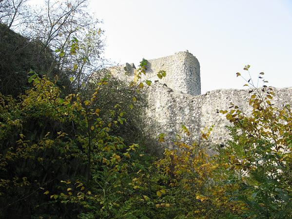
Beaumaris Castle, the moat and outer curtain wall

The history of Llywellyn ap Gruffudd's rise in Wales, and King Edward I's conquest deserve a longer post. But to put the construction of Edward's Welsh castles in context, here is a short summary of the events. (With lots of photos - Beaumaris was presenting itself at its best in the summer sunshine.)

(left: Portcullis openings in the southern gate passeage)

Llywellyn ap Gruffud of House Aberffraw (1223-1282; there are several Welsh rulers of that name) had used Henry III's problems with Simon de Montfort and other barons to extend his power in Wales and bring several Welsh rules under his hegemony, among them Gruffudd ap Gwenwynwyn of Powys. From 1258 on Llywellyn styled himself Prince of Wales, a title that was ackonwledged by King Henry III in the Treaty of Montgomery 1267. Llywellyn was granted the rule over Wales for the pay of an annual tribute of 3,000 marks gold.

But not all Welsh nobles were happy with that sort of overlordship, and in good Welsh tradtion Llywellyn's brother Davydd quarreled about the heritage (2) and eventually went into exile at the English court. Things changed with the death of Henry in 1272. His successor Edward I was a different sort of man. Ask the Scots. (The Welsh, too, but somehow Edward's Scottish conquest got more popular in the media.)

By 1167 Llywellyn had increasing problems with the Marcher Lords, among them Roger Mortimer with whom he was related (3); moreover King Edward had kidnapped his bride Eleaonor of Montfort, daughter of Simon of Montfort, and his brother Davydd made an alliance with Gruffudd ap Gwenwynwyn of Powys. So when Edward demanded Llywellyn to come to Chester and do homage for Gwynedd, Llywellyn decided it would be safer to stay at home. That of course, was an offense according to feudal law, and Edward went to Wales with an army to put the rebellious prince on the potty.

Edward invaded Gwynedd from the north-east (via Rhuddlan) with an army of some 15,000 men. Most of Llywellyn's Welsh vassals fell over their feet to make peace with Edward. Bereft of support, Llywellyn surrendered and agreed to the Treaty of Aberconwy. He kept the western part of Gwynedd and the tiltle Pince of Wales, while the eastern part was split between King Edward and Llywellyn's brother Davydd, and the vassalty of Powys and other noble houses was transfered to the crown. Lylwellyn was allowed to marry Eleanor, though.

At that time, King Edward already built or refortified some castles at the borders to Gwynedd, among them Rhuddlan, Flint, Builth, and Aberystwyth.

The sea gate with former drawbridge

But Davydd was not happy with what he thought a tiny bit of land. Also, King Edward had a talent to run roughshod over the people's feelings like personal dignity and national pride and angered Llywellyn and Davydd more than once. In 1282, Davydd started another rebellion which was soon joined by other Welsh rulers. Aberystwyth Castle was captured, Rhuddlan besieged, the Earl of Gloucester defeated in battle, as was a royal force crossing over from Anglesey.

Llywellyn initially wanted no part in the rebellion which he thought ill prepared and bound to fail, but he had no other option than support his brother if he did not want to lose everything. The archbishop of Canterbury, who mediated between King Edward and Llywellyn, offered him a large estate in England in exchange for the surrender of Wales, but Llywellyn refused. The offer well demonstrates the inability of the English king to understand the Welsh.

Beaumaris Castle, moat with corner tower

This was a much bigger affair than the troubles of 1277. Edward hired archer mercenaries form Gascony, gathered as big as a host as he could manage, including levies from southern Wales, and ordered the Cinque port fleet to supply and support the three armies. He marched from Rhuddlan again, Roger Mortimer of Chirk (4) from Mid-Wales, and the Earl of Pembroke (5) from the south.

(right: A room in the northeastern tower)

It is not entirely clear what happened in December 1282. We know that Llywellyn marched south where he was killed at the Battle of Orewin Bridge, facing the army of the Mortimers and his old enemy Gruffyd ap Gwenwynwyn of Powys. It is said that Edmund Mortimer, who was related to Llywellyn, offered negotiatons and lured him into an ambush, but there is no proof. Llywellyn got separted from his army, though, and was killed when surrounded by but a few retainers. His head was taken to London and displayed on a stake.

Davydd succeeded his brother as Prince of Wales, but his support was melting like snow in summer. Edward stroke right into the heart of Gwynedd and took Dolwyddelan Castle, the main seat of the Princes of Gwynedd in the 13th century. The rebellion ended when Davydd and his family who had taken to the mountains, were betrayed and captured in June 1283. Davydd was executed as traitor in September, his sons imprisoned and his daughters sent to nunneries (6). The Principality of Gwynedd ceased to exist (7).

Llywellyn's surving brother Rhodri had sold his Welsh possessions long ago and lied low on his estates in England. Rhodri's grandson Owain Lawgoch, Owain of the Red Hand, became a famous mercenary leader in France and would eventually claim the title, supported by exiled Welsh nobles and King Charles V of France. The threat of a French invasion in Wales - right in the middle of the Hundred Years War - was important enough for King Edward III of England (8) to have Owain assassinated in 1378.

King Edward stripped Gwynedd of all royal insignia and reorganised the land into counties and shires administered by English magistrates according to English law. In the Statute of Rhuddlan (1284) three new shires were created: Caernarfon, Merioneth and Anglesey; castles were built at Harlech, Caernarfon, and Conwy - the latter two including walled towns. They would be the administrative centres of the new shires and populated by English settlers. Plans were also made for a castle and settlement on Anglesey near the town of Llanfaes, but there was not enough money, so the plan was postponed. Edward's sheriff of Anglesey, Roger de Pulesdon, took his seat in the manor of Llanfaes.

The outer ward, with the inner curtain wall towers to the left

But there was still a rebellious spark in the subdued Welsh. In 1294, Madoc ap Llywellyn, member of a junior branch of House Aberffraw and fifth cousin of Llywellyn, used the growing discontent with the English administrators who often abused their power, and English taxes, to ally several Welsh nobles in an uprising that included southern lords from Glamorgan. The rebellion had been well planned and totally surprised Edward. Caernarfon and several other castles were taken, the castles of Harlech and Criccieth besieged, towns burned, Caerphilly partly destroyed; the unpopular sheriff of Anglesey, Roger de Pulesdon, was killed.

King Edward led an army into north Wales in December 1294. He reached Conwy Castle, having lost his baggage train in an ambush, and got stuck in the besieged castle for several months until his fleet could relieve him. But the Welsh could not withstand Edward's army in the field. They lost the battle of Maes Moydog in March 1295; Madoc ap Llywellyn escaped with nothing but his life and lived as fugitive until he was betrayed and captured. He obviously spent the rest of his life in prison in the Tower (9).

The failed rebellion only resulted in further suppressions and restrictions for the Welsh people.

The inner bailey (it would have been filled with buildings along the walls)

Well, financial troubles or not, a castle was now to be built on Anglesey. The Welsh population of Llanfaes was moved 12 miles to the south-west because Edward wanted an English town to go with his castle (albeit other than Caernarfon and Conwy, the town was never walled in). Sure, the site was the same distance from Caernarfon and Conwy and thus strategically sound, but Llanfaes had been a busy trading town due to its location and would never prosper on the new site. Another thorn in the Welsh side.

The castle was called after the place name Beau Mareys, 'fair march'. The work was overseen by Master James of St.George who had the responsibilty for all of Edward's castles in Wales. In 1295, he concentrated on the repair of Caernarfon and the building of Beaumaris. His work here is well documented; I'll get to that in the next post.

Another view of the outer ward

Edward truly wanted that castle like yesterday. In February 1296, the inner curtain wall stood to 6-8 metres, work on four of the inner towers had been begun, as well as on ten of the towers of the outer curtain wall. The south gate was already fitted with portcullises, and construction of the harbour that would allow to supply the castle garrison by sea, was well under way. An average of 2,000 labourers worked on the site, plus 400 stonemasons, 200 quarrymen and an unspecified number of carpenters and smiths. The place must have looked like an anthill. The transport of material involved 30 boats, 60 waggons and 100 carts moving to and fro.

The fun cost £ 270 a week in wages, not to mention the costs for material. The following year only a third of that sum would be spent and work progressed much slower. Edward's increasing involvment in Scotland led to a shortage of money and in 1298, work on the castle almost ceased.

There was a second period of builiding going on since 1306 because Edward feared that the Scots and Welsh might ally and attack England from two sides. The south barbican was built during that time, the outer curtain wall and the moat finished, as well as the north gate which had simply been walled up in 1298. Work on Beaumaris finally ended in 1330. The considerable sum of £ 15,000 had been spent until then.

The south gate from the outside

Albeit unfinished, the castle was strong enough to serve as defense and was garrisoned. It was taken by the Welsh during the rebellion of Owain Glyn Dŵr in 1403 and recaptured by royal forces in 1405 (10). It thus played only a small part in the rebellion, but since I have covered several Welsh raisings in this post already, it's a good place to present a short version of Owain's rebellion as well.

(left: A wall passage - unusually high to fit Edward I Longshanks - those in Pembroke are much lower)

Owain Glyn Dŵr was a descendant of both the princes of Powys and Deheubarth, and thus could claim the title Prince of Wales with some right after the princes of Gwynedd had died out. He got into trouble with Baron Grey de Ruthyn over some land and, as usual, the court decided in favour of the English lord. Grey then 'forgot' to tell Owain about a call of the levies, branding Owain as traitor at court. Owain, together with his son, brothers-in-law, the bishop of St.Asaph and other digruntled noblemen, launched an attack on Lord Grey's lands. The revolt soon spread to northern and central Wales which went over to Owain. King Henry IV's military invention in 1401 remained unsuccessful.

The following year, Owain captured Baron Grey. King Henry paid a heavy ransom for him. But when Owain captured Sir Edmund Mortimer at the battle of Bryn Glas, the king was not willing to pay the ransom (since Mortimer had a claim to the English throne). Mortimer negotiated an alliance with Owain instead, and later the Tripartite Indenture between Owain, Mortimer and Henry Percy, Earl of Northumberland. The three basically wanted to divide England and Wales among them.

With the Hundred Years War still being in full swing, Owain could also draw on French support, and the Scots never liked the English, either. Scottish and French privateers operated round Wales and a French army invaded Herefordshire. Several companies of English archers - probably of Welsh descent - went over to Owain. 1404 was his year. Owain called the first Parliament of all Wales at Machynlleth where he was crowned as Prince of Wales. Wales was to be an independent state with its own laws again (which had been replaced by English laws and courts since Edward I) and its own church.

But it would not last. In 1405, the king of France wanted peace with England and withdrew his support, while the young prince Henry (the latter Henry V; 11) adopted a strategy of economic blockade instead of punitive expeditions which often failed - he had led some of them himself, but the Welsh used guerilla strategies which were difficult to deal with. Some nobles began to look for reconciliation with the English, and many commoners went back to their fields and tools.

The southern gatehouse seen from the inner bailey

In autumn 1407, Owain had lost the castles of Aberystwyth and Harlech to the English; his wife and daughters were captured, his ally Edmund Mortimer died in battle. Owain remained free and still launched raiding parties, even managed to capture and ransom one of King Henry's supporters in 1412, but the rebellion more or less petered out. But contrary to his predecessors Davydd ap Gruffudd and Madoc ap Llywellyn, he was never betrayed, despite the handsome reward put on his head.

Wen Henry V became King in 1413, he decided for a more reconciliatory course and offered pardons to the leaders of the revolt. Owain refused and vanished into obscurity and legend. Even the date of his death is not known, it may have been 1415. Owain's legacy is his legend as Owain Glyn Dŵr and a bunch of statues in Wales.

The inner facade of the north gate

Beaumaris castle fell into disrepair, lacking roofs, with timber structures rotten away, until the Civil War when it was repaired and held for the king by Thomas Viscount Bulkeley since 1642 (he spent some £ 3,000 on those repairs); the commander of the garrison was Colonel Richard Bulkeley. . The castle was situated at a strategically important site on the route to the king's bases in Irleand. It surrendered to a Parliament army 1646 and was garrisoned by Parliament forces. It was briefly recaptured by royalists two years later, but eventually fell to the Parliament again. Contrary to other conquered castles, Beaumaris was not slighted since Cromwell feared an invasion from Scotland. It was instead garrisoned under Colonel John Johnes, a relative by marriage of Cromwell.

Charles II restored the Bulkeley family as constables of Beaumaris when he returned to the throne in 1660. But the castle was soon stripped of its valuable lead roofs and abandoned for good. It says something about those big Norman walls that so much of it survives until today.

(The next post will cover the architecture of Beaumaris Castle.)

Another view of the moat and the outer curtain wall

Footnotes
1) Actually, William's invading Wales was a response to Welsh border raids. He had his hands full with England already and probably would have left the conquest of Wales to the next generations.
2) There were more brothers and half-brothers involved, but Davydd was the most important.
3) Roger's mother was Gwladys Dhu, a daughter of Llywellyn the Great who also was Llywellyn ap Gruffudd's grandfather.
4) Edmund Mortimer and Roger Mortimer of Chirk took over from their father who died in October 1281, bereaving King Edward of one of his most able commanders.
5) William de Valence of Pembroke had replaced the inept Earl of Gloucester.
6) As was Llywellyn's daughter. All children died in captivity.
7) The Principality of Powys-Wenwynwyn was changed into a Marcher lordship; its rulers took the surname de la Pole.
9) At the time of Owain's death, the underage Richard II was king of England, but the assassination was likely set into motion by Edward III. The assassin, one John Lamb, needed time to gain Owain's confidence. He got £ 20 for his job.
9) We know he was not executed since that would have been mentioned in the sources, but there is not really any further information about Madoc.
10) Owain's main problem was the lack of artillery which was needed to conquer castles, and the lack of a fleet (though he would later get some help from the French and Scots there). He mostly took to guerilla strategies instead.
11) Henry IV's health failed since 1405, and his son, who had fought at his side in the Battle at Shrewsbury 1403, took up more responsibilies, often in conflict with his father.

Literature
R.R. Davies: The Age of Conquest. Wales 1063-1415, Oxford 1987, repr. 2000
Arnold Taylor: Beaumaris Castle - Cadw Guidebook, Cardiff 2004

Unifinshed Perfection - Beaumaris Castle in Wales: The Architecture

$
0
0

When work on Beaumaris Castle was finally abandoned in 1330, the curtain walls had been completed and all towers raised to battlement level at least. The inner towers were supposed to have an additional storey and should have been crowned by turrets the way you can see in Caernarfon and Conwy, but that was never done. The harbour was dug out as well as part of the moat. The southern barbican had been completed (but not the gate house). The northern gate house was completed to the first floor, and some of the interior buildings, including the chapel, may have been finished, too, though little remains of them today.

Beaumaris Castle, both curtain walls seen from the moat

But when William de Emeldon, chancellor of the exchequer of Ireland surveyed several Welsh castles after Edward the Black Prince was invested as Prince of Wales in 1343, things didn't look too good in Beaumaris. The chamber above the sea gate was dilapidated, roofs were lacking in several towers and the chambers below therefore ruinous, the chapel tower needed to be completed, the kitchen was unuseable, parts of the battlement had fallen down, and the southern gate house was in bad repair; the twin towers flanking the northern gate house needed their staircases to be completed. William estimated the most important repairs to cost £ 685. We don't know if any of the suggested repairs had been undertaken.

Remains of the harbour

Minor repairs went on, and the castle was garrisoned in 1389 (towards the end of the second phase of the Hundred Years War) and again in 1403 during the rebellion of Owain Glyn Dŵr. But no substantial renovation was done, and and the castle constable Roland de Velville reported that there was scarcely a chamber in Beaumaris where a man could lie dry in 1534. Five years later, the new constable, Richard Bulkeley, wrote to Thomas Cromwell, secretary to Henry VIII, that Beaumaris was "ruynous and ferre in decay", and badly equipped with arms to boot. Since relations between England and Scotland - ruled by the Catholic James V - were more than a bit unruly at the time, Henry VIII feared a Scottish invasion via Wales. Bulkeley bought gunpowder, bows and arrows, sallet helmets and brigandines for the garrison at his own costs.

View through the south gate

In 1609, the castle was "utterlie decayed". Later, another of those poor Bulkeleys who got stuck with Beaumaris, Viscount Thomas, paid £ 3,000 out of his pocket to repair the castle in service of King Charles I (see also the first post) in 1642. During the time the castle was held by Cromwell's men under Colonel John Jones after its surrender, two men of the garrison were imprisoned for "stealing ye leads of ye castle".

Lead was expensive. The lead roofs were officially dismantled in Beaumaris and Conwy in during the Restoration in 1660. What existed in the way of inner buildings was taken down in during time as well (the stones were probably used ot build Beaumaris Gaol in 1829); the rest got grown over by ivy.

View towards the north gate

The 19th century saw a rise in interest for picturesque ruins, and ivy-clad Beaumaris with its formidable towers attracted the first tourists. It was the location for a 'Royal Eistedfodd', a meeting of poets and singers, in 1832. Among the visitors were Victoria duchess of Kent and her daughter Princess Victoria - the future queen.

The Bulkeley family was connected with Beaumaris Castle since 1440 and held the office as constables without interruption since the Civil War. The sixth Lord Bulkeley bought the ruins from the Crown in 1807, but his successor Sir Richard Williams-Bulkeley gave the castle to the Commissoners of Works in 1925. Repairing those dang roofs turned out to be too expensive. *wink*

View into the inner bailey

The Commissioners of Works got rid of the pretty but ultimately wall damaging ivy and carried out repairs and restoration neccesary to prevent further decline. They also dug out part of the moat which had filled with silt and refilled it with water - half of the castle is thus surrounded by it again. Makes for some really nice photos. :-)

Beaumaris was declared part of the Castles and Town Walls of King Edward in Gwynedd World Heritage site in 1986. Beaumaris Castle is today managed by Cadw, the Welsh Assembly Government's agency for historic monuments.

A model of the castle

The drawing above shows Beaumaris Castle as it should have looked when finished. You can see the almost perfect symmetry of the double curtain walls with their towers set up in regular intervals, and the double D-shaped south gate and north gate. The only feature that stands out is the sea gate (left of the south gate). The walls and towers, as well as the gates, remain today, albeit some of them are lacking their upper storeys. The buildings in the inner bailey have mostly disappeared except for some foundations, as did the part of the south gatehouse that should have housed living quarters - the north gatehouse is in better shape (though lacking the second floor). All wooden structures, including the floors, decayed long ago.

The passage between sea gate and barbican

The material used are limestone (a smooth grey variant and a more common brown laminated stone), grey sandstone and green schists, all quarried locally on Anglesey. The distribution of the various stones in the wall is random, contrary to Caernarfon where the horizontal lines of red sandstone are clearly set to form decorative bands. The praecambrian green schist has only been used during the first building phase until 1298 and can be found in the walls up to 20 feet heigth. None of the stones are suitable for intricate carvings, which adds to the sturdy impression of Beaumaris - no fancy archs and elaborate window transoms.

Remains of the south gatehouse with the foundations of the staircase turrets

It was not easy to get into the castle if you couldn't provide an inviation letter. :-) The way through the sea gate, barbican and south gate involved a drawbrige and a series of no less than fifteen doors or portcullises. And in between those were murder holes and arrow slits through which all sort of upleasant things could be thrown or shot.

The D-shaped double towers of the south gate are but lacking their upper storey, but the building attached to it that would have faced the inner bailey has never progressed even to the level of the - also unfinished - northern gatehouse. The staircase turrets exist only in foundations, and the first storey apparently was never roofed in when work ceased in 1330. No wonder that the biggest post of repair costs on William de Emeldon's list was the southern gatehouse.

Remains of the barbican adjacent to the south gatehouse

Beaumaris was not only a formidable defense structure but also designed as royal residence, either for Edward I and maybe a future queen (his wife Eleanor of Castile had died in 1290), or his son Edward II, the Prince of Wales - who might have liked to help with the thatching of those roofs and digging out the moat - and his household But King Edward I visited the castle but once, in July 1296. Some temporary wooden housing had been set up for the king then; since the main work concentrated on the defense structures. I don't know if Edward II ever stayed at Beaumaris, maybe Kathryn can enlighten me.

Fireplaces in the inner wall

The gate houses were clearly intended to be grand structures with large inward facing windows and halls and chambers befitting a king. Several of the buildings along the inner curtain wall may have been completed and later fallen into decay. Some fireplaces and door frames can still be seen, as well as holes in the wall to support floor beams, and bits of wall plaster.

Besides the royal appartments, a great hall, and the kitchen, there would also have been lodgings for the constable and his household and maybe the local sheriff as well (if he didn't reside in Llanfaer), and those must have been habitable at the time when the castle was garrisoned

Remains of buildings along the inner curtain wall

The garrison would likely have lived in the towers of the inner curtain wall where several chambers were habitable during the time the castle was used, though originally barracks may have been planned, perhaps even in the outer ward. Some arched lintels that once supported a floor can still be seen. The towers were intended to be three storeys high, but the uppermost one was never finished. The tower halfway along the eastern inner curtain wall houses a little chapel that has been restored, but it was closed when I visited the place.

The interior of the north-east inner tower seen from an upper storey

I posted a photo of the inner passageways in my first post about Beaumaris. They would have run through the entire inner curtain walls at first floor level, and a significant part of them is still intact. Those passageways connected the various buildings and towers with their guardrooms, sleeping chambers and other rooms along the wall, and also held a set of 16 latrines which emptied into the moat by a system of drains. Yuck. The drains already needed mending in 1306.

Those passageways also still exist in Caernarfon and in Pembroke. The ones in Pembroke Castle are much lower than those in the Edwardian castles in northern Wales. He got his nickname 'Longshanks' for a reason.

The outer ward, with the outer curtain wall and the remains of battlements to the left

While the inner bailey was the place for accomodation, the outer ward was a defense structure. You didn't want to get caught between both sets of curtain walls and the twelve outer and six inner towers plus the inner gate towers. Arrowslits would allow a defense against outside besiegers, though some of them have been blocked, probably during the Civil War (when bows were mostly replaced by guns). The corbelled tables that supported the wooden battlements are still intact in part, though the upper crennellations are mostly gone.

Stairs leading to the battlements of the outer wall

Like the sea gate next to the southern gatehouse, there was another gate next to the northern gatehouse, the Llanfaes Gate. It was used during the time when the north gate had been blocked because its doors and portcullises were not yet working (they never did, it seems), but the Llanfaes Gate remained unfinished as well; their towers never got the outward looking D-shape outlined in the foundations. Today, the moat ends at Llanfaes Gate.

View from Beaumaris Castle across Conwy Bay to the mainland

Literature
Arnold Taylor: Beaumaris Castle - Cadw Guidebook, Cardiff 2004

To Seal the Conquest - Building Conwy Castle in Wales

$
0
0

The Welsh rebellion against King Edward I had failed. Llywellyn ap Gruffud had died in December 1382, Edward had taken the main seat of the Princes of Gwynedd, Dolwyddelan Castle, in January 1283 and Aberconwy in March. Llywellyn's brother Davidd was still at large in the mountains, but that seems to have been a minor problem for King Edward who considered northern Wales conquered.

Edward liked the site of Aberconwy Abbey, overlooking the river Conwy and the sea; and there was a nice rock promontory as well, the perfect place for a castle.

Conwy Castle seen from the seaside

There had been a castle at the other side of the river: Degannwy, founded by the Normans in the 11th century and destroyed by Llywellyn ap Gruffudd in 1263, after he had starved the English garrison into surrender during his wars with King Henry III. But Edward wasn't interested in rebuilding Degannwy (of which almost nothing remains today).

King Edward had been to Aberconwy before when he concluded the treaty with Llywellyn ap Gruffudd after their first clash in 1277. He now moved the Cistercian abbey, the burial place of the princes of Gwynedd (1), a few miles up the valley, and called for his chief architect, Master James of St.George, who took a look at the rock plateau and got some ideas.

Conwy Castle seen from the town side

Digging of the rock cut ditch around the future castle began a few days after Edward's decision. Try to get any craftsmen or labourers that fast today, lol. And without filling in any forms to boot.

Conwy Castle was planned in connection with an - equally fortified - town, and a stockade surrounding the site is mentioned as early as May 1283. Significant parts of the town fortifications which were soon constructed in stone, remain today (2).

The west barbican with its flanking towers

The work at first concentrated on the castle's outer defenses. Responsibility fell to Master George of St.James and Sir John de Bonvillars. Other men involved in the construction were the master carpenter Henry of Oxford and the engineer Richard of Chester. There are the names of further master masons and engineers in the accounts, some of them hailing form Savoy like George. But the main workforce were labourers from England and Wales, often conscripted. At the height of the construction work, some 1,500 men were busy there.

By November 1284 the towers and curtain walls were finished and a garrison of 30 men was put into the castle (probably living in tents or huts). £ 5,800 had been spent on the fun so far.

During the next two years the interior buildings, inlcuding the great hall, the chambers for the king and queen, and two chapels, were constructed. The castle was completed in 1287. Unfortunately, the work of these years is less well documented than the phase of 1283-84.

The town walls were also finished about that time. The totals cost of castle and town walls amounted to £ 15,000 (3).

Remains of the great hall in the outer ward

But albeit finished, Conwy Castle shared the fate with Beaumaris and already showed signs of decline in 1321. The roofs leaked and timbers had rotted, not to mention the garrison was poorly equipped, lacking bowstrings and working crossbows, and the stored grain was rotten. In fact, by the 1330ies, all of the king's northern Welsh castles were in such a bad state that King Edward III could not have been housed properly should he have decided to visit the country.

The combination of timber supports and lead roofs turned out to be a big problem. The chamberlain of the Black Prince who had been given the royal possession in Wales, Sir John of Weston, added eight stone arches in the great hall to support the roof in 1346. One of these still remains.

Remains of the chapel adjacent the great hall

But the castle was neglected again in the later 14th century. Yet there must have been some habitable rooms when King Richard II fled to Conwy in August 1399; and the castle was taken by some cousins of Owin Glyn Dŵr in 1401, though they surrendered it to the English a few months later (4).

Like Beaumaris, Conwy Castle played a small role in the Civil War. Conwy-born John Williams, archbishop of York, held the castle for King Charles. He paid for repairs as well as provisioning the garrison. But he had a falling-out with the governor Sir John Owen and went over to the parlamentarians. Nevertheless, Conwy was one of the last three castles in England and Wales to be taken by the parlamentarians. It was then partly dismantled; the - now repaired - damage of the Bakehouse Tower dates to the 1650ies. A few years later, all the lead was taken down to be reused.

View from the outer ward to the west barbican

We can thank Arnold J. Taylor, Chief Inspector of Ancient Monuments, for the conservation of what remains of Conwy Castle and the town walls today, and that is still an impressive lot. The castle had come to the Ministry of Work's guardianship in 1953. Taylor researched the construction and Mediaeval documents, and it was he who found out about Master George of St.James' connection with Savoy which explains some unusual features of the Edwardian castles in Wales. He was also instrumental in removing some latter additions to the town walls.

Conwy Castle and town walls are part of the Unesco World Heritage since 1986 and are now cared for by Cadw. Let's have a look at the place.

View from the southhwest tower across the outer ward to the inner bailey

The castle is basically rectangular in shape, with an outward bent to the south, following the outline of the rock outcrop. It consists of an outer ward with a great hall, a middle ward with a well, and the inner bailey which houses the lodgings of the king and his family. The curtain walls and the eight towers (about 20 metres high) rise directly out of the cliff, except for the town side where an additional dry ditch protects the castle. To the west (the town side) and the east barbicans offer additional protection.

The stones are mostly local sandstone of a grey variant, and red sandstone from Chester and the Wirral in places where carved details were needed. Originally, the castle walls were whitewashed and maybe decorated with heraldic devices in form of hangings and banners when the king was present. It must have been a stunning view in the sunshine, less austere than the grey walls on a dreary day like on my photos.

The outer ward

Originally, the main gate in the western barbican was reached by a drawbridge across the dry ditch, but today there is a way leading up from the town (after you paid your dime in the Visitor's Centre). The gate would have been further protected by a portcullis. Compared to the line of defenses in Beaumaris Castle, the entrance into Conwy Castle was easier, but only from the town side which was additionally protected by the town walls. The barbican consists of two big towers and a middle part with murder holes or machiolations and merlons for archers. The two-storeyed towers (with additional basements for storage) held rooms with fireplaces and latrines; they were likely used by the garrison or the castle's constable.

The gate leads into the outer ward. On the south side lies the great hall with a chapel. The foundations on the right side belonged to a kitchen with a brewhouse and bakehouse.

The great hall seen from the direction facing the barbican

The great hall and chapel are on courtyard level. The cellars below which had been dug into the bedrock are now open to the view. The hall was lit by windows in the curtain wall and three more elaborate ones facing the yard. The range was partitioned by wooden screens into the chapel, the hall and a smaller room with its own fireplace. The great hall was used for banquets but also official hearings and other state displays. Though the English kings did not stay in Conwy Castle often.

One can still see the projecting stubs of masonry where Henry of Snelston, master mason of the Black Prince, added the stone arches (made from Wirral sandstone) in 1346, to support the roof after the timber supports had rotten away.

View towards the Prison Tower (to the right; the one without a turret)), Kitchen Tower (left), across the middle ward to the royal appartments and towers in the background (right to left: Bakehouse Tower, King's Tower, Chapel Tower, Stockhouse Tower)

There is a direct connection from the great hall to the dungeons in the tower known as Prison Tower. The tower has a room known as 'dettors chambre' in the 16th century, for prisoners who were allowed some measure of comfort like a wooden bed. Below is a true dungeon, an oubliette that goes 12 feet deep into the bedrock and could only be reached by a trap door.

The Kitchen Tower on the opposite side of the outer ward contained store rooms and accomodation for the staff.

Middle Ward with the well

The inner bailey was separated by a curtain wall with a gate, running from Bakehouse Tower to Stockhouse Tower, and a dry ditch in the bedrock that could be crossed by a drawbridge. The bridge still existed in 1520, when one Dafydd ap Tudur Llwyd got paid for "makyng anewe brigge to entre into the ynder warde", but the ditch was filled in in the 1530ies. Nothing remains of the guard house at the gate.

The well is located in front of the ditch. It is 28 metres deep and fed by a spring. It once had been covered by a shingled roof on timber pillars. The well with its clean water was one of the few positive features of Conwy mentioned in a survey prior to the Civil War.

A view of the maze of the royal chambers

Conwy has the best preserved royal chambers in England and Wales. But some odd pathways and stairs that connect the rooms with those in the adjacent towers make it clear that the cahmbers were added after the outer walls and towers had been built, and were not planned thoroughly from the beginning. Master George was just too busy with all those castles, it seems. The royal appartments were like a palace that could be sealed off the rest of the castle and supplied from the eastern gate, which was protected by a second barbican, or the Water Gate beneath the Chapel Tower.

The rooms for the royal family and their immediate staff were at first floor level on both sides of a courtyard. The eastern range consisted of one large room, the southern one was divided into two chambers. The ground level held a kitchen in the south range and a cellar in the east site. Originally, both parts had a separate entrance; the eastern room was known as King's Great Chamber, the southern ones as King's Chamber and Queen's Chamber (5). But during the Tudor times, the rooms could only be reached by the east entrance and were known as great chamber, outer chamber and privy chamber.

Like in the great hall in the outer ward, the timber roof supports in the King's Great Chamber were replaced by stone arches in 1346. The windows facing the yard were unusually large for the time the castle was built; likely a Savoyard feature.

Window with seat in the King's Chamber

The Chapel Tower includes a second chapel for the private use of the royal family. The King's Tower with its four storeys housed the accomodation for the most important officers of the king's household like the treasurer and steward, not the king himself.

The Stockhouse Tower which is not connected to the royal chambers, held another prison (complete with chains at the wall) and probably more storage rooms. With so much place for storage one wonders why the garrison had to share one bowstring among them in 1321, lol. The Bakehouse Tower got its name due to the great oven built into one of its walls.

Each tower has an additional watchtower turret (the feature is missing in the unfinished Beaumaris Castle). Putlog holes in the walls point at the possibility of outward facing battlements, or brattices.

The east barbican

Behind the east range of the royal appartments is another barbican. It seems to have served not only as defense structure but also as garden overlooked by the king's and queen's chamber. There also was a water gate connecting to the Chapel Tower by a winding staircase down the bedrock which allowed to supply the castle by the sea, but that gate no longer exists.

The curtain wall of the barbican has a well preseved set of machiolations, or murder holes which you can see in the photo.

Kitchen Tower (left) and Stockhouse Tower seen from the western barbican

Footnotes
1) Moving the burial site was a humiliation for the Princes of Gwynedd as much as a strategical decision.
2) The town walls will get their own post.
3) The Conwy Guidebook gives the modern equivalent for the money: £ 5,800 would be £ 15-18 million today; £ 15,000 about £ 45 million. Less than the Berlin Airport and with a better result.
4) I'll leave the history of Conwy Castle to another post.
5) Though Queen Eleanor of Castile, Edward's wife, visited Conwy only once prior to the building of the royal appartments.

Literature
Jeremy A. Ashbee. Conwy Castle and town Walls - Cadw Guidebook, Cardiff 2007

Viewing all 241 articles
Browse latest View live